An Innovative method for NDVI correction and cloud removal in Sugarcane remote sensing
Published in Agricultural & Food Science
Clouds and cloud shadows are among the most significant challenges in the analysis of optical satellite imagery, particularly in agricultural monitoring applications that rely on accurate spectral information. In remote sensing studies, atmospheric disturbances caused by clouds reduce image quality and introduce noise into satellite datasets, thereby affecting the reliability of vegetation analysis and crop monitoring. Precise detection and removal of clouds and their shadows therefore represent a crucial pre-processing step in restoring optical satellite images for scientific investigation. This process becomes especially important in long-duration crops such as sugarcane, where continuous monitoring throughout the crop growth cycle is required for effective agricultural management and yield estimation.
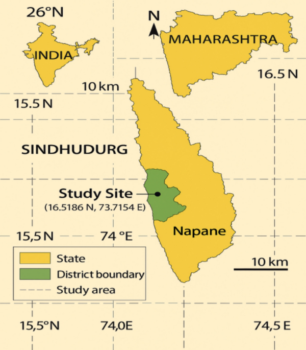
Sugarcane is a major commercial crop cultivated extensively in tropical and subtropical regions. The crop generally requires a long growth duration of approximately 12–15 months, making periodic monitoring essential for understanding crop health, productivity, and environmental stress conditions. In regions such as Napane village in Maharashtra, sugarcane cultivation is further complicated by red soil conditions, variable climatic patterns, and frequent atmospheric disturbances. These environmental factors often result in inconsistent spectral responses in satellite imagery, thereby making accurate vegetation assessment difficult. During the monsoon season, cloud cover becomes particularly severe, reducing the availability of usable satellite observations. Consequently, efficient cloud-removal and atmospheric correction techniques are necessary to improve the quality and reliability of remotely sensed data used in sugarcane crop analysis.
Among the various vegetation indices employed in agricultural remote sensing, the Normalized Difference Vegetation Index (NDVI) is one of the most widely used indicators for monitoring vegetation growth and crop condition. NDVI is calculated using the reflectance values of the near-infrared (NIR) and red spectral bands. Healthy vegetation strongly reflects NIR radiation while absorbing red light due to chlorophyll activity. The NDVI formula provides a numerical representation of vegetation vigor, biomass density, and photosynthetic activity. However, the accuracy of NDVI measurements is highly sensitive to atmospheric disturbances such as clouds, haze, and cloud shadows. When cloud-contaminated pixels are included in the analysis, the NDVI values become distorted, leading to incorrect interpretation of crop conditions and vegetation stress levels.
To address this issue, atmospheric correction and cloud-removal techniques are applied before performing vegetation analysis. Traditional cloud-reduction approaches commonly include mean and median compositing methods, which combine multiple satellite images over a given period to minimize cloud effects. In the mean method, the average pixel value from multiple observations is calculated, whereas the median method selects the median value for each pixel location. Although these methods reduce cloud contamination to some extent, they may also smooth important vegetation information and introduce inaccuracies when cloud coverage is high. This limitation becomes more evident in tropical agricultural regions where persistent cloud cover affects the majority of satellite observations during critical crop growth stages.
In the present study, a minimum image reducer method was employed to improve the quality of NDVI time-series data for sugarcane crop monitoring. The primary objective of this method is to preserve the minimum cloud-free pixel values from multiple satellite observations while eliminating cloud-contaminated pixels. Unlike mean and median compositing approaches, the minimum reducer method effectively identifies clearer vegetation signals by selecting pixels less affected by atmospheric disturbances. This technique enhances the temporal consistency of NDVI data and improves the accuracy of vegetation analysis, especially under conditions of dense cloud cover.
The implementation of the minimum image reducer involved processing multi-temporal Sentinel-2 satellite imagery within the Google Earth Engine (GEE) environment. Sentinel-2 data were selected because of their high spatial resolution and suitability for agricultural monitoring applications. Multiple images acquired over different dates were analyzed to generate cloud-free composite images. Initially, cloud masking procedures were applied using quality assessment bands and threshold-based filtering techniques. Subsequently, NDVI values were computed for each image using the spectral reflectance values obtained from the red and near-infrared bands. The minimum reducer algorithm was then applied to the NDVI time series to extract the minimum cloud-free vegetation values while suppressing noisy cloud pixels.
The performance of the proposed method was compared with conventional mean and median compositing techniques. Experimental analysis demonstrated that the minimum reducer method produced superior results in regions with high cloud percentages. The generated NDVI maps exhibited improved vegetation clarity, better boundary delineation of sugarcane fields, and reduced atmospheric noise. In comparison, the mean method often generated blurred vegetation patterns due to averaging effects, while the median method occasionally failed to remove thick cloud contamination completely. The proposed technique therefore proved to be more effective in preserving accurate vegetation information for crop analysis and monitoring.
Visualization of NDVI values before and after atmospheric correction further highlighted the effectiveness of the proposed approach. Prior to cloud removal, NDVI maps contained irregular patterns and distorted pixel values caused by cloud shadows and atmospheric scattering. After applying the minimum reducer method, the vegetation signals appeared more consistent and spatially coherent. The corrected NDVI maps enabled better identification of healthy and stressed sugarcane regions within the study area. This improvement is particularly beneficial for agricultural decision-making processes that depend on timely and accurate crop information.
The enhanced NDVI outputs generated through the proposed cloud-reduction technique provide several practical benefits for farmers and agricultural researchers. Accurate vegetation monitoring supports crop classification by distinguishing sugarcane fields from other land-cover types based on spectral characteristics. Furthermore, continuous NDVI analysis helps in monitoring crop growth stages and detecting abnormal vegetation conditions associated with nutrient deficiencies, water stress, or disease outbreaks. Early detection of such issues enables farmers to implement corrective measures in a timely manner, thereby improving crop productivity and reducing economic losses.
In addition to crop monitoring, the improved NDVI time-series data can contribute to more reliable yield prediction models. Since NDVI values are closely related to biomass accumulation and crop vigor, accurate vegetation indices provide valuable information for estimating future sugarcane production. This information can assist agricultural authorities, policymakers, and farmers in planning harvesting schedules, resource allocation, and market strategies. Moreover, the proposed atmospheric correction approach can support precision agriculture applications by enabling site-specific management practices based on spatial variability within sugarcane fields.
Overall, the study demonstrates that accurate cloud and cloud-shadow detection is essential for reliable remote sensing analysis in agricultural applications. The minimum image reducer method offers an effective solution for improving NDVI-based sugarcane monitoring under challenging atmospheric conditions. By preserving cloud-free vegetation signals and reducing atmospheric noise, the proposed approach enhances the quality of satellite-derived information used for crop classification, growth monitoring, disease detection, and yield estimation. The integration of cloud-removal techniques with multi-temporal satellite imagery and NDVI analysis therefore provides a valuable framework for sustainable agricultural management and precision farming practices in sugarcane cultivation regions such as Napane.
Please sign in or register for FREE
If you are a registered user on Research Communities by Springer Nature, please sign in