A well-validated 30-meter resolution tile drainage map for the United States
Published in Research Data
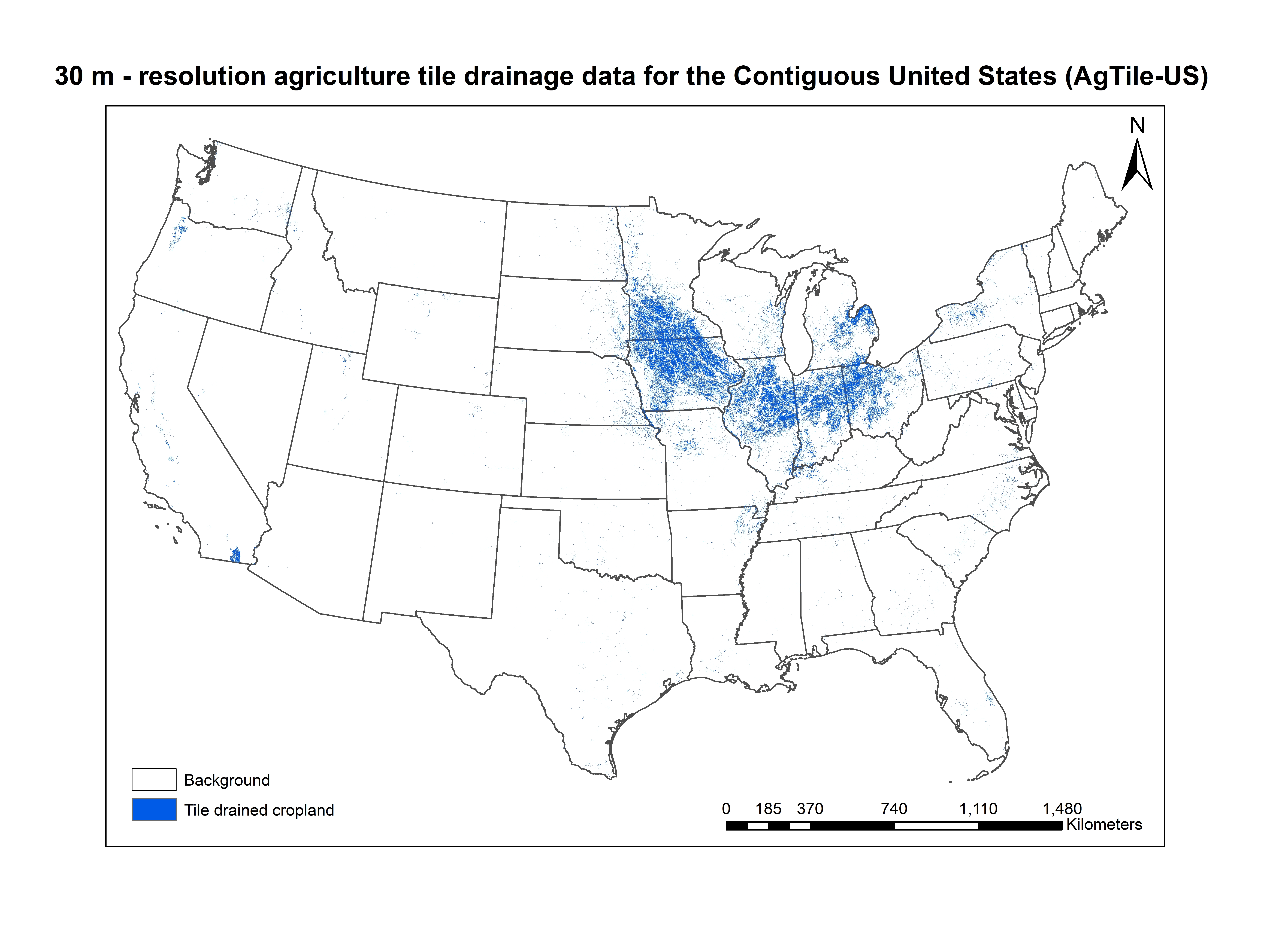

Subsurface tile drainage is one of the most widely-used agriculture management practices to enhance crop yield in regions with high water tables or poorly drained soils. Based on the U.S Department of Agriculture (USDA) National Agriculture Statistics Service (NASS) 2017 Census of Agriculture, the spatial extent of tile-drained croplands in the U.S. is around 22.48 million ha, out of which 18.79 million ha (83.8%) are mainly in six Midwestern states. Correctly modeling the tile-drainage impacts on the hydrologic cycle is a daunting challenge due to the lack of continental-scale high-resolution tile-drainage data, because farm-, field-, and sub-county-scale information on tile drainage are not available.
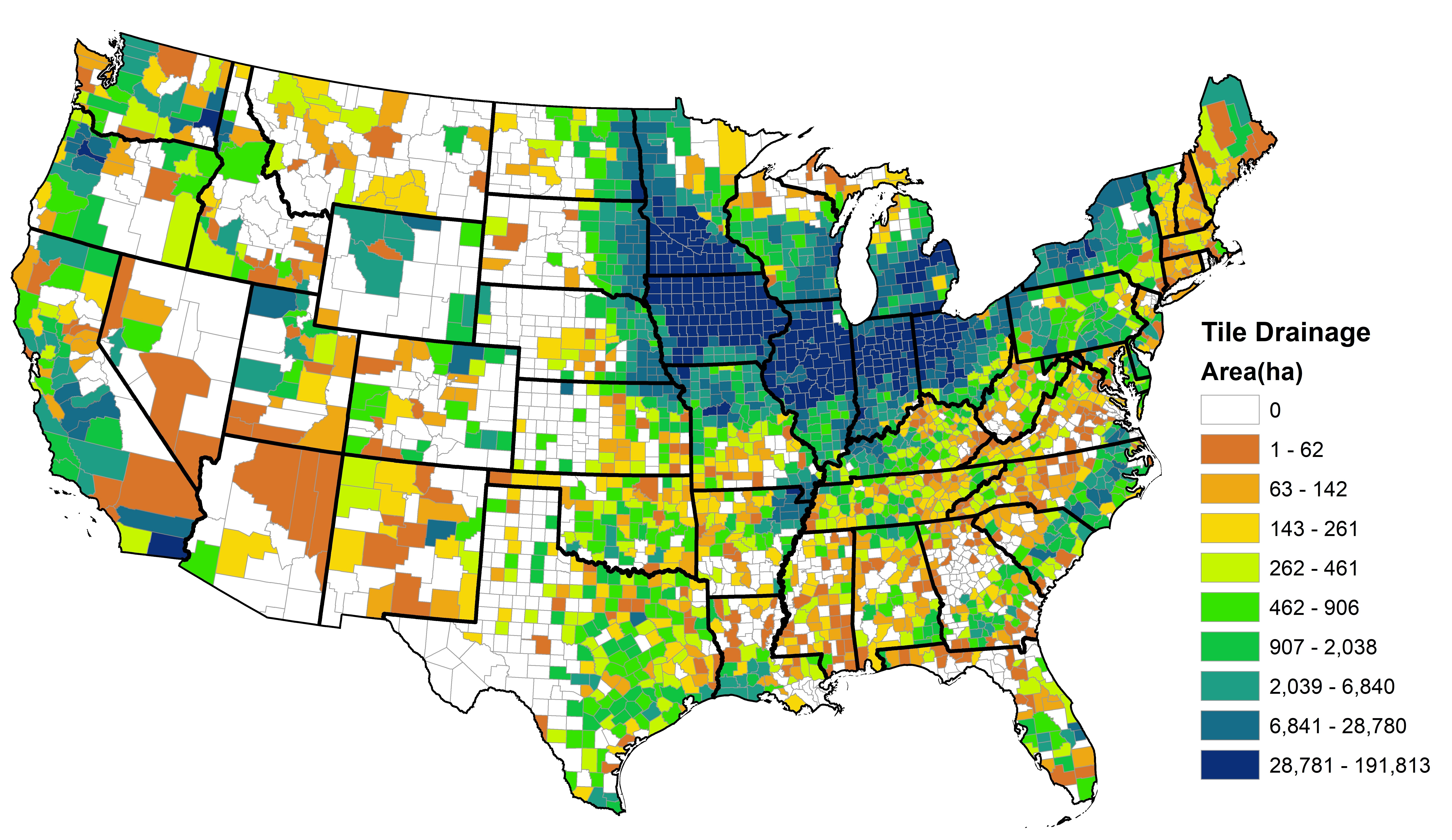
Therefore, we developed a present-day, 30-m resolution tile drainage map (AgTile-US) for the Contiguous U.S. (CONUS) using USDA Census of Agriculture 2017 county-level tile drainage information, National Land Cover Database-2016 cropland, Shuttle Radar Topography Mission- Digital Elevation Model derived slope, Soil Survey Geographic Database (SSURGO) version 2.0 soil drainage information and by employing a Geographic information system model.

Validation of AgTile-US with 16000 ground truth points (ground-truth data were manually identified from ESRI multi-resolution (15 m, 1 m, 0.6 m, and 0.3 m) aerial imagery basemap) indicated 86.03% accuracy at the CONUS-scale. Over the heavily tile-drained midwestern regions of the U.S., the accuracy ranges from 82.7% to 93.6%. These data can be used to study and model the hydrologic and water quality responses of tile drainage and to enhance streamflow forecasting in tile drainage dominant regions. The AgTile-US tile drainage maps are available in georeferenced GeoTIFF, and NetCDF-4 format files along with its quality information.
Follow the Topic
-
Scientific Data
A peer-reviewed, open-access journal for descriptions of datasets, and research that advances the sharing and reuse of scientific data.

Related Collections
With Collections, you can get published faster and increase your visibility.
Genomics in freshwater and marine science
Publishing Model: Open Access
Deadline: Jul 23, 2026
Computer vision in plant science and agriculture
Publishing Model: Open Access
Deadline: Jul 10, 2026


Please sign in or register for FREE
If you are a registered user on Research Communities by Springer Nature, please sign in