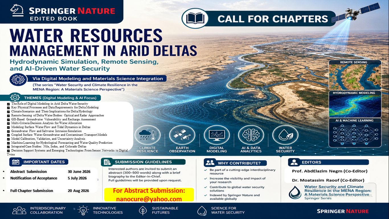
CALL of CHAPTERS...Water Resources Management in Arid Deltas Via Digital Modeling and Materials Science Integration
Published in Earth & Environment, Civil Engineering, and Mathematics
Target Audience
Hydrologists, water resource engineers, remote sensing specialists, GIS analysts, computational modelers, PhD candidates, and environmental agencies working in arid and semi-arid regions.
Description
This volume speaks to those who build the models, interpret the data, and make the predictions that guide water policy. Arid deltas face threats as complex as they are urgent. Climate change shifts precipitation patterns. Sea-level rise pushes saltwater into freshwater aquifers. Upstream dams alter flow regimes that persisted for millennia. Population growth multiplies demand. These aren't problems solved by guesswork. They require models simulating not just now, but different scenarios and policies.
This book provides those tools. It establishes the modeling context: physical processes, data requirements, and challenges unique to arid deltas. Then it moves systematically through the digital toolkit, remote sensing to extract water quality from satellite imagery and detect shoreline changes, GIS for groundwater vulnerability assessment, hydrodynamic and groundwater models for contaminant transport. Machine learning forecasts salinity intrusion and predicts water quality from sparse data. Case studies from the Nile, Indus, and Colorado deltas tie it together. The volume concludes with decision support systems, real-time sensor networks, and digital twins that simulate entire delta systems.
Table of Contents
Part I: Foundations of Delta Modeling
Chapter 1: The Role of Digital Modeling in Arid Delta Water Security
Chapter 2: Key Physical Processes and Data Requirements for Delta Modeling (Booked)
Chapter 3: Climate Scenarios and Their Implications for Delta Hydrology
Part II: Remote Sensing and GIS for Delta Monitoring
Chapter 4: Remote Sensing of Delta Water Bodies: Optical and Radar Approaches
Chapter 5: GIS-Based Groundwater Vulnerability and Recharge Assessment
Chapter 6: Multi-Criteria Decision Analysis for Water Allocation
Part III: Hydrodynamic and Groundwater Modeling
Chapter 7: Modeling Surface Water Flow and Tidal Dynamics in Deltas
Chapter 8: Groundwater Flow and Saltwater Intrusion Simulation (Booked)
Chapter 9: Coupled Surface Water-Groundwater and Contaminant Transport Models (Booked)
Chapter 10: Model Calibration, Validation, and Uncertainty Analysis
Part IV: Machine Learning and AI Applications
Chapter 11: Machine Learning for Hydrological Forecasting and Water Quality Prediction (Booked)
Part V: Case Studies and Future Directions
Chapter 12: Integrated Case Studies: Nile, Indus, and Colorado Deltas
Chapter 13: Decision Support Systems and Emerging Technologies: From Sensor Networks to Digital Twins (Booked)
📅 IMPORTANT DATES
| Event | Date |
|---|---|
| Abstract Submission Deadline | 30 June 2026 |
| Full Chapter Submission Deadline (after abstract approval) | 20 August 2026 |
📝 SUBMISSION GUIDELINES
-
Submit an abstract of 250–300 words (clearly indicating the target chapter number from the Table of Contents)
-
Include: chapter title, author name(s), full affiliation(s), email(s), and 5–7 keywords
-
Send your abstract to: nanocure@yahoo.com
-
Selected abstracts will be invited to submit full chapters
-
All chapters will undergo editorial screening and peer review
-
No Article Processing Charges (APC) / Free Publication
-
Peer‑Reviewed Chapters | ISBN‑Indexed International Publication
Materials scientist and inventor with a PhD from Alexandria University and research training at imec, Belgium (a leading European nanoelectronics center). I specialize in smart coatings, polymer science, nanomaterials, and water treatment technologies. I hold multiple US and Saudi patents in self-healing and degradable materials. Currently, I am the Co-Editor of a Springer book series on water security and climate resilience in the MENA region.
Please sign in or register for FREE
If you are a registered user on Research Communities by Springer Nature, please sign in