A new ensemble to investigate spatiotemporal patterns of surface ozone from space
Published in Research Data

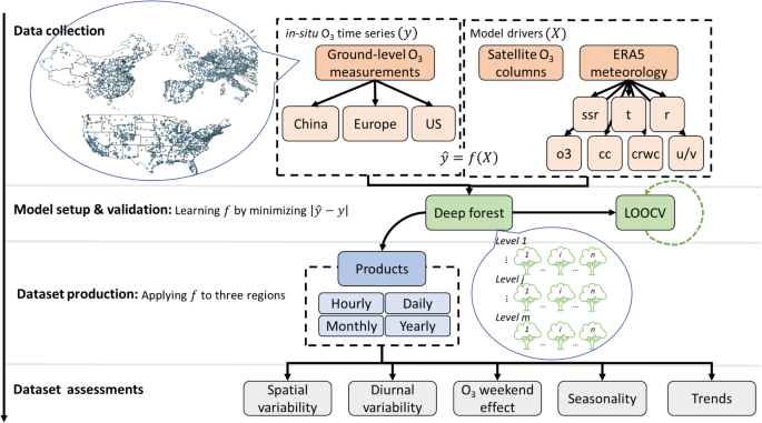
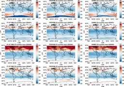
Surface ozone pollution is a global concern due to its detrimental effects on public health and food security. Yet it is not directly measurable from space due to the higher abundance of ozone in the stratosphere, which obscures measurements of surface ozone. Thanks to new-generation hyperspectral instruments and deep learning techniques, we have produced surface ozone datasets for a period of 10 years (2012-2021) in three regions: the Chinese mainland, Europe, and the continental United States. The surface ozone datasets were generated at a spatial resolution of 0.1◦×0.1◦ and across four timescales using the LEarning Surface Ozone (LESO) framework. The LESO framework proposed in our previous papers is independent of chemical transportation models and derives ozone in the lower atmosphere from satellite signals. All of the LESO datasets are available in Zenodo under the Creative Commons Attribution 4.0 International (CC BY 4.0) license.
This new ensemble of surface ozone concentrations possesses the capability to investigate the long-term spatiotemporal characteristics of ozone across a wider geographical range than any other currently available datasets. These datasets will not only contribute to an enhanced understanding of ecosystem resilience to climate change but also provide recommendations for globally coordinated ozone regulation.
References:
- Zhu, S., Xu, J., Zeng, J., Yu, C., Wang, Y., Wang, H., Shi, J., 2023. LESO: A ten-year ensemble of satellite-derived intercontinental hourly surface ozone concentrations. Sci Data 10, 741. https://doi.org/10.1038/s41597-023-02656-4
- Zhu, S., Xu, J., Yu, C., Wang, Y., Zeng, Q., Wang, H., Shi, J., 2022. Learning Surface Ozone From Satellite Columns (LESO): A Regional Daily Estimation Framework for Surface Ozone Monitoring in China. IEEE Trans. Geosci. Remote Sensing 60, 1–11. https://doi.org/10.1109/TGRS.2022.3184629
- Zhu, S., Xu, J., Zeng, J., Yu, C., Wang, Y., Yan, H., 2022. Satellite-derived estimates of surface ozone by LESO: Extended application and performance evaluation. International Journal of Applied Earth Observation and Geoinformation 113, 103008. https://doi.org/10.1016/j.jag.2022.103008
Follow the Topic
-
Scientific Data

A peer-reviewed, open-access journal for descriptions of datasets, and research that advances the sharing and reuse of scientific data.
Related Collections
With Collections, you can get published faster and increase your visibility.
Data for crop management
Publishing Model: Open Access
Deadline: Apr 17, 2026
Data to support drug discovery
Publishing Model: Open Access
Deadline: Apr 22, 2026


Please sign in or register for FREE
If you are a registered user on Research Communities by Springer Nature, please sign in