How Holocene Nile dynamics shaped the physical and cultural landscape of ancient Nubia
Published in Earth & Environment and Arts & Humanities
Read our PNAS study here.
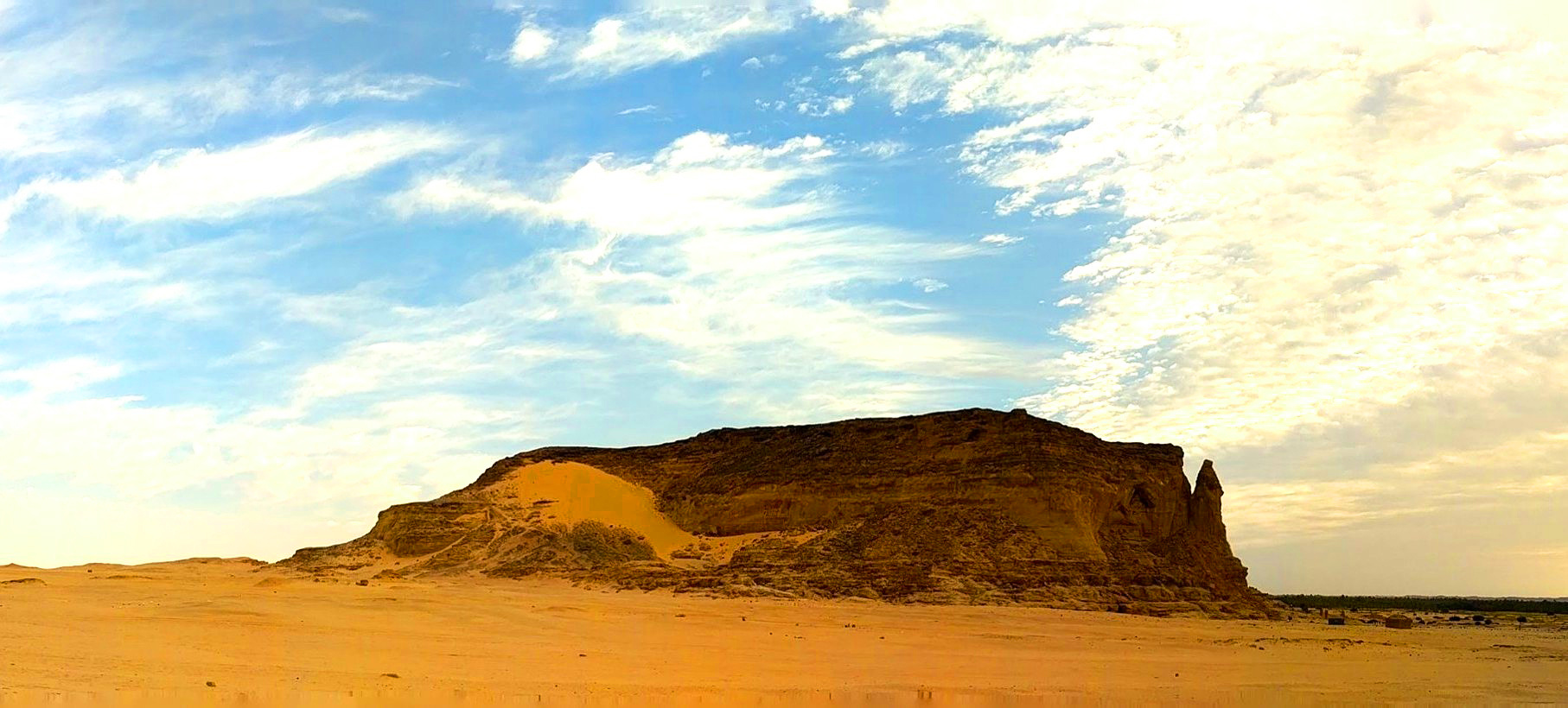
Fieldwork along the Nile has a way of collapsing time. At Jebel Barkal in northern Sudan, the sandstone inselberg rises abruptly above the floodplain (Photo 1) — a landmark that has drawn people, and meaning, for millennia. At its base lay Napata, one of the great urban centres of ancient Nubia. Temples, pyramids, and palaces still mark the site’s importance. But one question remained surprisingly open: why here?
, with the sandstone outcrop, temples, and pyramids in the foreground and the Nile and its floodplain in the background, viewed toward the south (photo credit: Sami Elamin, 2026).")
As geomorphologists, we suspected that part of the answer lay beneath the surface — quite literally.
Over several field seasons with the Jebel Barkal Archaeological Project, led by Geoff Emberling and El-Hassan Mohammed, we set out to reconstruct the ancient Nile landscape on which Napata developed. The site today lies about 1.5 km from the Nile, raising the question whether earlier channels once flowed much closer.
To address this, we investigated the subsurface of the Nile floodplain by drilling sediment cores across the valley, together with Tim Winkels and Pawel Wolf, supported by an excellent team of local workmen (Photo 2). In the field, the integration with the archaeological work, including contributions from Tim Skuldbøl and Sami Elamin, was essential for linking sedimentary units to the site’s cultural context.
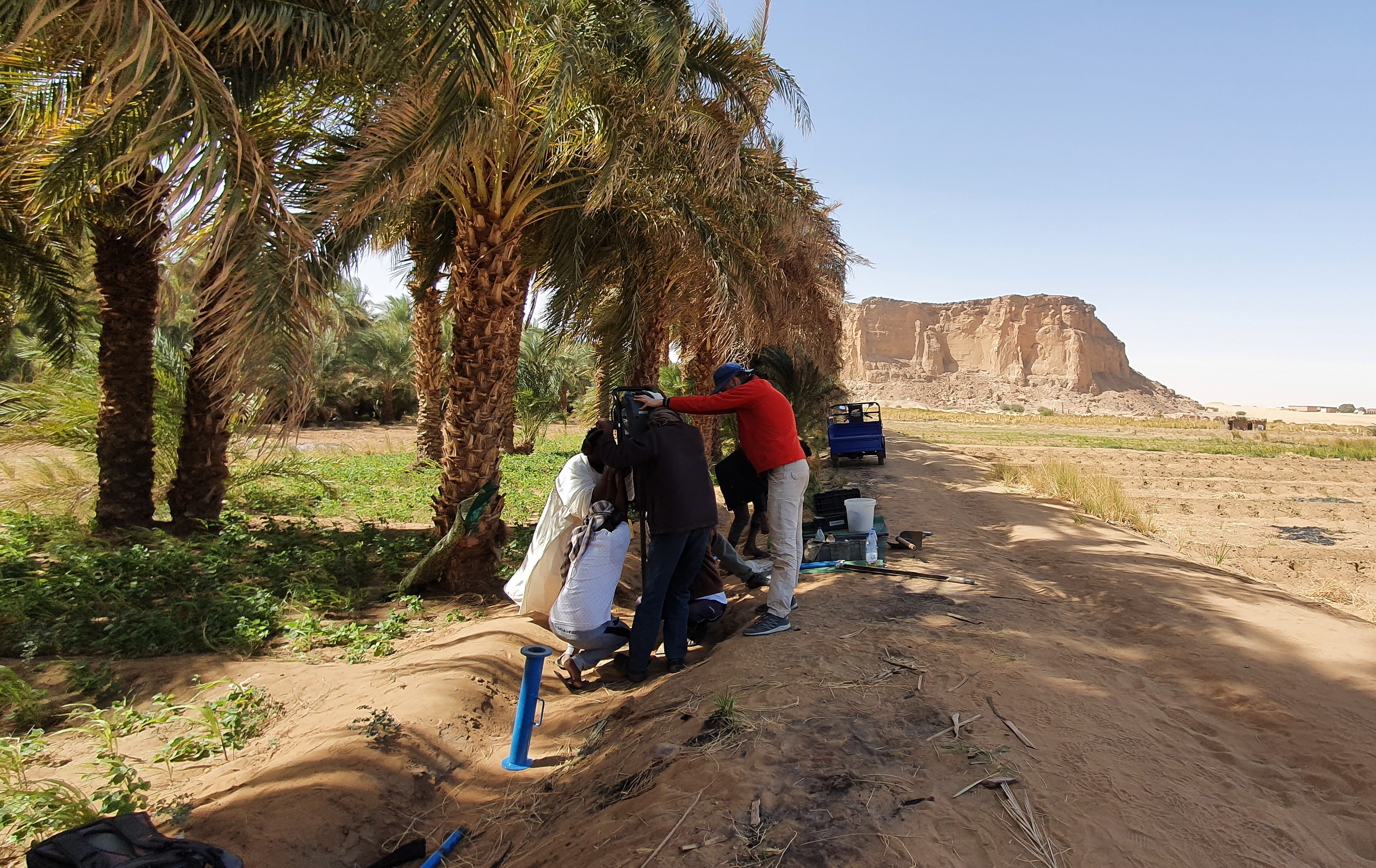
Photo 2. Percussion-corer team drilling along the transect line with Jebel Barkal in the background (photo credit: Pawel Wolf, 2022).
These cores form a long-term archive of river behaviour. Each represents a vertical timeline of sand, silt, and clay deposits; taken together, they allow us to reconstruct cross-sections through the valley and trace how the Nile has changed over thousands of years.
Samples were collected every 10 cm using hand augers and percussion drilling, and described in detail in the field. Sands typically represent former river channels, while finer clays reflect floodplain environments. Boreholes commonly reached depths of 7–10 metres. Back at our desks, these data were digitised and combined into transects, providing a continuous view of the Nile Valley stratigraphy.
To establish a chronology, we collected samples for Optically Stimulated Luminescence dating, analysed by Elizabeth Chamberlain, while ceramic fragments were studied by Saskia Büchner-Matthews to provide additional chronological constraints.
What emerged was a clear picture of long-term change. During the early Holocene, the Nile incised deeply into its valley, creating a dynamic landscape. Around 4,000 years ago, this system shifted towards floodplain aggradation, building up the valley floor.
From that point onward, the Nile at Jebel Barkal appears to have occupied a relatively stable position within the valley.
This contrasts with more dynamic behaviour observed elsewhere along the Nile and is likely related to the confined valley setting near the Fourth Cataract. The resulting stability and development of fertile floodplain soils provided favourable conditions for settlement and help explain why Napata emerged and persisted at this location.
Rather than occupying a highly dynamic landscape, the inhabitants of Napata lived in a setting where the river’s behaviour was, on geological timescales, relatively consistent. At the same time, the location offered clear advantages: access to water, fertile land, and connectivity along the Nile corridor, combined with the symbolic prominence of Jebel Barkal itself.
One of the most interesting aspects of this work is how closely environmental change and human activity were intertwined (Photo 3). The landscape did not determine where people lived, but it shaped the range of possibilities. The rise and persistence of Napata can be understood, at least in part, as a response to a stable and productive riverine environment.
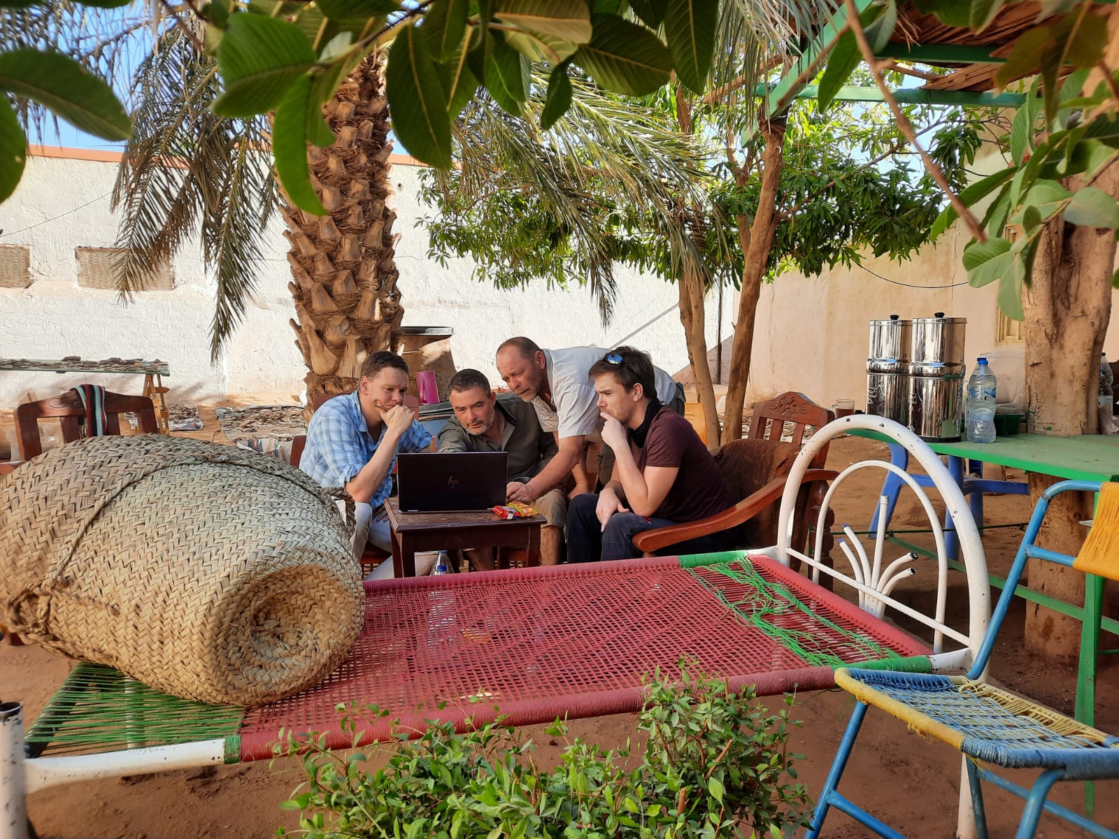
Photo 3. Discussing the Nile’s buried deposits. From left to right: Jan Peeters, Tim Skuldbøl, Pawel Wolf, and Tim Winkels (photo credit: Saskia Büchner-Matthews, 2023).
This study builds on earlier work along the Nile, including our research in Egypt, where we identified a similar large-scale system shift around 4,000 years ago (Peeters et al., 2024), also detailed in a Springer Nature Research Communities blog post. Extending that perspective upstream into the Cataract Nile reveals both similarities and important regional differences.
More broadly, the work highlights the value of combining geological and archaeological approaches. By integrating sedimentary records with site data, we can move beyond static reconstructions and begin to understand landscapes as dynamic systems that evolve together with human societies.
Standing at Jebel Barkal today, it is easy to focus on the visible remains — temples, pyramids, and the dramatic rock itself. But beneath the surface lies a much stronger story, written in layers of sediment, recording how the Nile shaped the land on which one of Africa’s earliest urban centres emerged.
[Jebel Barkal background photo credit: Gregory Tucker, 2018]
Please sign in or register for FREE
If you are a registered user on Research Communities by Springer Nature, please sign in