Reconstructing over a century of changing tides
Published in Earth & Environment and Civil Engineering
A puzzle scattered across centuries and continents
When we think about tides, we often imagine something predictable and unchanging. But what if the tides we see today are very different from those a century ago?
Answering that question turned out to be less about running models, and more about detective work.
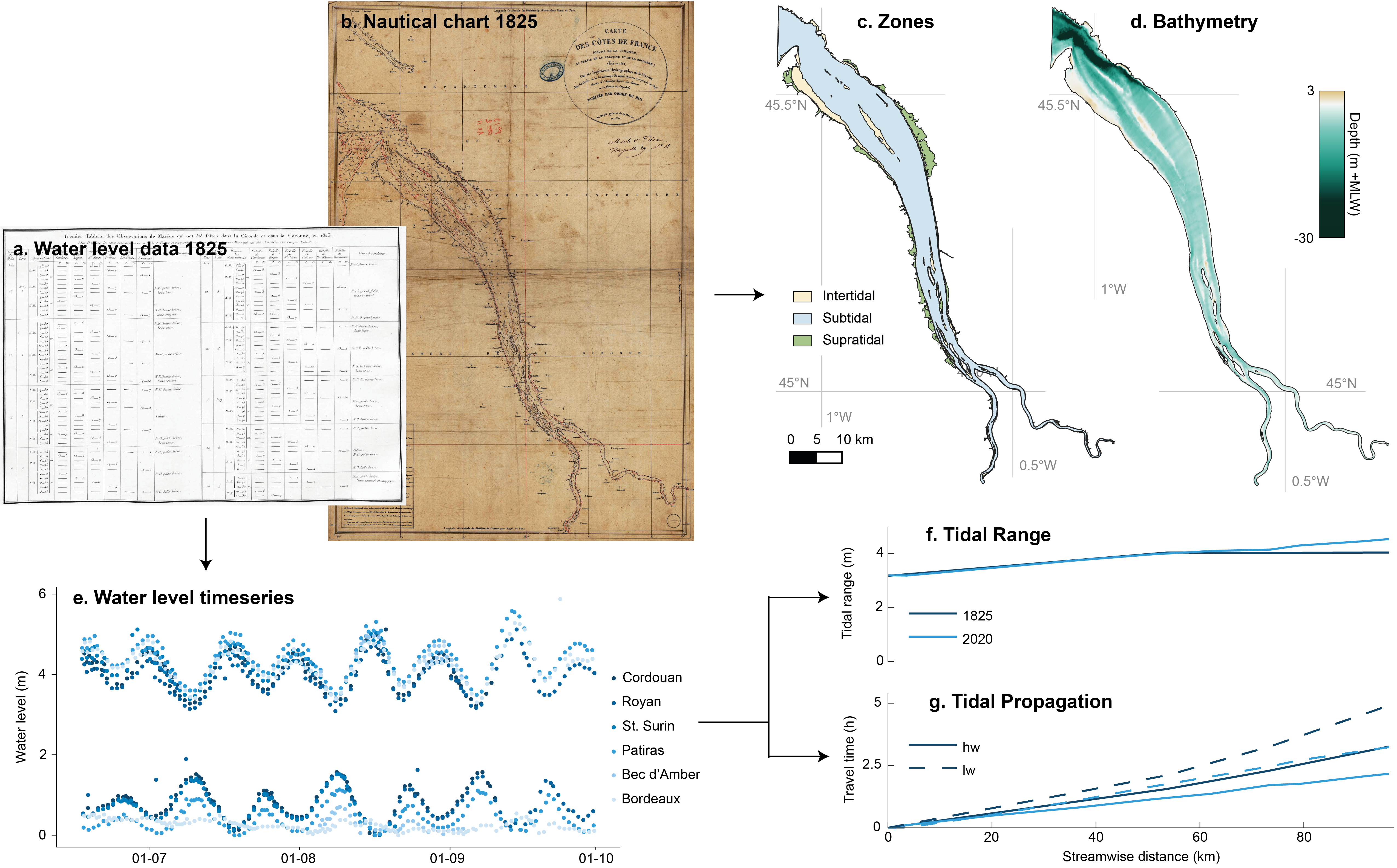
There is no single dataset that tells you how tides have evolved over long timescales. Instead, the information is scattered across centuries of archives: old tide tables, nautical charts, hydrographic surveys, handwritten records, and modern measurements.
Over the course of this project, we spent a lot of time digging through both online and offline archives, trying to piece together fragments of information from estuaries across Europe, Asia, and North America. Some data came from beautifully digitized databases; other parts had to be manually extracted from scanned documents or historical charts.
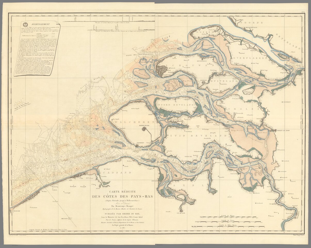
One of the more unusual steps was digitizing old nautical charts to reconstruct past estuarine geometry. These charts allowed us to build digital elevation models of estuaries as they existed decades, or even more than a century, ago. Combined with tide tables and water level records, this made it possible to track how tidal dynamics evolved over time.
Making incomparable data comparable
Each estuary came with its own formats, conventions, reference levels, and time coverage. Bringing all of this into a consistent dataset required careful processing and a lot of iteration.
As the project evolved, so did our scripts. New ideas, new datasets, and new questions meant that workflows were regularly updated or rebuilt. Looking back, there were definitely steps we would approach differently now, but I guess iterative process was essential in shaping the final analysis.
A clear signal emerges
Once everything finally came together, a surprisingly consistent picture emerged.
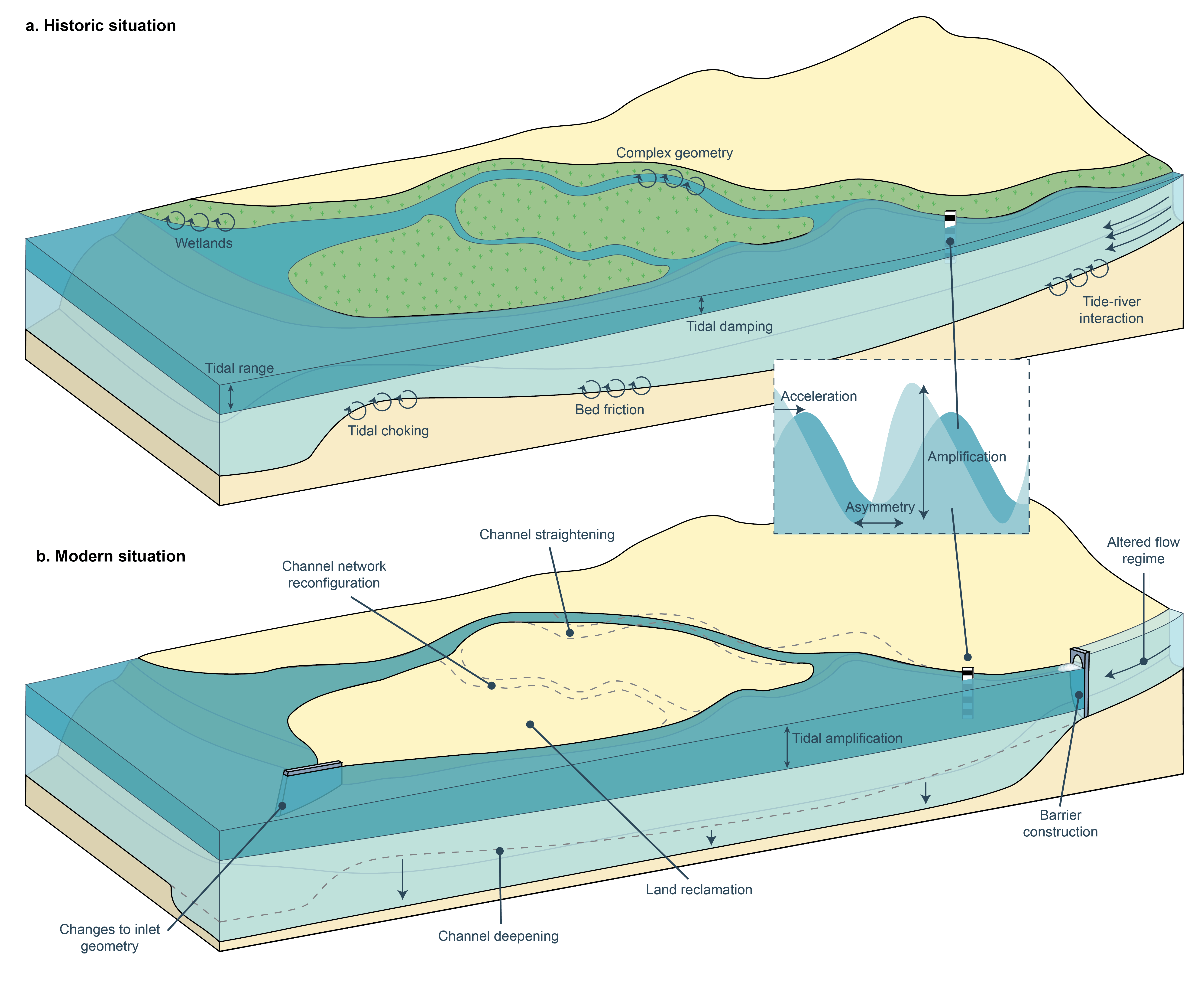
Across the 25 estuaries we studied, the tidal range has generally increased, and the tidal wave now propagates faster and further inland. In many cases, the changes inland are much larger than what you would expect based on sea-level rise alone.
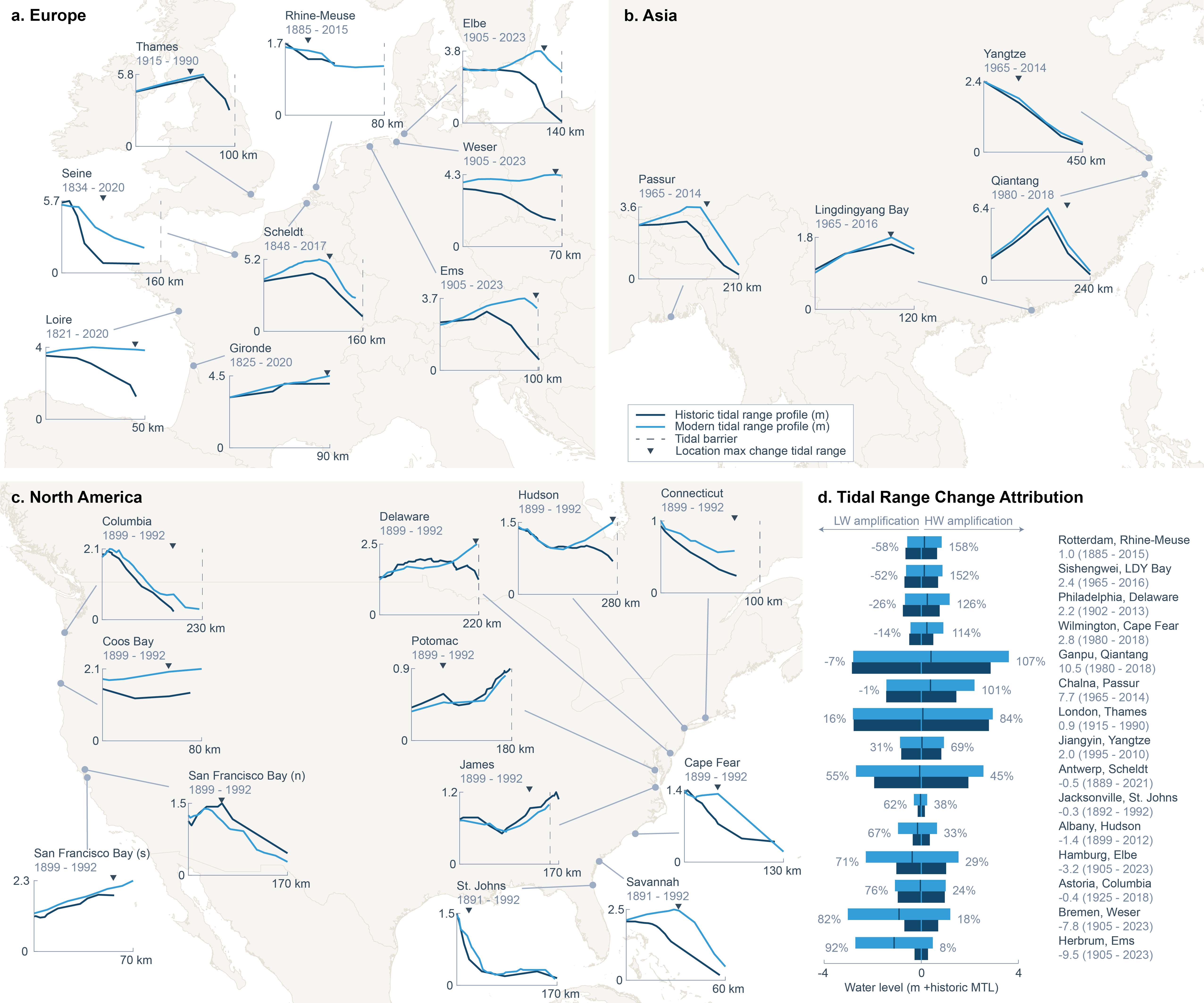
What stood out most was how strongly these changes align with human interventions, particularly channel deepening (often through dredging), land reclamation, and barrier construction.
Not just a problem—also an opportunity
One of the encouraging insights from this work is that these changes are not purely driven by global processes. Because human interventions play such a large role, they also offer opportunities for mitigation.
If parts of these systems can be restored, for example by making channels shallower again or reintroducing intertidal areas, there is potential to dampen tidal amplification. That could even help reduce how strongly sea-level rise is felt further inland.
In other words, the same systems that we have altered can, to some extent, be steered back.
A collective effort
This project would not have been possible without the help of many others. I am deeply grateful to my co-authors for joining me in this quest for data, and for their insights and guidance throughout the process. I would also like to thank the student assistants who helped digitize the data.
Reconstructing the past of something as dynamic as tides is not straightforward, but it is incredibly rewarding when the pieces finally fall into place.
Follow the Topic
-
Nature Geoscience
A monthly multi-disciplinary journal aimed at bringing together top-quality research across the entire spectrum of the Earth Sciences along with relevant work in related areas.

Related Collections
With Collections, you can get published faster and increase your visibility.
Urban fires around the globe
Publishing Model: Hybrid
Deadline: May 31, 2026
Atmospheric rivers
Publishing Model: Hybrid
Deadline: May 31, 2026


Please sign in or register for FREE
If you are a registered user on Research Communities by Springer Nature, please sign in