Let's cover the soil
Published in Earth & Environment
Soil is the foundation of life on Earth. In 1994, the United Nations Convention to Combat Desertification (UNCCD) was founded to protect and restore Earth’s land, following two high-level UN conferences in 1977 and 1992 on land degradation and desertification. The first task was to assess where and how severely Earth’s land had degraded. Only satellite remote sensing provides suitable, global, and spatiotemporally consistent data for the assessment. Yet, the available remote sensing sensors cannot see through the vegetation to assess the soil health. So, researchers used changes in vegetation greenness as a proxy for land degradation assessment. However, in the past decades, satellite observations show that the Earth is greening due to climate change and land management; at the same time, ground surveys show that soil quality has declined due to extensive agricultural practices.
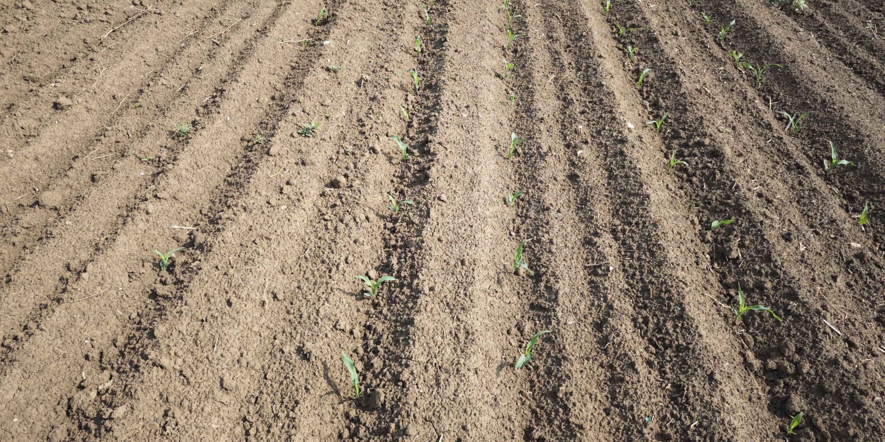
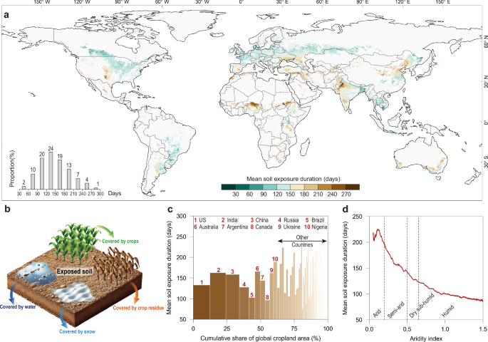
To investigate this paradox, we see things from a different angle to map the bare soil fraction in global croplands as a proxy for land degradation risk. Because leaving the soil directly exposed to sunlight and air without vegetation cover will lead to fast losses of soil organic carbon and microorganisms, especially under extreme climate events. Conventional tillage often leaves soil directly exposed during cropping phases of initial growth, post-harvest, and fallowing. The picture below was taken during a flight from Wuhan to Beijing, showing the desert-like cropland over Henan, the largest province of grain production in China.

We developed a new method based on satellite imagery that can produce daily soil exposure occurrence across global croplands from 2001 to 2022, based on which we evaluated the associated degradation risks caused by extreme climate events. We find that while 57% of global croplands experienced a reduction in soil exposure duration in the past two decades, 86% are increasingly subjected to climate extremes. The areas exposed to increasing climate extremes tend to have higher soil organic carbon levels, indicating an intensified degradation risk of global nutrient-rich cropland soils.
Our study offers an innovative remote sensing perspective for monitoring soil degradation, contributing to the achievement of global initiatives such as the United Nations Convention to Combat Desertification and the Sustainable Development Goals. It also provides evidence to support improvements in sustainable agriculture practices.
More importantly, through this research, we hope to spark greater global awareness of soil health and inspire collective action to protect the very foundation of life on Earth.
Follow the Topic
-
Nature Communications
An open access, multidisciplinary journal dedicated to publishing high-quality research in all areas of the biological, health, physical, chemical and Earth sciences.
Related Collections
With Collections, you can get published faster and increase your visibility.
Women's Health
Publishing Model: Hybrid
Deadline: Ongoing
Biosensing
Publishing Model: Hybrid
Deadline: Jun 30, 2026


Please sign in or register for FREE
If you are a registered user on Research Communities by Springer Nature, please sign in