The global Sahel monsoon ocean-pressure index reconciles its regional and large-scale features
Published in Earth & Environment
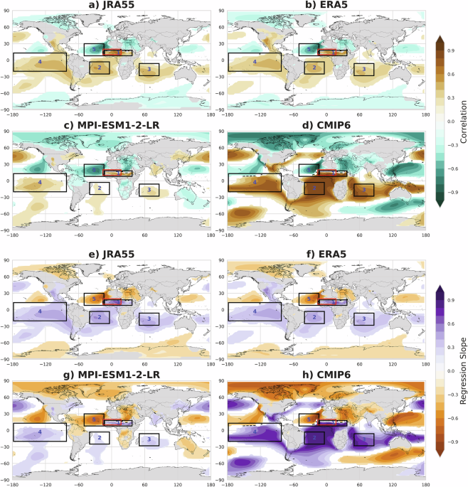

The Sahel region in Africa experiences major changes in rainfall, shifting between severe droughts and heavy rains. Scientists have struggled to understand and predict these shifts accurately using traditional methods, which usually only look at local land and sea surface temperatures. To contribute to a better understanding, we developed a new index called the Sahelian Monsoon Ocean-Pressure Index (SMOPI). Instead of just looking at local weather, SMOPI looks at sea-level pressure across five key areas around the world, including the Sahel itself, parts of the Atlantic Ocean, the Indian Ocean, and the Pacific Ocean. By combining these regional and global pressure patterns, SMOPI successfully captures both local weather behaviors and large-scale climate connections, like El Niño, the Atlantic Meridional Mode and the Indian Ocean Dipole (IOD). When SMOPI is strong and positive, the Sahel gets plenty of rain, driven by good moisture flow and favorable wind patterns high in the atmosphere. When SMOPI is weak and negative, the region suffers from drought because moisture is pushed away. SMOPI helps explain why climate models failed to properly show historical Sahel droughts. Because it connects local weather with global climate systems, SMOPI is a powerful, reliable new tool that can help scientists monitor, understand, and better forecast rainfall in the Sahel as the global climate changes.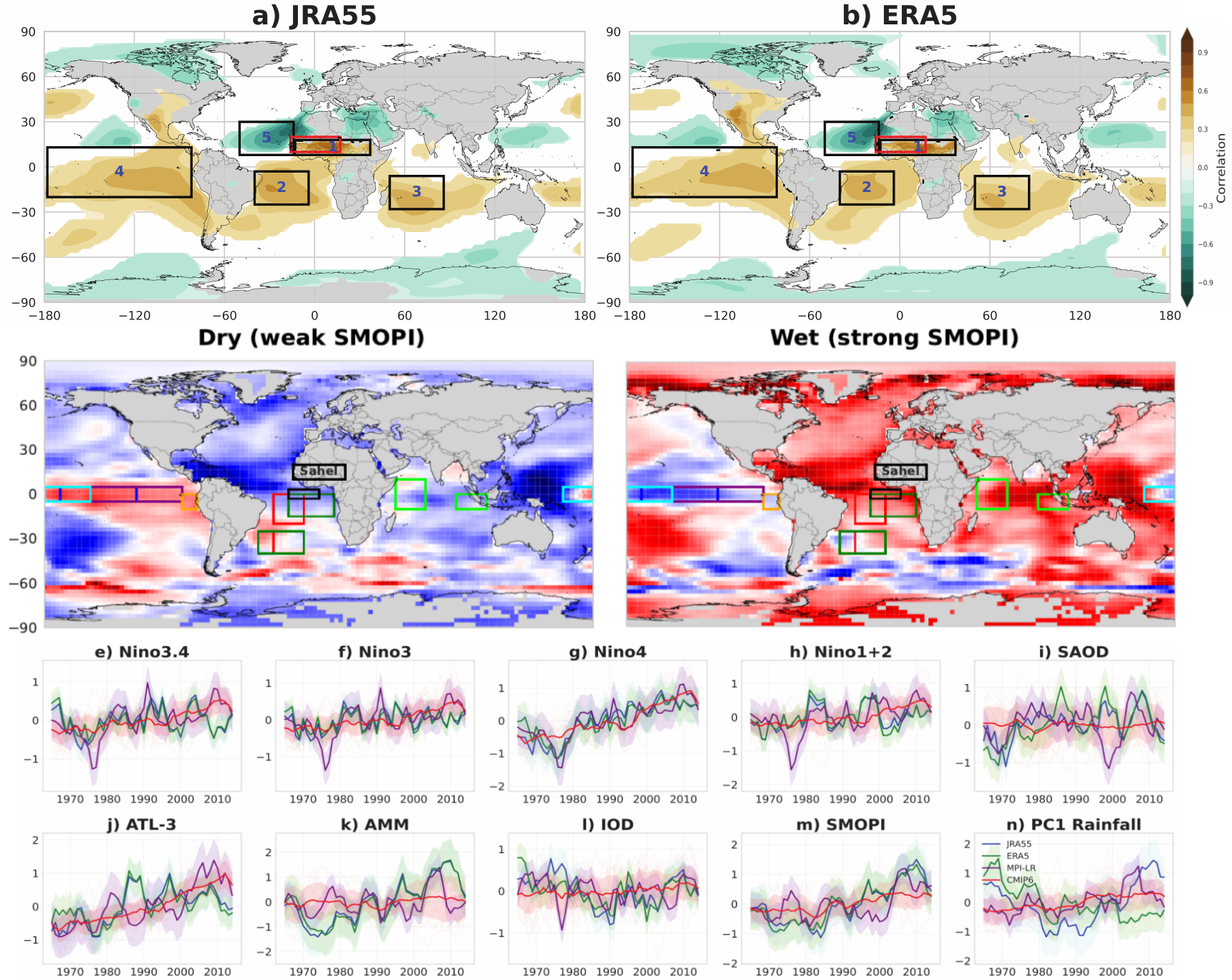

Follow the Topic
-
npj Climate and Atmospheric Science
This journal is dedicated to publishing research on topics such as climate dynamics and variability, weather and climate prediction, climate change, weather extremes, air pollution, atmospheric chemistry, the hydrological cycle and atmosphere-ocean and -land interactions.

Related Collections
With Collections, you can get published faster and increase your visibility.
Atmosphere-Biosphere Interactions
Publishing Model: Open Access
Deadline: Oct 31, 2026
AI-Driven Innovation in Atmospheric Chemistry and Composition–Climate Interactions
Publishing Model: Open Access
Deadline: Oct 31, 2026