When One Model Is Not Enough: Toward Region-Adaptive AI for Ground Deformation
Published in Earth & Environment and Computational Sciences






The full open-access article is available in Environmental Earth Sciences:
Why should one model be expected to understand an entire landscape?
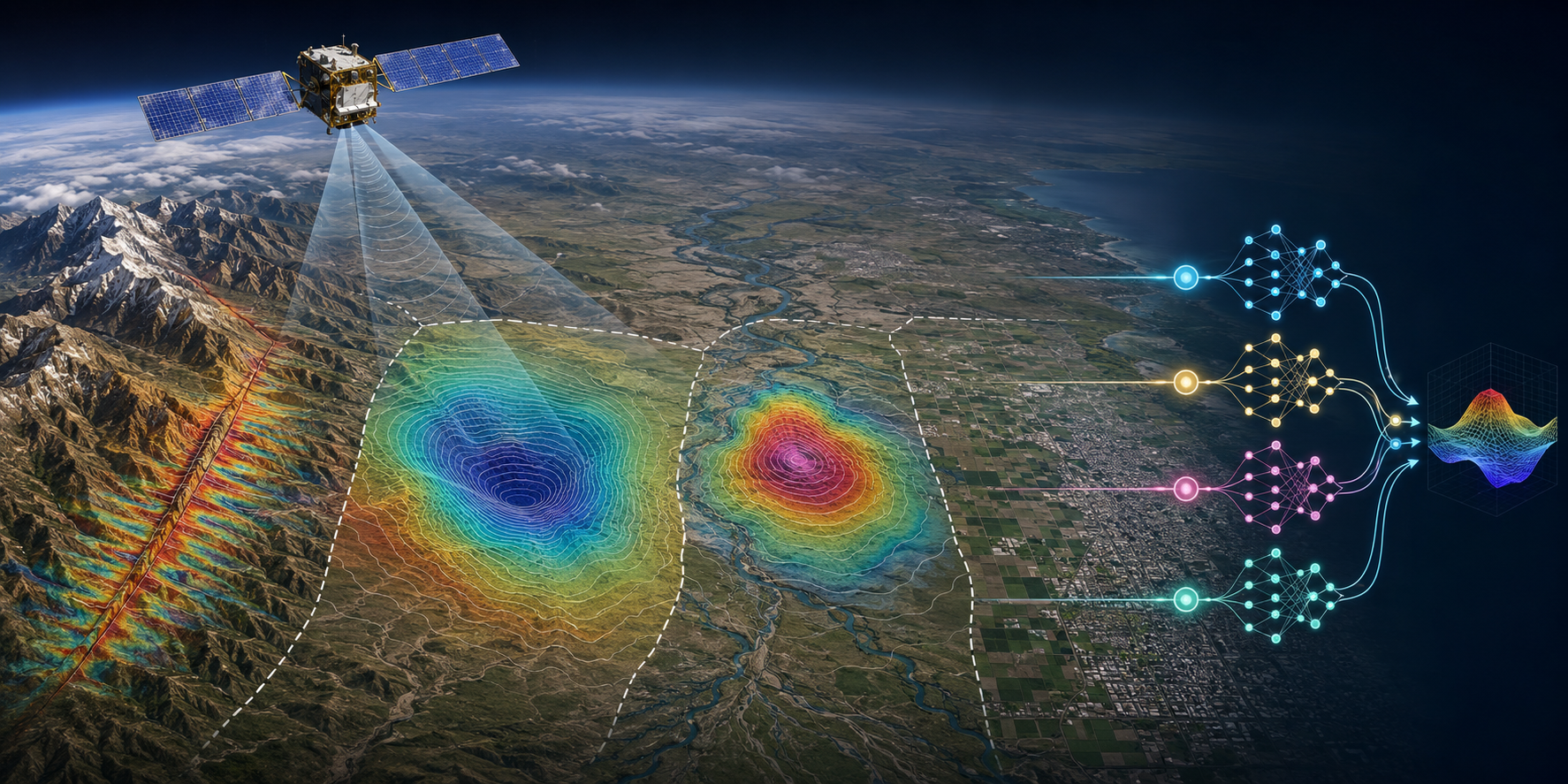
The idea behind our study began with a mismatch that we repeatedly encountered in ground-deformation research. The Earth’s surface is inherently heterogeneous, yet many artificial intelligence models are developed as if an entire study area were governed by the same geological, hydrological, and environmental conditions.
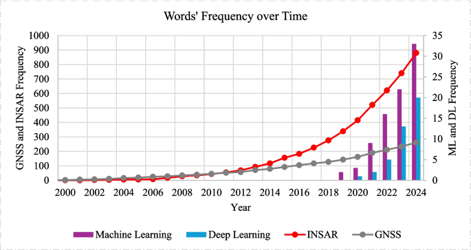
Synthetic Aperture Radar (SAR), particularly Interferometric SAR (InSAR), has transformed our ability to monitor ground deformation. It enables millimetre-scale surface movements to be observed across large areas and over long periods. Artificial intelligence further extends this capability through pattern recognition, anomaly detection, susceptibility assessment, and deformation forecasting.
However, high predictive accuracy in one region does not guarantee comparable performance elsewhere. A model trained in an alluvial basin affected by groundwater extraction may not adequately represent a tectonically controlled mountainous region. Even within the same study area, multiple deformation mechanisms may coexist.
This led us to a simple question:
If the Earth is spatially heterogeneous, why should a single artificial intelligence model be expected to interpret every part of it equally well?
Looking beyond headline accuracy
To investigate this question, we searched the Web of Science and Scopus databases and identified 21,656 publications related to ground and surface deformation. After merging the databases and removing duplicate records, 11,874 unique publications remained. A multi-stage screening process ultimately identified 62 studies that jointly addressed SAR observations, artificial intelligence, and the forces controlling deformation.
Our objective was not simply to determine which algorithm produced the lowest error. We wanted to understand which deformation forces had been modelled, which artificial intelligence methods had been used, how their performance had been evaluated, and which limitations continued to restrict their practical use.
The review revealed that there is no universally superior model. Model performance is closely related to regional context. Topography, lithology, tectonic activity, groundwater dynamics, precipitation, hydrological processes, land-cover change, and anthropogenic activities rarely operate independently. Their interactions vary between regions and across spatial and temporal scales.
Several persistent limitations also emerged. Models developed for particular geographical settings were often difficult to generalize. Deformation regions were frequently defined using manual or subjective boundaries. Independent validation using GNSS, levelling, or LiDAR observations remained limited. Model explainability, uncertainty assessment, and reproducibility were also not consistently incorporated into existing workflows.
These findings suggested that the main question should not be:
Which artificial intelligence model is the best for ground-deformation monitoring?
Instead, we should ask:
Which model, data configuration, and explanation are most appropriate for each deformation region?
From a research gap to ARAIS
This shift in perspective led us to propose the Adaptive Regional Artificial Intelligence System (ARAIS).
ARAIS is a conceptual framework built around four interconnected components:
- Data integration: SAR observations are combined with geological, hydrological, meteorological, topographic, and anthropogenic datasets within a spatially and temporally consistent structure.
- Regionality and scalability: large and heterogeneous study areas are automatically divided into more homogeneous deformation regions.
- Region-based automatic model selection: suitable machine-learning or deep-learning algorithms, hyperparameters, and deformation-force configurations are selected separately for each region.
- Explainable and generative AI-based reporting: region-specific interpretations and decision-support outputs are produced with the support of explainable artificial intelligence methods.
ARAIS does not prescribe a single universal algorithm. Instead, it provides a roadmap for developing systems in which the analytical strategy can adapt to the physical and environmental characteristics of each region.
Testing the central idea
One of the most important decisions in developing the study was not to stop after identifying the limitations in the literature. We wanted to test whether the central idea of regional modelling could produce measurable benefits.
We therefore conducted an illustrative proof of concept using the SARisk platform. The experiment was based on an InSAR dataset covering the 2020–2024 period in the Gediz Graben–Sarıgöl region of western Türkiye. The processing pipeline began with 140,986 measurement points. Following quality filtering, the deformation time series were divided into four clusters using the GHOST/SPARK approach.
We then compared a single global model with cluster-specific models across 11 machine-learning algorithms. The cluster-specific models outperformed the global approach in three of the four deformation regions. The improvement in RMSE reached 13.5% in one cluster. Moreover, global models required approximately three to five times longer training periods than their cluster-specific counterparts.
The most revealing aspect of this result was not a single accuracy value. It was the evidence that different parts of the same landscape responded better to different modelling strategies.
The proof of concept deliberately excluded geological and environmental forcing variables. This allowed us to test whether heterogeneity within the raw InSAR time series alone was sufficient to justify regional modelling. The results indicated that even before external deformation forces are introduced, treating the study area as a collection of distinct deformation regimes can improve both predictive performance and computational efficiency.
Why regional adaptation matters
Limited generalizability is a methodological concern in scientific research, but it becomes a more serious issue when models are used operationally. Decisions involving infrastructure safety, groundwater management, land subsidence, landslide risk, and disaster preparedness require systems that are not only accurate but also scalable, transferable, and scientifically explainable.
ARAIS represents a transition from asking one global model to understand an entire heterogeneous landscape toward allowing each region to be analysed according to its own data patterns and deformation mechanisms.
The next stages of this research will focus on integrating region-specific deformation forces, testing spatial and temporal transferability, conducting independent validation with geodetic observations, and developing explainable reporting mechanisms. These steps will be essential for transforming ARAIS from a conceptual framework into an operational and reproducible GeoAI system.
The central message of our study is straightforward:
The Earth is heterogeneous, and the artificial intelligence systems used to monitor it should be capable of adapting to that heterogeneity.
The full open-access article is available in Environmental Earth Sciences:

Follow the Topic
-
Environmental Earth Sciences
This is an international multidisciplinary geosciences journal concerned with anthropogenically altered interactions within the geosphere and between the geosphere–biosphere.