Behind the GERD first filling: Assessing the downstream impacts without data exchange
Published in Earth & Environment



The Grand Ethiopian Renaissance Dam (GERD), inaugurated in 2025, is the largest hydropower dam in Africa. With a storage capacity of 74 billion m3, the GERD will completely change the hydrology of the Blue Nile, causing major implications for the two downstream states, Sudan and Egypt. Despite negotiations since construction began in 2011, the three countries have yet to reach an agreement on the filling and long-term operation of the dam.
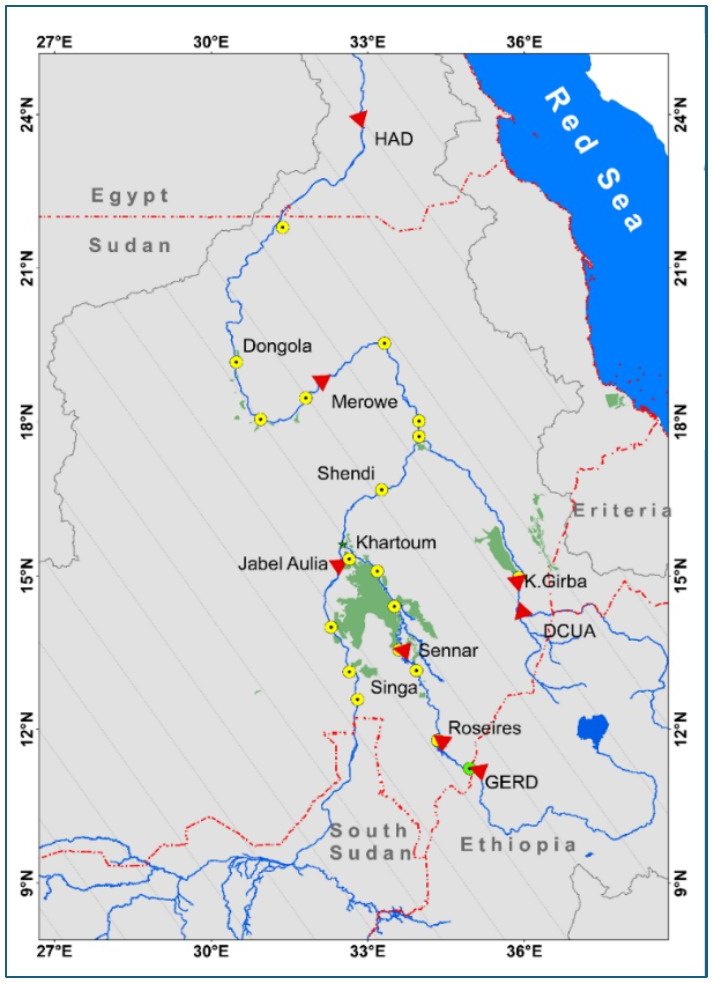
One of Sudan's major concerns has been the safety and operation of Roseires Dam, located just over 100 km downstream of the GERD. Without formal data exchange between the countries, how could Sudan anticipate releases from the much larger upstream reservoir?, and what are the implications?
Reconstructing dam operations
We combined several independent datasets and modelling tools to reconstruct the GERD's first filling and evaluate its impacts on Ethiopia, Sudan and Egypt.
First, we used the mesoscale Hydrological Model (mHM), driven by satellite-based precipitation data (CHIRPS), to estimate river inflows to the GERD. We then reconstructed reservoir water levels using observations from Sentinel-1, Sentinel-2 and Jason-3 satellites. Information on gate operations was obtained from publicly available media sources, carefully examined and cross-checked against satellite observations and hydrological evidence.
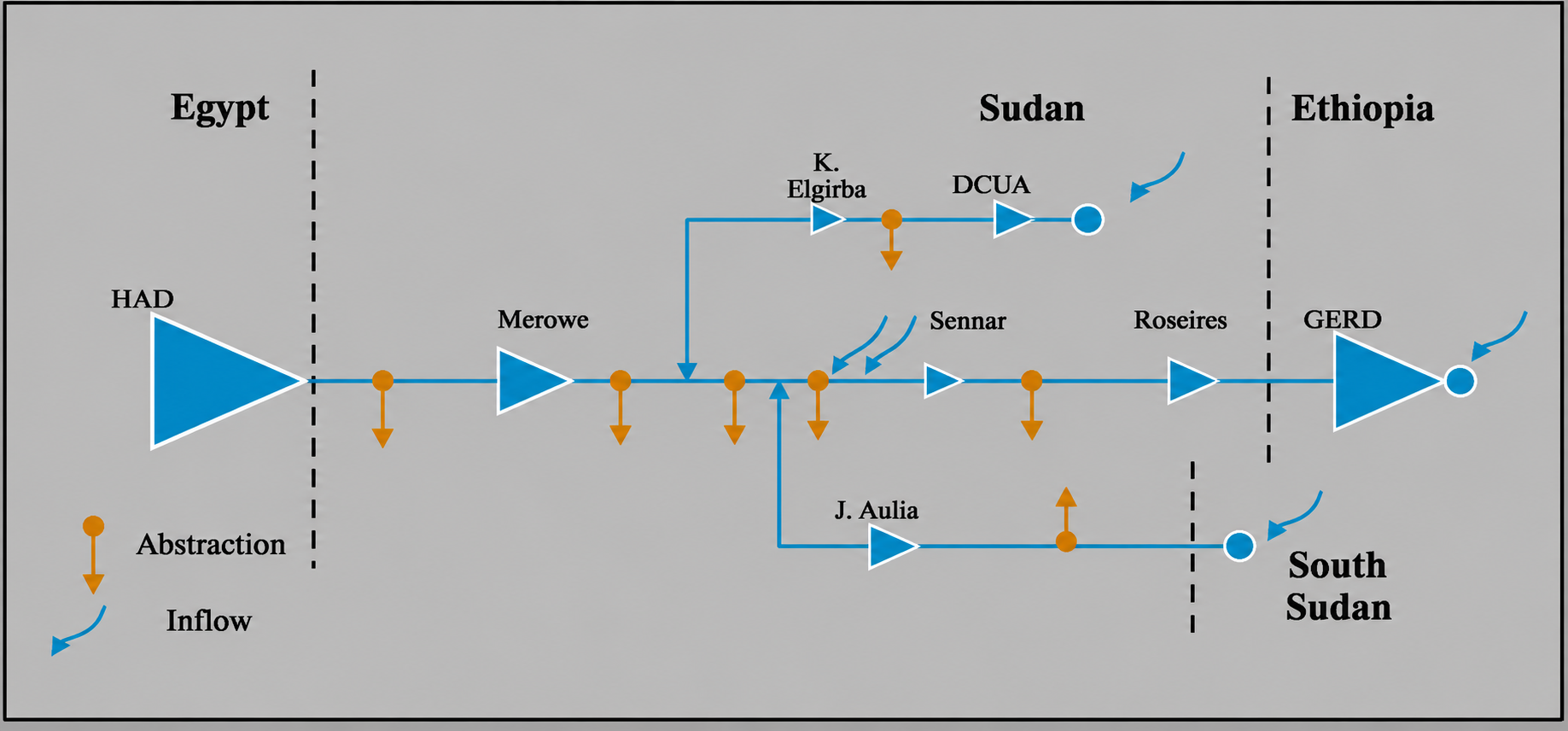
Finally, we applied the River Basin Simulation Model (RIBASIM), operating at 10-day time steps, to assess water availability and hydropower generation across the Eastern Nile. We compared the actual filling during 2020–2024 with Ethiopia's originally announced filling plan, while accounting for mitigation measures implemented downstream.
What did we find?
Our analysis revealed substantial differences between the planned and actual filling trajectories.
In Ethiopia, hydropower generation during 2020–2024 reached only about 25% of the planned generation, primarily because of delays in commissioning the turbines.
In Sudan, hydropower generation was largely maintained despite reduced releases from the GERD. This was mainly achieved because of higher reservoir levels of Sudanese reservoirs. However, the impacts were not uniformly positive. Our analysis indicates that floodplain agriculture, which depends on seasonal river flooding, experienced reductions in inundation ranging from approximately 4% to 50%, depending on location and the volume of water retained by the GERD.
Egypt experienced relatively limited impacts during the first filling. Exceptionally wet conditions across the upstream Nile catchments produced high river flows. Together with mitigation measures adopted in Egypt, these conditions helped maintain high water levels in the High Aswan Dam, with negligible reductions in hydropower generation.
These findings highlight an important distinction: the relatively limited downstream impacts during the first filling should not be attributed to GERD operations alone. They also reflect unusually favorable hydrological conditions and downstream mitigation measures.
Conducting research during the war in Sudan
Behind these scientific findings lies another story: the circumstances under which the research was conducted.
The need for this research became particularly urgent as Sudan descended into war in April 2023. Government institutions and research facilities were severely disrupted, while electricity and internet access became increasingly unreliable.
Four of our five researchers were displaced to different countries. As a result, the research was conducted entirely through remote collaboration, with team members working across national borders and institutional affiliations.
The study received no dedicated funding. All five authors contributed voluntarily, motivated by the need to address an important knowledge gap for Sudan and the wider Nile Basin.
Completing this research under such difficult circumstances was an achievement in itself. It also demonstrated the value of scientific collaboration and publicly accessible datasets when conventional research infrastructure and institutional support are disrupted.
Beyond the first filling: Lessons for transboundary water management
Our research demonstrates how publicly available satellite data and modelling tools can support transboundary water management where formal data exchange is absent.
The limited downstream impacts of the GERD's first filling were largely due to exceptionally wet years and mitigation measures in Sudan and Egypt. Similar outcomes cannot be assumed under prolonged drought or different operating conditions.
While scientific evidence can reduce uncertainty, it cannot replace cooperation. We hope that our research contributes to more transparent, evidence-based and cooperative management of the Nile, where unilateral actions and limited information exchange have contributed to mistrust in an already fragile region.
Follow the Topic
-
Nature Communications
An open access, multidisciplinary journal dedicated to publishing high-quality research in all areas of the biological, health, physical, chemical and Earth sciences.