Evolving Understanding of What It Takes to Forecast Strong Tropical Cyclones
Published in Earth & Environment and Law, Politics & International Studies



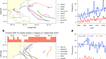

This Story Behind the Paper is associated with the recent publication of Li et al (2026) in Communications Earth and Environment.
Why it is so difficult to predict a typhoon/hurricane's intensity
Tropical cyclones (TCs, hurricanes/typhoons) belong to the most devastating natural hazards on Earth. Over the several recent decades, TC track forecasts have improved substantially. However, for warnings, evacuation, and disaster preparation – sometimes for mere survival of a coastal city or economy of an island nation – the key issue is not only where the storm will go, but how strong it will become. Unfortunately, progress in forecasting of TC intensity has been very slow. Therefore, a fundamental theoretical and practical question remains : why it is so difficult to predict a TC intensity. Our response to this question is that the TC forecasting routine should include all physical processes responsible for air-sea interaction, and especially the effects of wind waves.
Oceanography entered the field of tropical-cyclone forecasting
In 2000, Bender and Ginis introduced ocean coupling to the GFDL hurricane forecasting model and found improvement in the forecasting of intensities of two hurricanes in the Western Atlantic and two hurricanes in the Gulf of Mexico. The success brought Oceanography into the realm of TC forecasting. First Institute of Oceanography (FIO) entered the field around that time. Prior to that GFDL milestone, forecasting of this meteorological phenomenon was done with atmospheric models. Among the many deficiencies of that first generation of models, they overestimated the intensity of weak and moderate hurricanes, while overpredicting strong TCs. The overestimate of the intensity of weak and moderate hurricanes was much reduced by the cooled sea-surface temperature by the hurricanes themselves by the coupled atmosphere-ocean model. Nevertheless, this second generation of forecasting systems is still unable to address the issue of severe underprediction of strong TCs. For example, most strong TCs undergo a phase of rapid intensification. Even for leading forecasting centers the probability of detection of TC rapid intensification does not exceed 15-20%.
Intensive research in this area continues, greatly capitalizing on new technologies, such as Earth observing satellites and more and more powerful computers. Trying to improve the record and achieve the 10-year goal set by the 2017 US Weather Act, most centers tend to prioritize increasing model resolution. The finest model mesh, achieved recently, is 1.5 km. Nevertheless, the underprediction of strong TCs persists. This situation is not expected to improve until the resolution reaches 10m.
The decade of early 2000s, when GFDL first showed the promise of coupled ocean-atmosphere modelling for predicting TCs, was also the time when the First Institute of Oceanography (FIO) embarked on intensive research of interaction between surface waves and turbulence. This was also the period of active design of the Global Ocean Observing System (GOOS) by the international community. The importance of ocean waves for various meteorological and climatological applications was broadly recognized (e.g., Swail et al., 2001), and wind waves were included in the list of Essential Ocean Variables.
Generational evolution of forecasting models
In early generations of TC models, the sea surface was treated mainly as a static boundary across which heat, moisture and momentum are exchanged. However, under a TC, the ocean surface is neither flat, nor quiet. It is moving, wave-covered, and dynamically active. Surface wave processes directly affect the energy supply and dissipation of TCs and thus influence their intensity. Sea spray from breaking surface waves and reduced drag coefficient fuel TCs, especially in the course of their rapid intensification. The effects of sea spray and drag reduction have been recognized by some groups. Their parameterizations were developed and tested. Why haven’t they been included in the forecasting systems? Some groups probably tried to do so and found out that these effects exacerbate the problem of overprediction of intensities of weak and moderate TCs. The solution here is in inclusion of effects of mixing due to non-breaking surface waves. This process is an inherent component of the FIO model suite. Its inclusion leads to deepening of the mixed layer depth and lowering the SST. Consequently, the intensity of the weak to moderate TCs remains under control. At the same time, for strong TCs, the mixed layer is already very deep, and this effect becomes negligible. Comprehensive and simultaneous account of these three key wave effects is the solution to predicting TCs. The probability of detection of RI increases to 90%, and the underestimation of RI intensity is reduced by 82% in comparison with the mean results for all seven operational typhoon forecasting models in the Northwest Pacific.
Inclusion of these effects is important not only in TC forecasting. It also helps to eliminate an important systematic error in climate models highlighted in the IPCC Sixth Assessment Report. The CMIP6 models tend to simulate a too-shallow mixed layer and, as a consequence, too high SST in the summer hemisphere. In the FIO-ESM (Earth System Model) model this systematic error was considerably reduced.
The group of authors of this article is an alloy of physical oceanographers, mathematicians, and climate scientists, with experience in ocean waves and air-sea interactions. Qiao, Ryabinin – at the time the Executive Secretary of UNESCO-IOC, and other co-authors of this paper actively discussed how to apply the new theoretical understanding of wind-wave effects on air-sea interaction in operational forecasting of TCs. The FIO proposal "Ocean to climate Seamless Forecasting system (OSF)" was codesigned and endorsed by UNESCO-IOC as an Ocean Decade programme. One of the priority questions for OSF is how to use seamlessness, scale interactions, and comprehensive “physics” to improve operational predictions for multiple practical purposes. An answer related to the role of surface waves in prediction of TCs is given in the present paper.
Global efforts
The societal value of this work cannot be underestimated. A major leap forward in operational prediction of strong TCs becomes technically possible. Here we only demonstrated this opportunity, but its practical realization would require a well-coordinated global effort. Future steps should be multidisciplinary. For example, it is demonstrated that better forecasts require better initialization, which will benefit from better in-situ observations, especially at the ocean surface, including for waves. To that effect, a low-cost, high-precision, multi-parameter Jingwei buoy with AI technology was developed by Qiao’s group. Assimilation of wave data can further improve various meteorological predictions. AI can further strengthen forecasting system. Seamless approach is able to maximize the benefit of multiple predictive techniques. Climate models can benefit from it as well. In our opinion, these results are highly relevant for achieving further progress under the Early Warnings for All – a major UN undertaking coordinated by the World Meteorological Organization.
Open source
FIO is making the forecast model code available to download in an open-source format.

Follow the Topic
-
Communications Earth & Environment
An open access journal from Nature Portfolio that publishes high-quality research, reviews and commentary in the Earth, environmental and planetary sciences.

Related Collections
With Collections, you can get published faster and increase your visibility.
Ecological resistance and resilience under global change
Publishing Model: Open Access
Deadline: Apr 07, 2027
Hazards in Mountain Regions
Publishing Model: Open Access
Deadline: Nov 02, 2026

