Mountain glacier extents at the Last Glacial Maximum
Published in Earth & Environment
Explore the Research
Mountain glacier extents at the Last Glacial Maximum - Scientific Data
Scientific Data - Mountain glacier extents at the Last Glacial Maximum
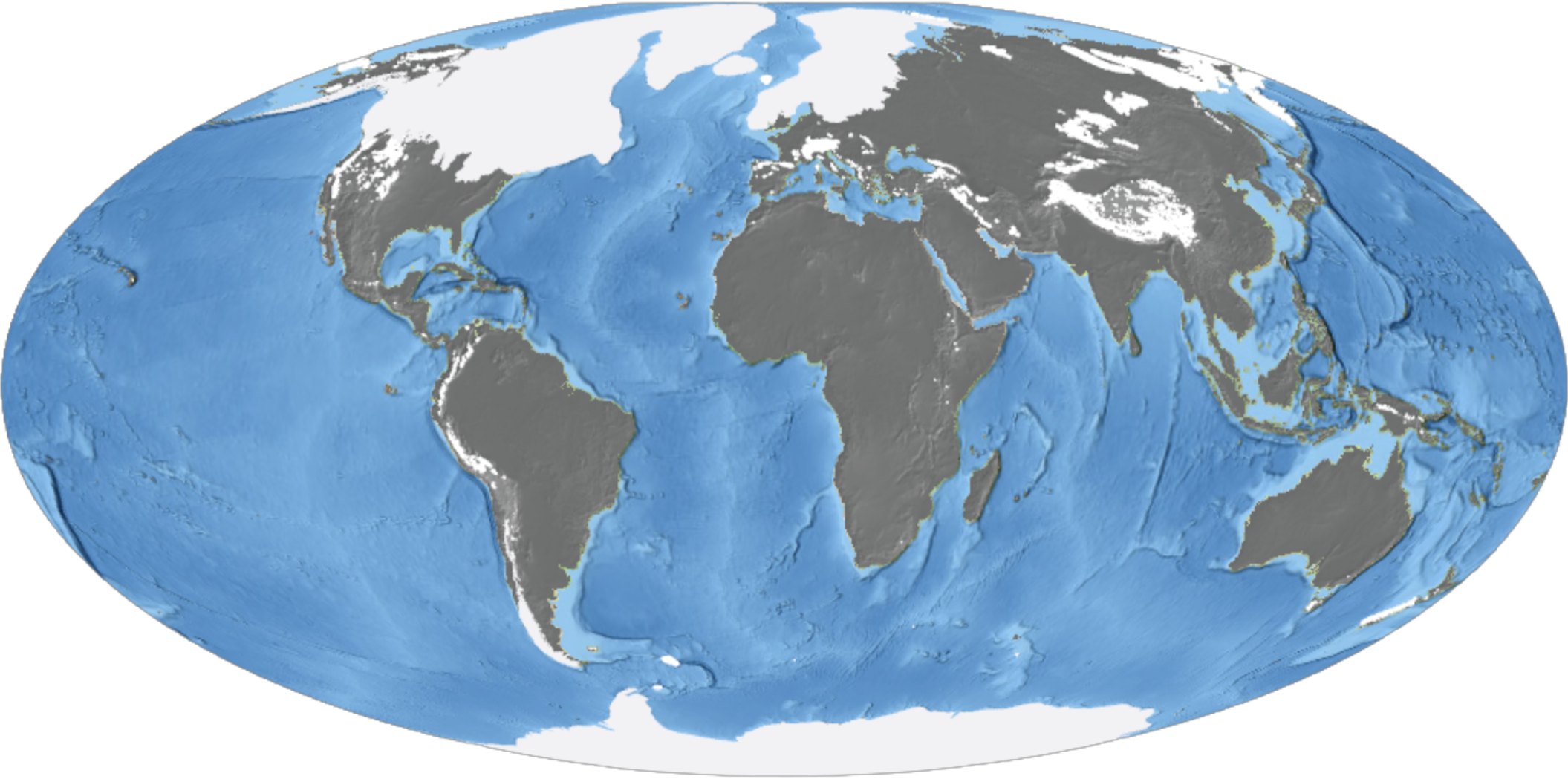
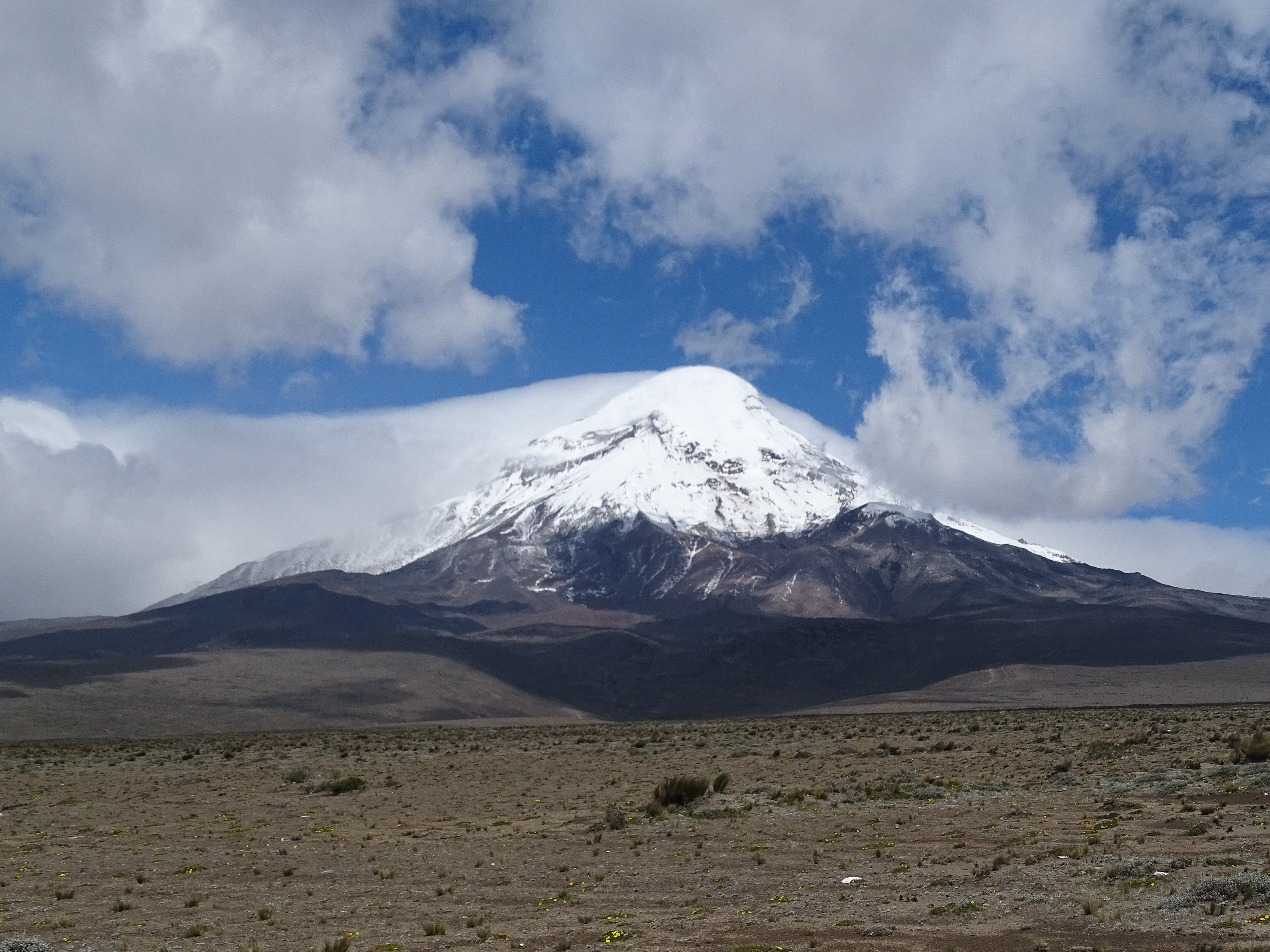
Approximately 21.000 years ago, our planet was 4 to 6 °C colder than today, with glaciers stretching far beyond the mountains we now know and dominating our landscapes for millennia. This Ice Age of peak cold temperatures and expansive glaciers is known as the Last Glacial Maximum (LGM). The glaciers we observe in the present are merely scattered remnants of the colossal ice masses that once prevailed. If we could travel back in time, we could understand how they responded to changing climate, how they shaped the mountain landscape, and also better predict when today’s glaciers may disappear as the globe continues to warm (Figure 1).
Since travelling back in time was beyond our reach (and budget), another path had to be pursued. Yet before we could even begin our journey of reconstructing glaciers through time, we first had to start with the basic question: when and where did mountains host their largest glaciers?
To uncover this spatiotemporal puzzle and establish the starting point for tracing the long history of glacier advances and retreats, the GLACIMONTIS project was created by Suzette G.A. Flantua and Augusto C. Lima to uncover this spatiotemporal puzzle and establish the starting point for tracing the long history of glacier advances and retreats. Joined by Martin Margold, Helen E. Dulfer and Anna L.C Hughes, the GLACIMONTIS team started its endeavor into the past of mountain glaciers.
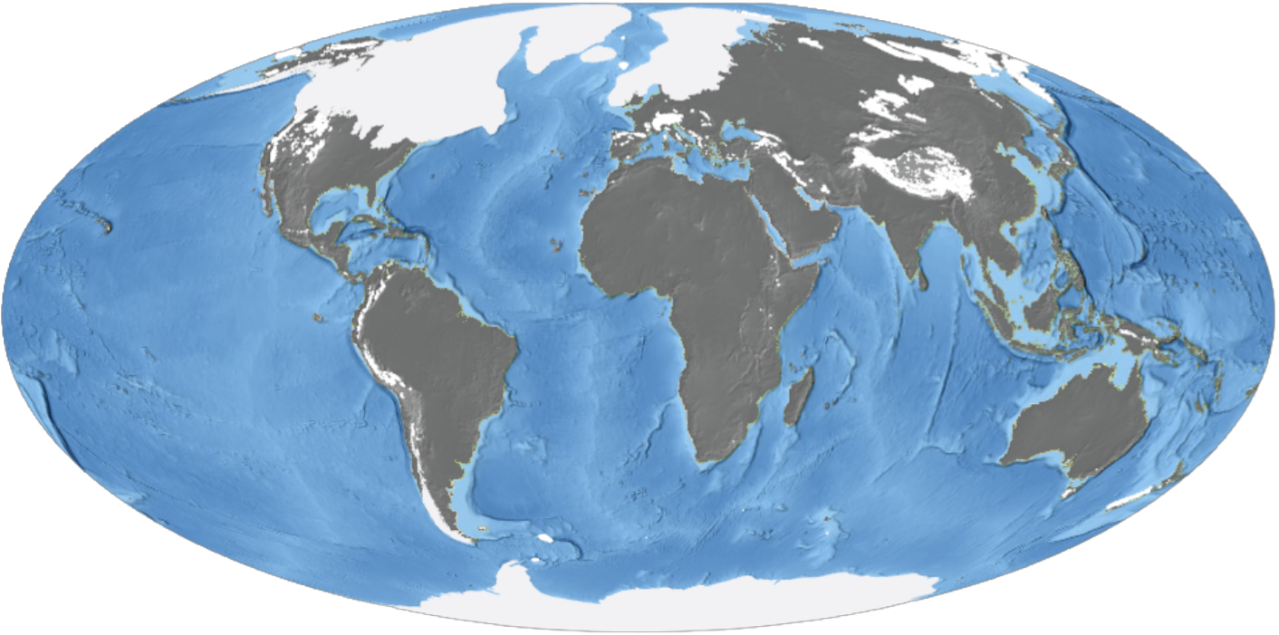
Fortunately, glaciers leave clues behind in the landscape that can be used to trace their former positions, timing, shapes, and sizes, and are collectively known as glacial landforms. Over decades of research, scientists around the world have already followed many of these clues, mapping them and reconstructing snapshots in time of past glacier configurations. You can see in Figure 2 the global state of this knowledge, showing where mountain ranges have been assessed, where glacier reconstructions are available, and where major gaps remain.
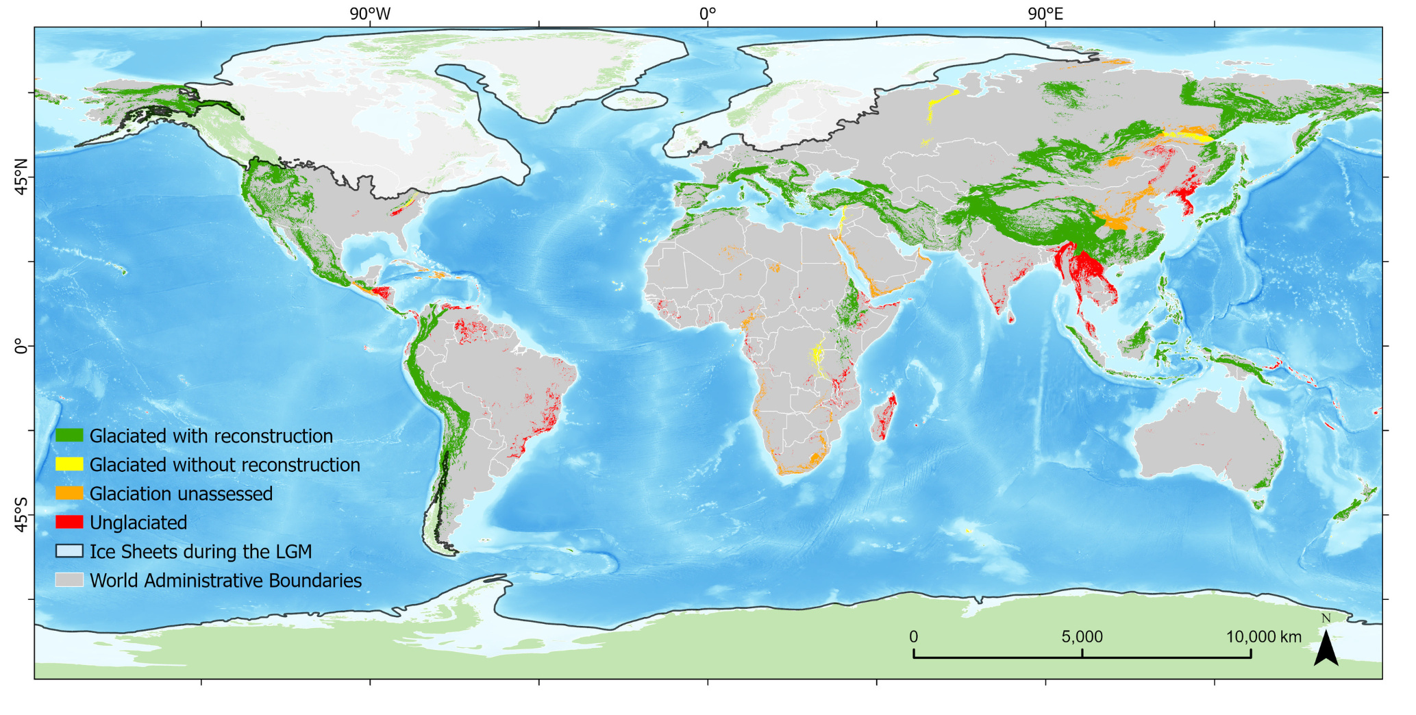
Figure 2. Global distribution of mountain ranges classified according to current knowledge of past glaciation and the availability of glacier reconstructions. Lima et al. 2026. Nature Sci Data.
Our challenge, then, shifted again: it was not to trace the glaciers directly from the landscape, but to trace them through hundreds of studies scattered across the global literature. GLACIMONTIS was designed to address this challenge by integrating these dispersed reconstructions into one global geodatabase of mountain glaciers at the Last Glacial Maximum. In doing so, we aimed to not only compile where past glaciers once existed, but also to bring together information on when they existed and climatic conditions associated with them.
At first, this seemed like a straightforward task. In practice, however, retrieving the data revealed a much more complex literature landscape. Many reconstructions were not openly accessible, and requests for data often resulted in unanswered emails or, occasionally, refusals.
Even when data could be obtained, they appeared in many different forms: digital files, printed maps, figures embedded in papers, or formats that were difficult to reuse. Published figures varied greatly in quality and resolution, and many were not provided as georeferenced maps. In some cases, essential spatial information was missing altogether. The challenge was not only to find the data, but also to interpret, standardize, and connect reconstructions that were often incomplete, inconsistent, or fragmented across publications. On top of all that, the Last Glacial Maximum itself added a temporal challenge: although it is often treated in the literature as a single global moment (21,000 yr ago), many mountain glaciers reached their maximum extent at local times.
At the same time, this process also revealed the collaborative spirit behind the field. Many researchers were enthusiastic about sharing their data, and some became part of the project journey itself. It was through this openness that Iestyn Barr and Benjamin J.C. Laabs joined GLACIMONTIS. More broadly, the project was only possible because of many individual and collective efforts that came before it, especially regional compilations and databases developed over previous decades, such as those by Ehlers et al. (2011) and the Western U.S. Paleoglacier Working Group.
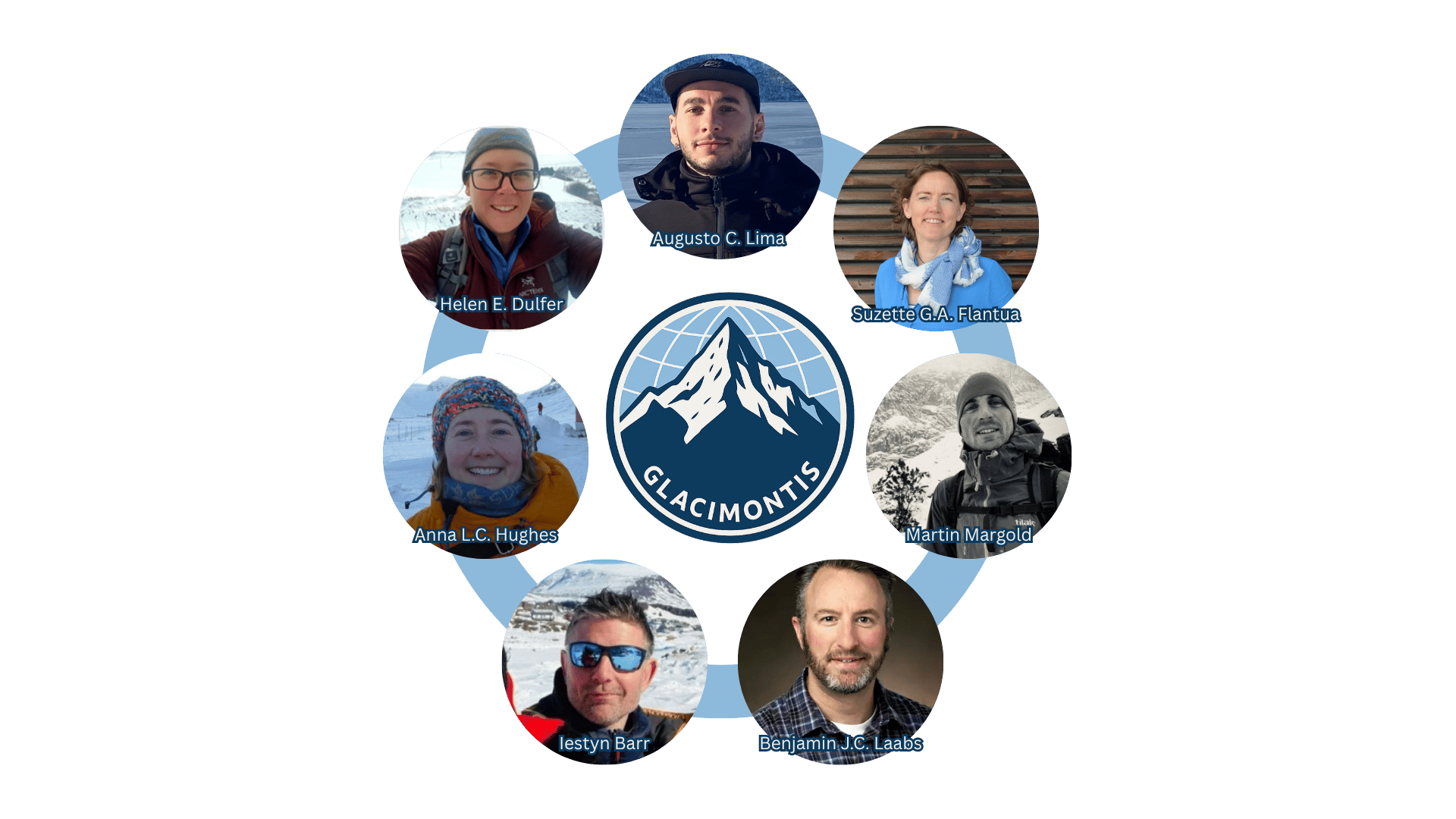
Figure 3. The GLACIMONTIS team. The project brings together expertise in glacial geomorphology, paleoglacier reconstructions, paleoclimate, biogeography and mountain landscape change.
Throughout the GLACIMONTIS project, it became clear that heterogeneity is part of the reality of past environments. Rather than trying to eliminate this variability, we focused on making it traceable. Each reconstruction in the GLACIMONTIS database can be linked back to its original source, allowing every glacier footprint to be followed throughout the literature. We also carefully interpreted each study’s context and assumptions, preserved the original interpretations as faithfully as possible, and documented our data retrieval and handling process.
Because glacier maxima did not occur everywhere at the same time, GLACIMONTIS adopted an extended timeframe, capturing not only glaciers associated with the global LGM, but also those representing local glacier maxima. In the end, the project brought together 15,014 glacier reconstructions from 209 studies across 271 mountain ranges worldwide, updating knowledge in 135 mountain ranges and highlighting research gaps in 71 others. The result is a global picture of reconstructed paleoglaciers, showing the mapped extent of former mountain glaciers compiled across the world (Figure 4).
We hope that this work will make it easier for researchers to access former glacier reconstructions and their information, whether for regional analyses or global comparisons. By providing a global geodatabase, GLACIMONTIS can support a wide range of applications, from paleoclimate studies, through applications on numerical modelling evaluation, to investigations of landscape evolution and ecological change. At a broader level, the project also highlights the importance of data integration in science. Many of the insights we seek depend not only on generating new data, but also on bringing existing knowledge together in meaningful ways.
Follow the Topic
-
Scientific Data
A peer-reviewed, open-access journal for descriptions of datasets, and research that advances the sharing and reuse of scientific data.

Related Collections
With Collections, you can get published faster and increase your visibility.
Computer vision in plant science and agriculture
Publishing Model: Open Access
Deadline: Oct 10, 2026
Wearable and Computer Vision Data for Health and Behaviour Research
Publishing Model: Open Access
Deadline: Aug 08, 2026


Please sign in or register for FREE
If you are a registered user on Research Communities by Springer Nature, please sign in