Navigating Margins — The Lived Geopolitics of Uzbekistan’s Sokh Enclave
Published in Social Sciences, Earth & Environment, and Statistics


Why Sokh?
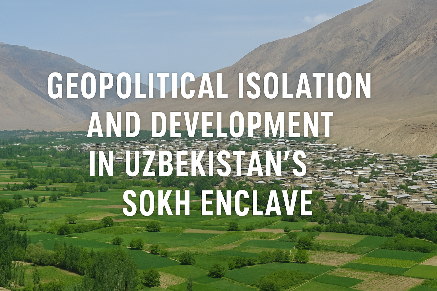
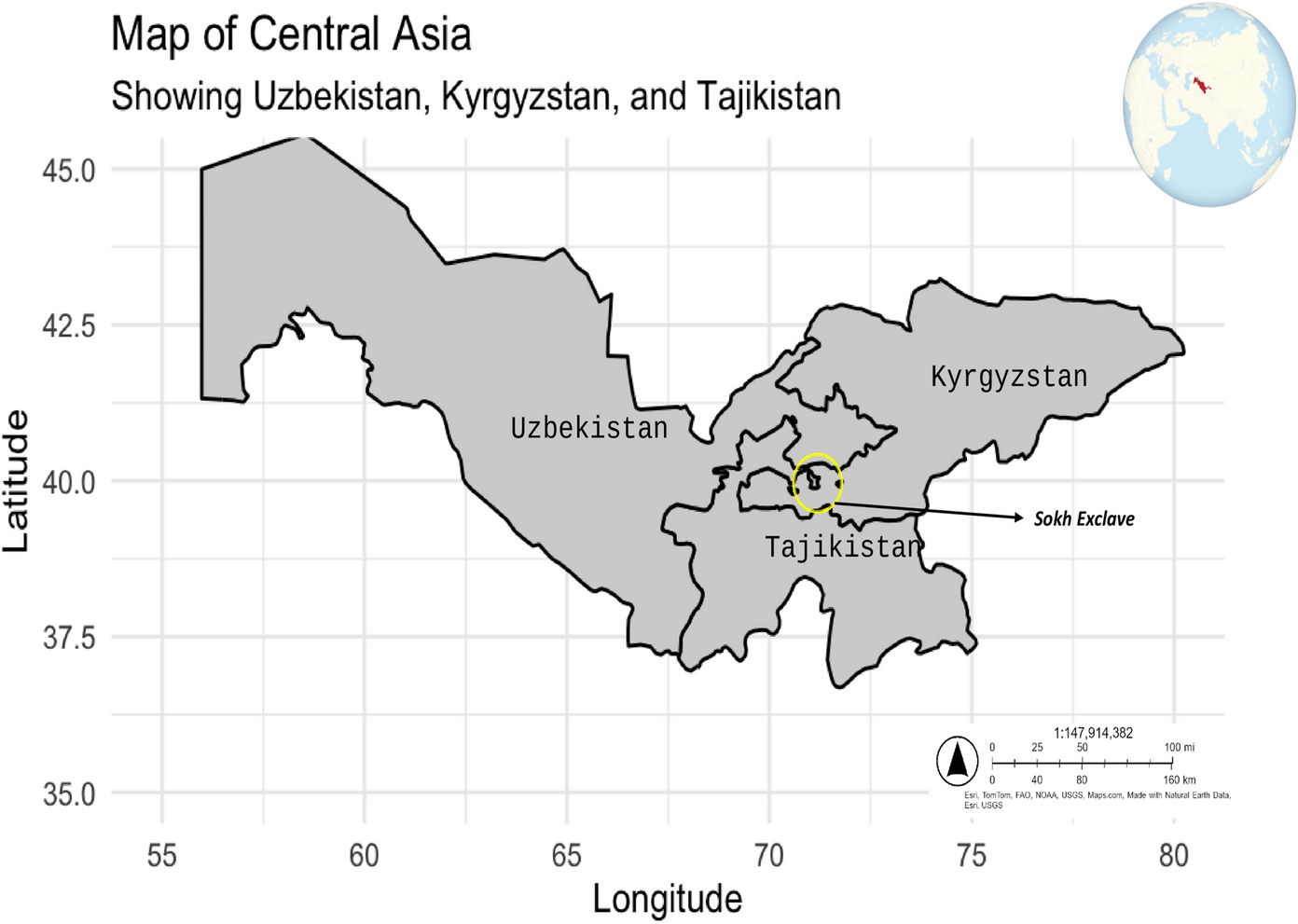
The Sokh enclave has long been a cartographic curiosity on the map of Central Asia—a small pocket of Uzbekistan entirely surrounded by Kyrgyz territory and inhabited predominantly by ethnic Tajiks. But what drew our attention to Sokh was not just its geopolitical oddity, but the everyday lived realities shaped by that oddity. What does it mean to be part of a state that you cannot easily access? How do borders not just divide land but shape identity, development, and belonging?
As scholars working on post-socialist space and political geography, we were intrigued by Sokh as a microcosm of larger questions that haunt many post-Soviet societies: what happens when inherited borders no longer align with social realities or administrative capacities? How does statehood materialize in isolated, fragmented spaces? This paper emerged from that set of questions.
What We Did
In our article, Geopolitical Isolation and Development in Uzbekistan’s Sokh Enclave, we approached Sokh not just as a border issue, but as a socio-spatial formation shaped by overlapping sovereignties, historical legacies, and everyday negotiations. Drawing on original fieldwork—including a structured survey of 260 residents and ethnographic observations—we sought to understand how enclave life affects people’s sense of development, citizenship, and future possibility.
Our methodology combined critical geopolitics with grounded empirical research. We collected responses around themes like economic conditions, access to services, perceptions of the state, and aspirations for the future. These were complemented by site visits, interviews with local stakeholders, and an analysis of infrastructural and policy interventions in the region.
What We Found
Sokh is a space shaped by tension—and resilience. Its residents experience real constraints: restricted mobility, disrupted infrastructure, and diplomatic friction between Uzbekistan and Kyrgyzstan that can make border crossings unpredictable or entirely closed. Many of our respondents expressed feelings of abandonment—both by the Uzbek state and by international development agencies.
Yet Sokh is not merely a story of victimhood. What surprised us was the diversity of local strategies to adapt, resist, and thrive. Agricultural self-sufficiency—especially in fruit and livestock production—has become a key pillar of local sustainability. In recent years, informal tourism and eco-tourism initiatives have emerged, albeit precariously. These are small-scale, often self-organized efforts to craft a more autonomous future under conditions of isolation.
A core insight of our research is that development in Sokh is not only hindered by geography—it is also mediated through geopolitical uncertainty. The enclave sits at the intersection of three identities: it is ethnically Tajik, politically Uzbek, and geographically Kyrgyz. This creates a deep ambiguity in terms of belonging and governance. The result is a space in which sovereignty is practiced, not presumed—where state presence is always partial and negotiated.
Why It Matters
Enclaves like Sokh are often treated as exceptions—remnants of colonial or Soviet-era cartography. But we argue that they should be seen as sites of intense geopolitical learning. Sokh reveals how modern states handle—or fail to handle—territorial fragmentation, ethnic pluralism, and the spatial limits of governance.
At a time when border disputes and territorial anxieties are once again making headlines globally, studying Sokh reminds us that borders are not just lines on a map. They are lived infrastructures, shaping how people access education, healthcare, livelihoods, and citizenship itself. For Central Asia, where multiple enclaves exist and border relations remain volatile, these insights are crucial for peacebuilding, regional cooperation, and inclusive development.
Conceptually, our study contributes to debates on enclave governance, scalar politics, and the geographies of marginality. We propose that enclaves like Sokh be understood not as “failed” or “forgotten” spaces, but as territories-in-flux, where identity, power, and space are constantly renegotiated. This requires both policy sensitivity and theoretical nuance.
Behind the Scenes
The making of this paper was deeply collaborative. It brought together scholars from geography, development studies, and regional area studies—each of whom brought unique linguistic, methodological, and cultural insights to the research. Fieldwork was led by Mr. AbduKodir Toshpulatov and Prof. Dr. Shavkatjon Jumakhanov, whose prior experience in the Fergana Valley and deep understanding of cross-border dynamics were indispensable.
Getting access to Sokh was not easy. Permissions had to be coordinated with both local and national authorities, and our field team had to remain adaptable to sudden changes in border policy or travel restrictions—some of which emerged during the COVID-19 pandemic. The survey instrument was translated into both Uzbek and Tajik to ensure inclusivity, and data collection followed strict ethical guidelines, including informed consent and anonymization of responses.
What started as a side interest in geopolitical enclaves soon became a full-fledged project, shaped by conversations with local residents, government officials, and cross-border traders. We are particularly grateful to the people of Sokh, who generously shared their experiences, challenges, and aspirations with us—often under difficult conditions.
Looking Forward
This paper is just the beginning. In future research, we hope to expand our study to other enclaves in the region—such as Barak, Shakhimardan, and Vorukh—to better understand how enclave governance varies across contexts. We are also interested in the long-term impacts of infrastructural investment and whether new forms of digital connectivity (e.g., mobile banking, online education) might mitigate some of the effects of spatial disconnection.
We also call on policymakers in both Uzbekistan and Kyrgyzstan to prioritize enclave development in bilateral negotiations. Sokh’s challenges are not just local—they reflect broader patterns of marginality that are intensified by national politics and historical inertia. Only through cooperative and inclusive policies can the potential of these territories be fully realized.
Conclusion
The Sokh enclave is not merely a border problem—it is a spatial condition that forces us to think differently about development, governance, and identity. It invites us to reimagine what statehood means when territory is fragmented and borders are unstable. More importantly, it highlights the voices and strategies of people who, despite being pushed to the margins, are actively shaping their own futures.
We hope this study will encourage more critical and grounded scholarship on enclaves, borderlands, and the often-overlooked spaces of the post-socialist world.
Follow the Topic
-
GeoJournal
This journal is an international journal devoted to all branches of spatially integrated social sciences and humanities.

Related Collections
With Collections, you can get published faster and increase your visibility.
Topical Collection on Integrating AI with RS-GIS for Climate Change, Disaster Risk, and Urban Resilience
The rapid advancement of Artificial Intelligence (AI), Machine Learning (ML), Deep Learning (DL), and Geospatial Artificial Intelligence (GeoAI) has revolutionized the way Earth Observation (EO) data are processed, interpreted, and utilized for environmental monitoring and decision-making. The unprecedented availability of multi-source satellite datasets, including optical, radar, hyperspectral, thermal, LiDAR, and UAV observations, combined with high-performance cloud computing platforms, has created new opportunities for addressing global environmental and societal challenges.
Climate change has become one of the most pressing issues facing humanity, influencing ecosystems, natural hazards, water resources, agriculture, urban environments, biodiversity, and human health. Understanding these complex interactions requires advanced analytical approaches capable of integrating large-scale geospatial datasets with intelligent computational models.
This Topical Collection aims to provide a leading international platform for cutting-edge research that integrates Artificial Intelligence with Remote Sensing, Geographic Information Systems (GIS), Earth Observation, and spatial data science to improve the monitoring, prediction, assessment, and management of climate change and its impacts on both natural and human systems. The issue will highlight innovative methodologies that combine satellite observations, spatial modelling, machine learning, and explainable AI to support evidence-based environmental management and sustainable development.
Significance of the Topical Collection
Recent advances in satellite missions such as Sentinel-1, Sentinel-2, Landsat 8/9, MODIS, WorldView, PlanetScope, ICEYE, NISAR, GEDI, ICESat-2, and UAV technologies have generated unprecedented volumes of Earth observation data. Simultaneously, AI techniques—including deep learning, transformers, graph neural networks, reinforcement learning, and explainable AI have transformed geospatial analysis by enabling automated feature extraction, accurate prediction, and intelligent decision support.
Despite these advances, significant challenges remain in integrating heterogeneous geospatial datasets with AI models while ensuring robustness, interpretability, scalability, and operational applicability. This Special Issue seeks to bridge these gaps by promoting interdisciplinary research that combines geospatial sciences with modern AI methodologies to address climate-related challenges at local, regional, and global scales.
The Topical Collection will encourage the development of innovative frameworks capable of:
- Monitoring climate change and environmental dynamics.
- Predicting natural hazards and disaster risks.
- Assessing ecosystem vulnerability and resilience.
- Evaluating urban expansion, heat islands, and urban morphology.
- Quantifying population exposure and socio-economic vulnerability.
- Supporting sustainable resource management and policy formulation.
- Advancing explainable, trustworthy, and operational GeoAI solutions.
Expected Contributions
This Topical Collection seeks papers that:
- Develop novel AI algorithms for Earth observation.
- Integrate multiple satellite datasets for environmental monitoring.
- Improve climate change prediction accuracy.
- Introduce explainable and trustworthy GeoAI methodologies.
- Apply AI to disaster risk reduction.
- Advance urban sustainability research.
- Demonstrate operational applications using real-world datasets.
- Provide transferable frameworks applicable across different geographic regions.
- Support the United Nations Sustainable Development Goals (SDGs).
This Topical Collection will provide a comprehensive platform for showcasing state-of-the-art research at the intersection of AI, RS, GIS, and Earth Observation. By bringing together experts from geospatial sciences, environmental studies, computer science, climate research, and urban planning, it will foster interdisciplinary collaboration and accelerate the development of innovative AI-driven solutions for climate change mitigation, environmental sustainability, disaster resilience, and evidence-based decision-making. The collection aims to become a key reference for researchers, practitioners, policymakers, and industry leaders working to harness geospatial intelligence and artificial intelligence for a more resilient and sustainable future.
The Topical Collection will be coordinated by Aqil Tariq at@buaa.edu.cn; aqiltariq85@gmail.com. Please feel free to contact the organizer/editor about the suitability of a manuscript for this Topical Collection. We particularly welcome submissions from researchers based in diverse regions and contexts and interdisciplinary submissions that integrate spatial demography with other fields.
Please submit your manuscript through the Springer SNAPP system, with a note on the cover letter stating that the submission is for consideration for the Topical Collection on Integrating AI with RS-GIS for Climate Change, Disaster Risk, and Urban Resilience.
Publishing Model: Hybrid
Deadline: Ongoing
Parks and Protected Areas Around the World: Emerging Directions in Current Research
The 21st century is one in which the geography of the world’s protected places, the national parks, forests, wilderness, historic monuments, marine reserves, and landscapes are receiving overdue attention. An enormous amount of work is being generated examining these places using a variety of social science and physical science research methods, ranging from participant observation and surveys to satellite-based water quality observations.
This work does not just celebrate these places but examines the struggles to keep them intact and healthy in the face of population and land use pressures, air and water pollution, habitat degradation, and climate change. They may serve as the lungs of the planet, its water filters, and its cultural repositories of our values and hopes.
Significance of the Special Collection
This Special Collection aims to provide a leading international platform for cutting-edge research that examines the geography of protected areas, integrating social science, with Remote Sensing, Geographic Information Systems (GIS), Earth Observation, and spatial data science to improve the monitoring, prediction, assessment, and management of these areas.
Expected Contributions
This Special Collection seeks papers that examine:
- Climate Change, Resilience, and Protected Areas
- Environmental health
- Visitation to protected areas and visitor activities within them
- Environmental consequences of protected area development
- Air and water pollution
- Ecosystem Services and Human Well-Being
- Transportation to and within protected areas
- Human/wildlife interactions
- Cultural landscapes within protected areas
- Conflict and protected areas
- Social, Economic, and Political Perspectives on Protected Areas
- Governance, Institutions, and Conservation Policy
- Biodiversity Protection and Ecosystem Management
- Geospatial Technologies, Data, and Innovation for Conservation
- Emerging challenges in parks and protected areas conservation
- Innovative funding and investment approaches for long-term protected area stewardship
- Threats to protected areas (mining, energy development, urban growth)
- Maritime protected areas
- Gateway Communities, Regional Development, and Protected Areas
- The future of protected areas in the Anthropocene
This Special Collection will provide a comprehensive platform for showcasing state-of-the-art research at the intersection of social and physical science. It will foster interdisciplinary work that will integrate disparate fields that have examined these places to find new solutions to pressing problems. The collection aims to become a key reference for researchers, practitioners, policymakers, and industry leaders working to harness geographical knowledge and expertise for a more resilient and sustainable future.
Submission Guidelines
Authors are invited to submit their manuscripts through the Geojournal-Springer SNAP submission portal. Please refer to the journal's guidelines for detailed instructions on manuscript preparation and submission.
Contact: Selima Sultana at GeoJounralEiC@uncg.edu and Joe Weber at jweber2@ua.edu.
Publishing Model: Hybrid
Deadline: Ongoing