Seasonal velocity patterns provide insights for the soft-bed subglacial hydrology continuum
Published in Earth & Environment, Electrical & Electronic Engineering, and Mathematical & Computational Engineering Applications
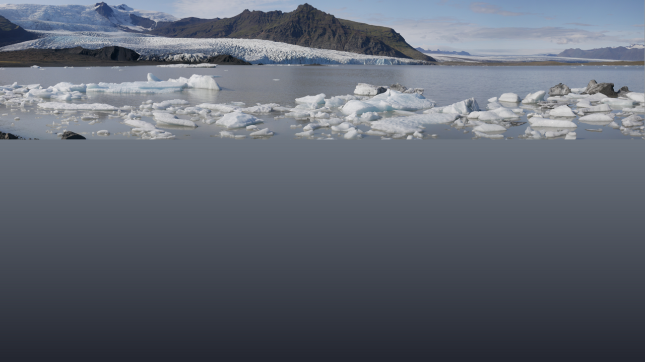
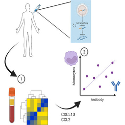
As global temperatures warm, glaciers are melting, and this results in changes to freshwater resources and sea level rise. However, it is difficult to model these relationships because one of key drivers to glacier behaviour is the way that water moves at the glacier base (subglacial hydrology). Glaciers can move over hard (rocky) or soft (sedimentary) beds, and it has been assumed that the subglacial hydrology associated with rigid beds comprises a predominantly channelised drainage, whilst soft-bedded glaciers have a distributed/multichannel system. This is important because the subglacial hydrology controls the rate of glacier sliding (slipperiness). It has been argued that a distributed drainage has a higher water pressure, resulting in faster surface velocity and more ice loss.
However, due to the logistical problems of studying the subglacial environment, there are very few instrumented studies, and thus difficulties in calibrating glaciology models. In this paper we present a detailed seasonal data set from four soft-bedded temperate glaciers and show that there is a continuum between channelised and distributed drainage, which may be related to grain-size but is also influenced by subaqueous processes. These different hydrologies have a distinctive seasonal velocity pattern, and although they have been identified using a multi-data stream, we suggest they can be classified solely using Sentinel-1 satellite-based glacier velocity data.

Environmental Sensor networks
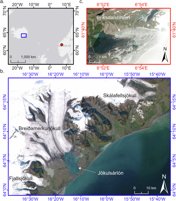
This paper brings together data from four soft bedded glaciers. Briksdalsbreen in Norway, and Skálafellsjökull, Fjallsjökull and Breiðamerkurjökull in Iceland. These glaciers were studied as part of the Glacsweb project (glacsweb.org), which is a long term project to use sensor networks to study the subglacial environment. This project brings together experts in glaciology, computer science and engineering to use the latest networking technology to understand glacier response to climate change.

Our initial research took place at Briksdalsbreen in Norway (2003-2006), where we developed the first wireless in situ probe to measure subglacial processes. These were 16cm long, and measured tilt, pressure, case strain, water pressure and temperature. We used a hot water drill to make a borehole to the glacier bed and insert the probes into the ice and the underlying sediment (till). The probes sent their data back to the glacier surface, and then onto the internet, to be studied back in the UK. These probes were able to send data for a whole year. However, due to climate change, the glacier itself dramatically retreated, and we were forced to change location.

We then moved to Skálafellsjökull in Iceland (2008-2013). We were able to improve the efficiency of the probes (they were able to last 2 years) and added a geophone system to measure ice quakes, and a time lapse camera to measure discharge.
, in the 'laboratory', geophones ready to be deployed, and on the ice")
Subsequently we moved to Fjallsjökull and Breiðamerkurjökull (2017-2024), where we installed a custom built GNSS as part of an internet of things system. Positional data were collected and also sent back to the UK. Two generations of these low-cost custom-built systems were installed and the final version was installed in 2023 using a drone to deliver systems 1 km up on to a heavily crevassed glacier surface (where manual installation would have been impossible). After 10 months the system stopped sending data, but luckily the missing data was manually retrieved from the base station’s backup. This enabled us to study velocity changes, which are driven by the subglacial hydrology.
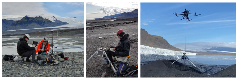
The web connected GNSS system (base, rover and UAV installation)
Soft-bed subglacial hydrology continuum model
Although these research projects were initially designed as stand-alone to investigate subglacial processes, it became clear when they were compared that there was a continuum of different subglacial hydrology’s from channelised to distributed. Using our data we could also estimate the percentage of time spent associated with different dominant subglacial processes (sliding or deformation), which could be related to past and present sedimentation.
Since the launch of the Sentinel-1 satellite in June 2017 (12-day interval) we have been able to derive continuous glacier-wide velocities, which show a similar pattern to the GNSS results.
Bringing together all the data from the sites (in situ probe, ground penetrating radar, ice quakes, discharge, GNSS) allowed us to identify the subglacial hydrology. These different hydrologies had very distinctive seasonal velocity patterns, which could be identified from the Sentinel-1 satellite velocity data alone. Since these data are freely available online, this identification has the potential to be applied to a wide range of glaciers to determine the relative occurrence of different subglacial hydrological systems and enable a larger scale testing of the properties determining the channelised/distributed continuum.
The project gave the teams a unique interdisciplinary research experience. Investigations on the glacier are physically challenging for both humans and equipment, and numerous lessons of dealing with real-world science/engineering were learnt. We wish to thank all those involved over the years for their hard work under difficult conditions, thoughtful ideas and good humour!
Follow the Topic
-
Communications Earth & Environment

An open access journal from Nature Portfolio that publishes high-quality research, reviews and commentary in the Earth, environmental and planetary sciences.
Related Collections
With Collections, you can get published faster and increase your visibility.
Climate extremes and water-food systems
Publishing Model: Open Access
Deadline: May 31, 2026
Archaeology & Environment
Publishing Model: Hybrid
Deadline: Mar 31, 2026

Please sign in or register for FREE
If you are a registered user on Research Communities by Springer Nature, please sign in