Urban Growth vs. Nature: How GIS Revealed Kaduna's Flood Crisis
Published in Social Sciences and Plant Science
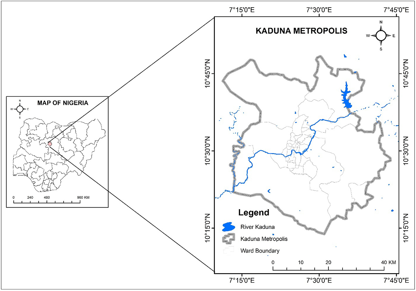
Kaduna Metropolis, a town located in northwestern Nigeria, is not only one of the fastest-growing cities in Nigeria but also a town with rich historical and political significance. Kaduna was established during the colonial era. Kaduna once served as the capital of Northern Nigeria, becoming a hub of political administration, commerce, and industrial development. Over the decades, this legacy has attracted migrants from surrounding rural areas and other states in Nigeria, all in search of better livelihoods, education, and opportunities.
This continued migration, coupled with natural population growth, has significantly transformed the town's demographics. From a population of about 250,000 people in the 1960s, Kaduna’s urban population has grown to over 2.5 million as of 2024. With this significant growth came the inevitable need for land, more land for housing, infrastructure, markets, and roads. As urban expansion sprawled beyond the original city boundaries, once-vacant lands, often ecologically sensitive or unsuitable for settlement, became occupied.
The most concerning aspect of this settlement expansion is the encroachment onto the River Kaduna floodplain. Historically, this floodplain played a critical role in buffering the city from flood events by absorbing excess water during periods of heavy rainfall. However, weak enforcement of planning and environmental laws allowed informal and formal settlements to spring up within this natural flood zone. Residential buildings, schools, roads, and commercial spaces were developed without adequate consideration for flood risk or hydrological impacts.
As a result, urban flooding has emerged as a recurring and intensifying problem in Kaduna. Many neighbourhoods experience seasonal floods, often leading to the destruction of property, disruption of livelihoods, and temporary or permanent displacement of residents. Yet, until recently, there had been no comprehensive mapping of flood-prone areas in the city. Most flood responses in the town were reactive, focused on disaster relief rather than proactive planning and risk mitigation.
This gap in understanding and planning became the motivation behind our study. We embarked on this research to address a critical question: Which areas in Kaduna are most vulnerable to flooding, and what are the key factors contributing to this vulnerability?
To answer this, we turned to a robust integration of Geographic Information Systems (GIS) and the Analytical Hierarchy Process (AHP). GIS provided the spatial framework needed to analyze the terrain, land use, hydrology, and other environmental features of Kaduna, while AHP offered a robust multi-criteria decision-making tool to weigh and integrate diverse flood-causative factors. Our methodology involved the integration of multiple datasets, including ASTER Global Digital Elevation Model (DEM) and Landsat 8 OLI/TIRS imagery. We also gathered ground-truth data from historical flood sites using handheld GPS devices, providing a real-world reference for our modelling.
Using these inputs, we identified and processed nine flood-causative factors: elevation, slope, drainage density, the topographic wetness index (TWI), the stream power index (SPI), distance from streams, distance from roads, land use/land cover, and the normalized difference vegetation index (NDVI). These parameters were carefully selected based on both expert judgment and established practices in flood susceptibility studies.
By employing AHP, we assigned weights to each factor based on its relative importance in contributing to flood risk. The result was a composite flood susceptibility map of Kaduna Metropolis. The findings were striking: approximately 25.77% of the city falls within high flood vulnerability zones, 60.31% within moderate zones, and just 13.36% within low-risk areas. Most notably, the validation of our model, which was done by comparing it with historical flood data, revealed a high degree of accuracy, with a Receiver Operating Characteristic (ROC) score of 0.94. All historical flood events were situated within the high-risk zones predicted by our model.
This level of precision underscores the relevance and applicability of our approach for urban flood planning. Beyond the technical achievements, the implications of this study are deeply human. It provides city planners, policymakers, and emergency management agencies with actionable intelligence to prioritize interventions, regulate development, and design flood-resilient infrastructure. It also offers residents and communities a clearer understanding of their flood risk, empowering them to make informed decisions.
Importantly, this study is not just a technical exercise, but a response to the lived realities of a growing urban population grappling with environmental vulnerability. As cities like Kaduna continue to grow, integrating spatial science into urban planning will be critical to achieving sustainable and safe human settlements. We hope that this work serves as a model for other flood-prone urban centres across Nigeria and Sub-Saharan Africa, where rapid urbanization and environmental mismanagement are creating similar challenges.
Follow the Topic
-
Discover Geoscience
This is a fully open access, peer-reviewed journal that supports multidisciplinary research and policy developments across the field of geoscience.

Related Collections
With Collections, you can get published faster and increase your visibility.
Applied Sciences in Geo-Energy Transition
Geo-energy transition marks a critical shift from conventional fossil energy systems to low-carbon, renewable, and subsurface-based solutions, playing a key role in global climate change mitigation and carbon neutrality goals. This collection seeks to showcase the theory, technology, and practice spanning the entire lifecycle of geo-energy transitions—from resource assessment, extraction and storage to techno-economic assessment and policy analysis.
We invite original research articles, reviews, and case studies addressing the evaluation, exploration, development, and long-term monitoring of underground clean energy systems, including geothermal energy, hydrogen, helium, noble gas, etc. Topics also include geological carbon storage, underground energy storage, related materials and engineering innovations, as well as techno-economic analysis, life-cycle assessment, and regulatory or policy frameworks.
Keywords: Geo-energy transition, Low-carbon technologies, Subsurface energy systems, Carbon neutrality, Techno-economic assessment
This Collection supports and amplifies research related to SDG 7.
Publishing Model: Open Access
Deadline: Sep 24, 2026
Weather and Climate Extremes: A Special Reference to Multidisciplinary Research and Policy Developments
This Collection, titled "Weather and Climate Extremes: A Special Reference to Multidisciplinary Research and Policy Developments," focuses on the increasing global challenges posed by extreme weather events and climate phenomena. As these events intensify due to changing climate patterns, their impacts on ecosystems, infrastructure, human health, and socioeconomic systems become more pronounced, necessitating a multidisciplinary approach to understanding and addressing these complexities.
The Collection aims to bring together research from diverse fields, including atmospheric sciences, hydrology, ecology, engineering, public health, and social sciences. It encourages innovative contributions that explore cutting-edge solutions to predict, manage, and mitigate the effects of climate extremes. Topics may include advanced modelling techniques, nature-based solutions, climate-resilient infrastructure, risk assessment frameworks, and strategies for equitable policy development. The emphasis is placed on integrating scientific understanding with actionable solutions that address vulnerability, resilience, and adaptation.
Moreover, this Collection seeks to foster cross-disciplinary collaborations to bridge the gap between scientific research and policy implementation. By highlighting case studies, theoretical advancements, and practical approaches, it aims to advance the dialogue on climate resilience and inform decision-making processes globally. This platform aspires to serve as a critical resource for researchers, practitioners, and policymakers striving to navigate the escalating challenges of a changing climate.
Given the increasing frequency and intensity of climate extremes, this topic holds critical importance. Such extremes profoundly affect ecosystems, infrastructure, and human livelihoods, demanding coordinated efforts across disciplines to analyse risks, develop mitigation strategies, and inform policy. This Collection seeks to bring together cutting-edge research and innovative approaches from diverse fields, bridging scientific understanding and actionable policy frameworks. The proposed focus areas include, but are not limited to:
• Advances in modelling and forecasting weather and climate extremes
• Impacts on ecosystems, agriculture, water resources, and public health
• Nature-based solutions and climate-resilient infrastructure
• Interdisciplinary frameworks for risk management and adaptation planning
• Policy advancements addressing vulnerability, resilience, and equity
This call aims to engage a broad community of researchers, practitioners, and policymakers to enhance global discourse and support evidence-based decision-making by emphasising multidisciplinary contributions.
This Collection supports and amplifies research related to SDG
Keywords: Weather Extremes Modeling; Climate Change Impacts; Risk Assessment Frameworks; Nature-Based Solutions (NbS); Resilient Infrastructure Design; Equitable Policy Development; Interdisciplinary Climate Research; Adaptation and Mitigation Strategies; Socioeconomic Vulnerability Analysis; Extreme Event Forecasting
Publishing Model: Open Access
Deadline: Aug 31, 2026
Please sign in or register for FREE
If you are a registered user on Research Communities by Springer Nature, please sign in