Bridging Data Gaps: The First Continental Dataset for Soil Erosion in North Africa
Published in Earth & Environment, Computational Sciences, and Mathematics
Behind the Paper: A Journey into North Africa’s Soil Erosion Mapping
Scientific breakthroughs often emerge from challenges that inspire determination and collaboration. The story of our work, which culminated in the first large-scale soil erosion susceptibility dataset for North Africa, is no exception. Over three years of meticulous research, my colleague Essam Heggy and I (Adil Salhi), supported by the University of Southern California and NASA, embarked on an ambitious mission to fill a critical gap in environmental data for this dynamic and vulnerable region.
The Challenge: Bridging a Data Gap
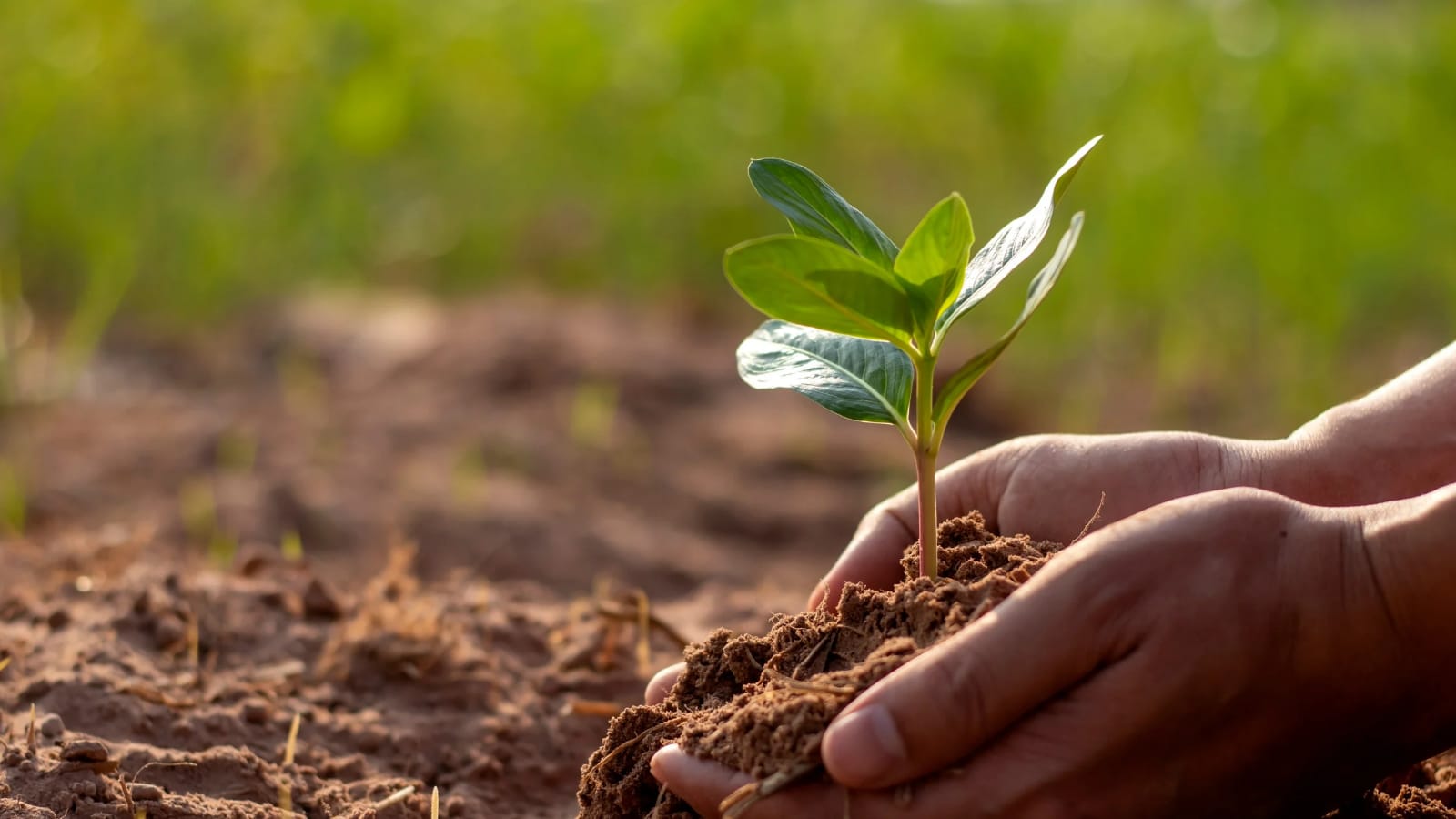
North Africa, with its vast hydrological basins and diverse terrains, faces escalating risks from soil erosion driven by climate change and human activities. Existing studies have been limited to localized areas, leaving policymakers and stakeholders without the comprehensive insights needed to address large-scale land degradation. This gap in data inspired our initiative to create a dataset capable of informing sustainable land management and resilience-building efforts across the region.
We knew that tackling a challenge of this magnitude would require innovative methods and a resilient mindset. Our goal was clear: develop a publicly accessible dataset that accurately depicts soil erosion susceptibility on a continental scale. The road to achieving this was far from straightforward, but our commitment to this cause only strengthened as we progressed.
Building SESMAR: A Pioneering Effort
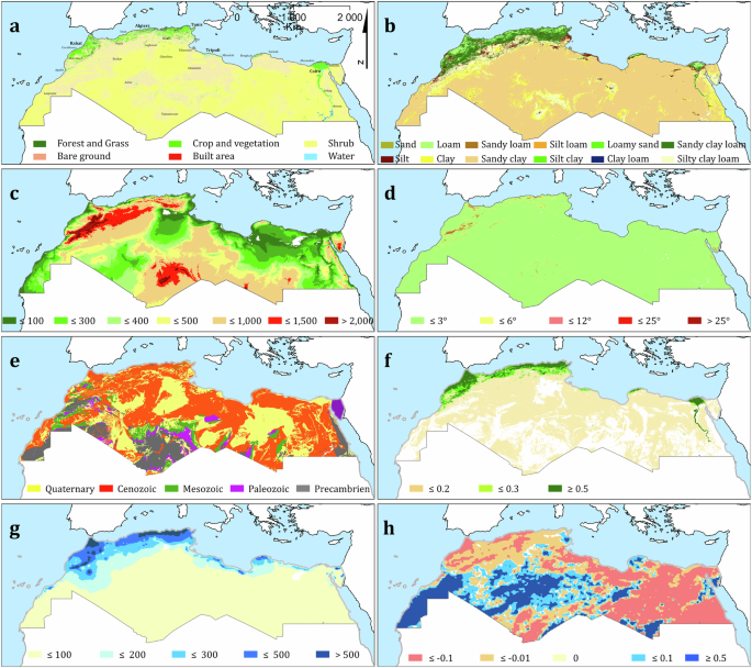
The Soil Erosion Susceptibility Maps and Raster Dataset (SESMAR) is the culmination of countless hours spent gathering and analyzing diverse datasets. Using the Revised Universal Soil Loss Equation (RUSLE) model as the foundation, we integrated multiple factors (from land use and soil characteristics to vegetation cover and rainfall erosivity) to calculate annual soil loss across 5.8 million square kilometers.
Google Earth Engine became a cornerstone of our work, enabling the processing of vast datasets with remarkable efficiency. By combining data from global sources such as the European Soil Data Centre (ESDAC) and the Global Rainfall Erosivity Database (GloREDa), we ensured that our model captured both regional nuances and broader trends. The result was a dataset with unparalleled resolution and accuracy for North Africa’s hydrological basins.
Overcoming Challenges
The journey was not without obstacles. Data scarcity posed a significant challenge, particularly in remote areas where high-resolution information was unavailable. To address this, we developed innovative approaches to estimate missing parameters, such as rainfall erosivity, using proxy indicators and validated methodologies. These efforts allowed us to maintain consistency and accuracy across the dataset.
Validation was another critical step. To ensure SESMAR’s reliability, we compared our findings with published studies and datasets from 20 diverse watersheds. This rigorous process demonstrated that our model could accurately assess soil erosion across a wide range of conditions, affirming its potential for practical application.
Collaboration Across Borders
Collaboration was at the heart of our success. Working with Essam Heggy, whose expertise spans hydrology and climate resilience, brought invaluable insights to the project. Our partnership with NASA provided access to advanced tools and methodologies, ensuring our work was firmly grounded in the region’s unique environmental context.
These partnerships transcended geographical boundaries, underscoring the importance of global cooperation in addressing environmental challenges. The multidisciplinary nature of our team allowed us to integrate knowledge from various fields, creating a dataset that is as robust as it is comprehensive.
Impact and Future Directions
SESMAR is more than just a dataset; it is a tool for change. By providing high-resolution maps and actionable insights, our work empowers stakeholders to prioritize erosion control measures, enhance agricultural productivity, and mitigate the impacts of climate change. The dataset’s open-access nature ensures that researchers, policymakers, and practitioners worldwide can leverage its findings to drive sustainable development.
Looking ahead, we hope to see SESMAR inspire further research and innovation. Updates to the dataset will incorporate new data and methodologies, ensuring its continued relevance in a rapidly changing world. We also envision its application extending beyond North Africa, serving as a model for similar initiatives in other regions facing environmental degradation.
Reflections on the Journey
As we reflect on this journey, one thing stands out: the power of perseverance and collaboration. From late nights troubleshooting data inconsistencies to moments of breakthrough when complex models finally yielded meaningful results, every step reinforced our belief in the importance of this work. It was a journey that tested our resolve but also deepened our appreciation for the intricate interplay of science, technology, and human determination.
For Essam and me, this project is a testament to the impact that dedicated research can have in addressing pressing global challenges. It is our hope that SESMAR not only advances scientific understanding but also contributes to building a more resilient and sustainable future for North Africa and beyond.
Follow the Topic
-
Scientific Data
A peer-reviewed, open-access journal for descriptions of datasets, and research that advances the sharing and reuse of scientific data.

Related Collections
With Collections, you can get published faster and increase your visibility.
Genomics in freshwater and marine science
Publishing Model: Open Access
Deadline: Jul 23, 2026
Genomes of endangered species
Publishing Model: Open Access
Deadline: Jul 01, 2026
Please sign in or register for FREE
If you are a registered user on Research Communities by Springer Nature, please sign in