Tracking Dust Plumes with Satellite Observations
Published in Earth & Environment
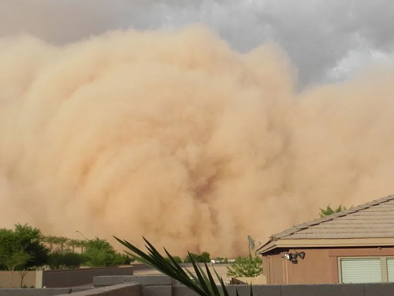
Where do dust storms originate? What were the preceding environmental conditions leading to the storm? What are the pathways of dust storms? As an asthma sufferer growing up in the middle of the desert, I've felt the gusts of dust storms firsthand, which encouraged me to investigate the environmental science behind this phenomenon and to seek answers to these questions.
To do so, I began by trying to identify dust source areas and analyzing their soil moisture conditions. A review of the literature indicated that satellite observations are commonly used to analyze dust aerosols. Specifically, they use observations from polar-orbit satellites which despite their broad coverage only collect one or two images per location per day, merely providing a snapshot of these rapid storms that can travel at speeds up to 100 km/hr.
The literature presented several methods and assumptions to trace the origins of dust aerosols from this data, but I found them unsatisfactory. My dissatisfaction was supported by findings from Schepanski et al. (2012)[1]. Their findings highlighted the importance of temporal frequency and emphasized the advantages of geostationary-orbit satellites. Unlike their polar-orbit counterparts, geostationary satellites maintain a constant view over a specific area, offering sub-hourly retrievals vital for tracking the movement of dust plumes and tracing their origin. I was initially baffled by the underutilization of geostationary observations, but it became clear to me that the reason was the lack of publicly available and ready-to-use dust aerosol observations datasets, which sparked my interest to curate and share one.
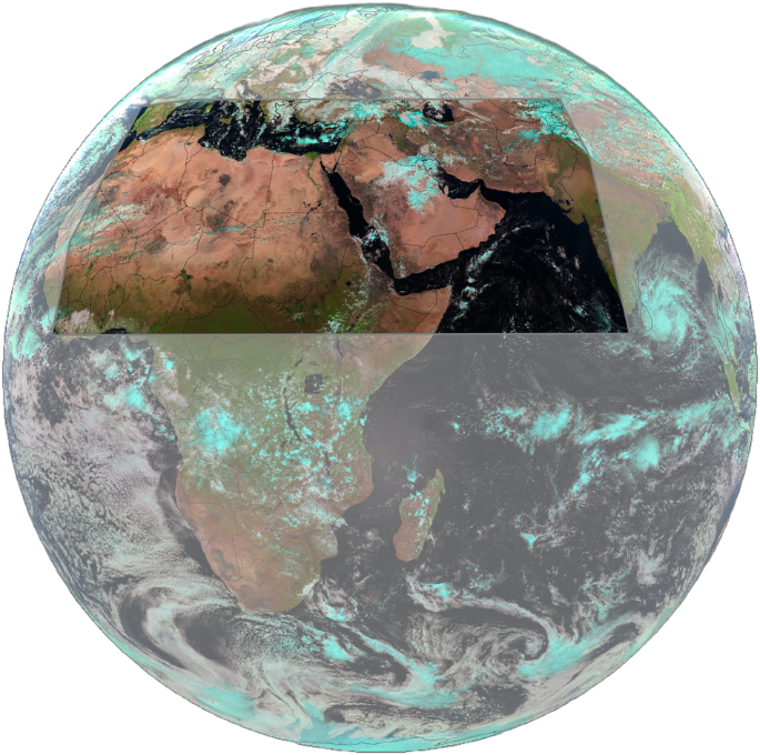
In our recent publication (https://www.nature.com/articles/s41597-024-03452-4 ), we introduce the "DustSCAN" dataset (the name derives from combining "dust" and "DBSCAN" the latter being the clustering algorithm used in tracking dust). Leveraging the continuous, round-the-clock monitoring capabilities of geostationary satellites, DustSCAN provides an unprecedented view of dust plume movements. It tracks 9,950 distinct plumes in hourly resolution across the major parts of the global "Dust Belt", including the Sahara, Arabian Peninsula, and Western and Central Asia. Our framework to develop the dataset combined the use of infrared observations to find dust-affected pixels, a clustering algorithm to group pixels into plumes, and subsequent manual quality control to ensure the validity of the data.

The development of this dataset was a substantial undertaking. The original files totaled a massive 20 terabytes. Downloading, processing, and storing this data required extensive computational resources and lasted several months. To streamline the process, we used hourly data resampled to a coarser resolution of 0.25 degrees instead of the original 15-minute, 3km data. While using the finer resolution would have provided even more detail, it would have severely prolonged the project.
In conclusion, the creation and publication of the DustSCAN dataset represent a significant advance in the study of dust plume dynamics. By providing continuous, high-resolution observations of dust movements, this dataset facilitates detailed research and enhances our understanding of environmental interactions. Alongside the dust data, we have released supplemental datasets including observations of vegetation and soil moisture and modeled wind speeds, all synchronized at the same resolution. This data integration enables researchers to investigate the relationships between dust storms, their source areas, and relevant environmental factors. We are currently engaged in further studies using DustSCAN to identify dust source areas, track plume pathways, and assess the impact of droughts on dust emissions.
References:
[1] Schepanski, K., Tegen, I. & Macke, A. Comparison of satellite based observations of Saharan dust source areas. Remote. Sens. Environ. 123, 90–97, 10.1016/j.rse.2012.03.019 (2012).
Follow the Topic
-
Scientific Data
A peer-reviewed, open-access journal for descriptions of datasets, and research that advances the sharing and reuse of scientific data.

Related Collections
With Collections, you can get published faster and increase your visibility.
Computer vision in plant science and agriculture
Publishing Model: Open Access
Deadline: Oct 10, 2026
Wearable and Computer Vision Data for Health and Behaviour Research
Publishing Model: Open Access
Deadline: Aug 08, 2026

Please sign in or register for FREE
If you are a registered user on Research Communities by Springer Nature, please sign in