Underfoot and Overlooked: Groundwater’s Key Role in Ecosystem Resilience
Published in Earth & Environment, Ecology & Evolution, and Sustainability

Ecosystems dependent on groundwater are incredibly diverse – spanning coastal estuaries, inland wetlands, rivers and streams, terrestrial forests and shrublands, desert springs, and even existing within subterranean aquifers. Despite the importance of groundwater in sustaining biodiversity and ecosystems that regulate our climate, very little research and management efforts have gone into quantifying groundwater requirements for ecosystems, nor are there sufficient legal frameworks and policies in place globally to ensure they get the water they need.
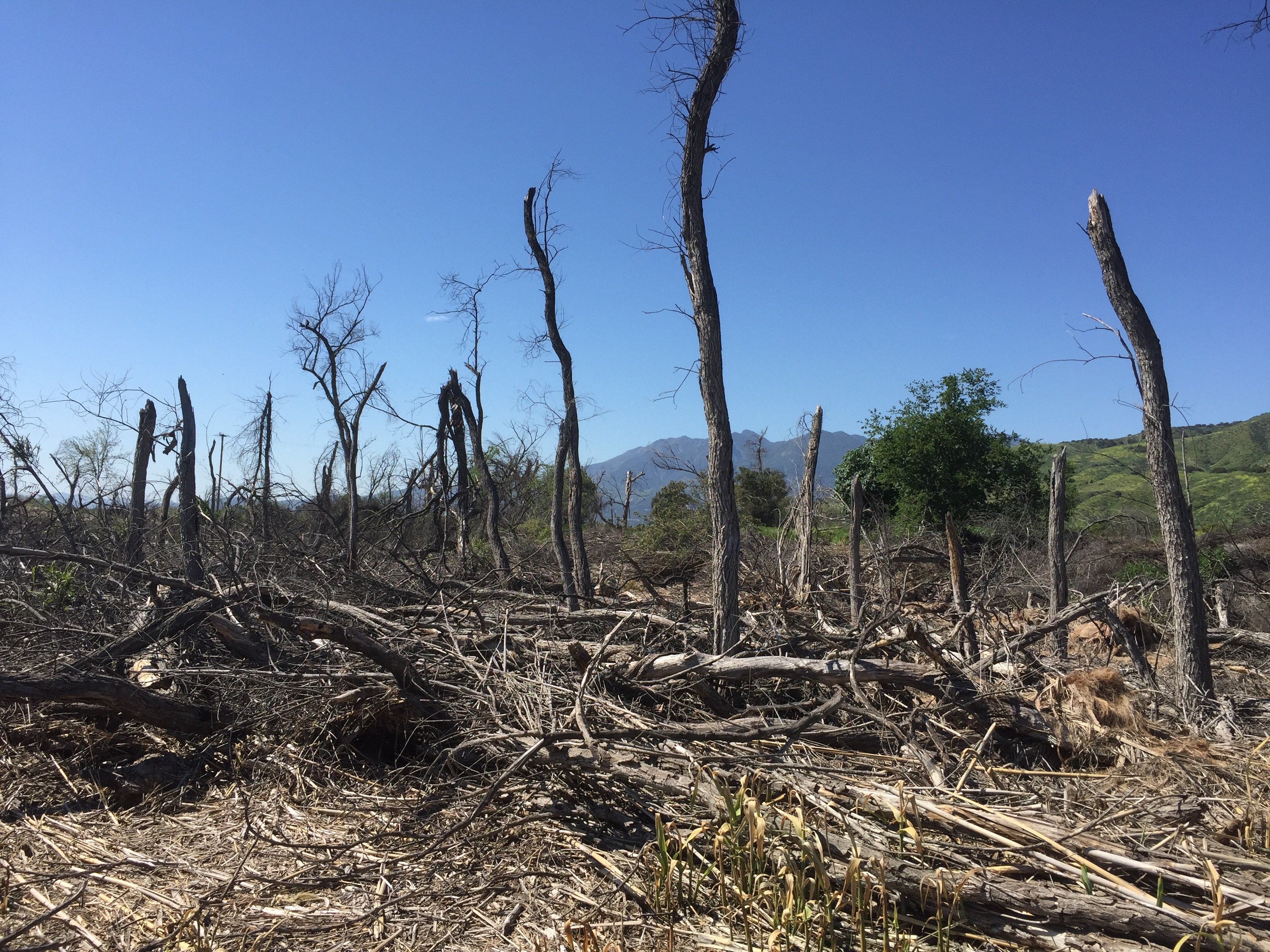
Even in places where groundwater management or conservation efforts exist, explicit water allocations and management actions to sustain critical species, habitats, and functions are rarely implemented, resulting in ecosystems to receive whatever residual water that remains – if any – after growing human demands are met. When ecosystems lose access to groundwater, impacts to their foundational plant communities can range from minor water stress to more harmful impacts, such as forest die-off, with a cascading series of consequences for dependent wildlife, biophysical processes, and ecosystem services. While some impacts may be reversible, others may lead to permanent loss of species and habitats.

California is one of several jurisdictions globally with protections for groundwater-dependent ecosystems. Here, water agencies are required to consider impacts to groundwater-dependent ecosystems under the Sustainable Groundwater Management Act. Because California is a top global biodiversity hotspot, conservation efforts can have outsized importance if successful. The challenge is that information on ecosystem water requirements has been lacking. In California and elsewhere, water agencies lack the ecohydrological expertise, shallow groundwater monitoring data, and financial resources to conduct site-specific analyses.
To address these challenges, we carried out a regional study across California to identify what groundwater levels cause severe adverse impacts (ecological thresholds) and what groundwater levels are needed to sustain ecosystems (ecological targets). Across California’s many ecoregions, we identified ecological thresholds and targets, as well as mapped potential drought refugia by utilizing long-term satellite-based data that are publicly available and extend worldwide. We used 38 years (1985 – 2022) of Landsat imagery to detect anomalies in vegetation growth during drought by calculating the normalized difference vegetation index (NDVI), a measure of vegetation greenness, for nearly 250,000 groundwater-dependent ecosystem mapped features and paired that with field-based groundwater level data. Because Landsat imagery is ubiquitous and publicly available, our approach can be reproduced in other regions with groundwater-dependent ecosystem maps and field-based groundwater level data.
In our study, we utilized Z-scores, a well-established statistical metric to indicate how many standard deviations an individual observation is from its mean value. Z-scores were determined at each mapped groundwater-dependent ecosystem feature for both NDVI and groundwater values. A locally calibrated metric was necessary because of the large range in baseline NDVI values due to vegetation type, coverage, and seasonal phenology, and because plants are adapted to site-specific groundwater depths and fluctuation ranges. Using Z-scores rather than the raw data enabled us to account for location-specific differences in ecological responses to groundwater levels due to seasonal and interannual groundwater fluctuations, species-specific tolerance and adaptations to water stress, and local hydrological influences. As a result, the Z-score transformed data enabled us to quantify ecological thresholds and targets relative to the local, historical baseline conditions in a manner that can be applied to groundwater-dependent ecosystems generally. This approach enables ecological responses to drought across a large region to be tracked despite major differences in vegetation species composition and density, aquifer properties, natural climate, and surface water flow and groundwater regimes.
We found that most groundwater-dependent ecosystems are adapted to seasonal and interannual groundwater-level fluctuations. However, when groundwater levels exceeded 1.3 standard deviations from the local mean (deeper than approximately 4 meters depth to groundwater in most places), significant decreases in vegetation greenness occurred, which in places corresponded to severe vegetation die-off. We also found that ecosystems with groundwater levels within approximately 1 meter from the rooting depths of vegetation were healthier and more capable of dealing with drought. This provides essential information when managing groundwater resources because rooting depth data are more readily available and can be used by water agencies to establish protective measures when allocating water or developing projects that can restore groundwater around ecosystems.
We also explored which groundwater-dependent ecosystems were most resilient to drought and likely to be key areas to sustain biodiversity and critical habitat in the face of global and regional climate change. Identifying areas with reliably stable groundwater that can serve as drought refugia is increasingly vital amidst the intensification of deluge and drought events that California and other regions around the globe are experiencing. We found that only 1% of groundwater-dependent ecosystems across California are potential drought refugia, and that both natural and anthropogenic factors can contribute to the shallow groundwater conditions necessary to sustain drought refugia.
This latest research provides a simple yet effective approach to support regional analyses necessary to inform where to prioritize limited resources, establish more extensive monitoring well networks, and implement new policies so that groundwater can be protected for critical ecosystems in California and elsewhere.
Follow the Topic
-
Nature Water

This journal publishes research on the evolving relationship between society and water resources on a monthly basis. It covers the natural sciences, engineering, and social sciences, with a particular interest in regards to interdisciplinary research.
What are SDG Topics?
An introduction to Sustainable Development Goals (SDGs) Topics and their role in highlighting sustainable development research.
Continue reading announcementRelated Collections
With Collections, you can get published faster and increase your visibility.
Remote sensing and forests
Publishing Model: Hybrid
Deadline: Apr 30, 2026
Water pollution and advanced treatment processes
Publishing Model: Hybrid
Deadline: Feb 28, 2026


Please sign in or register for FREE
If you are a registered user on Research Communities by Springer Nature, please sign in