Assessing air quality impacts of peatland fire smoke in Indonesia
Published in Earth & Environment and Public Health

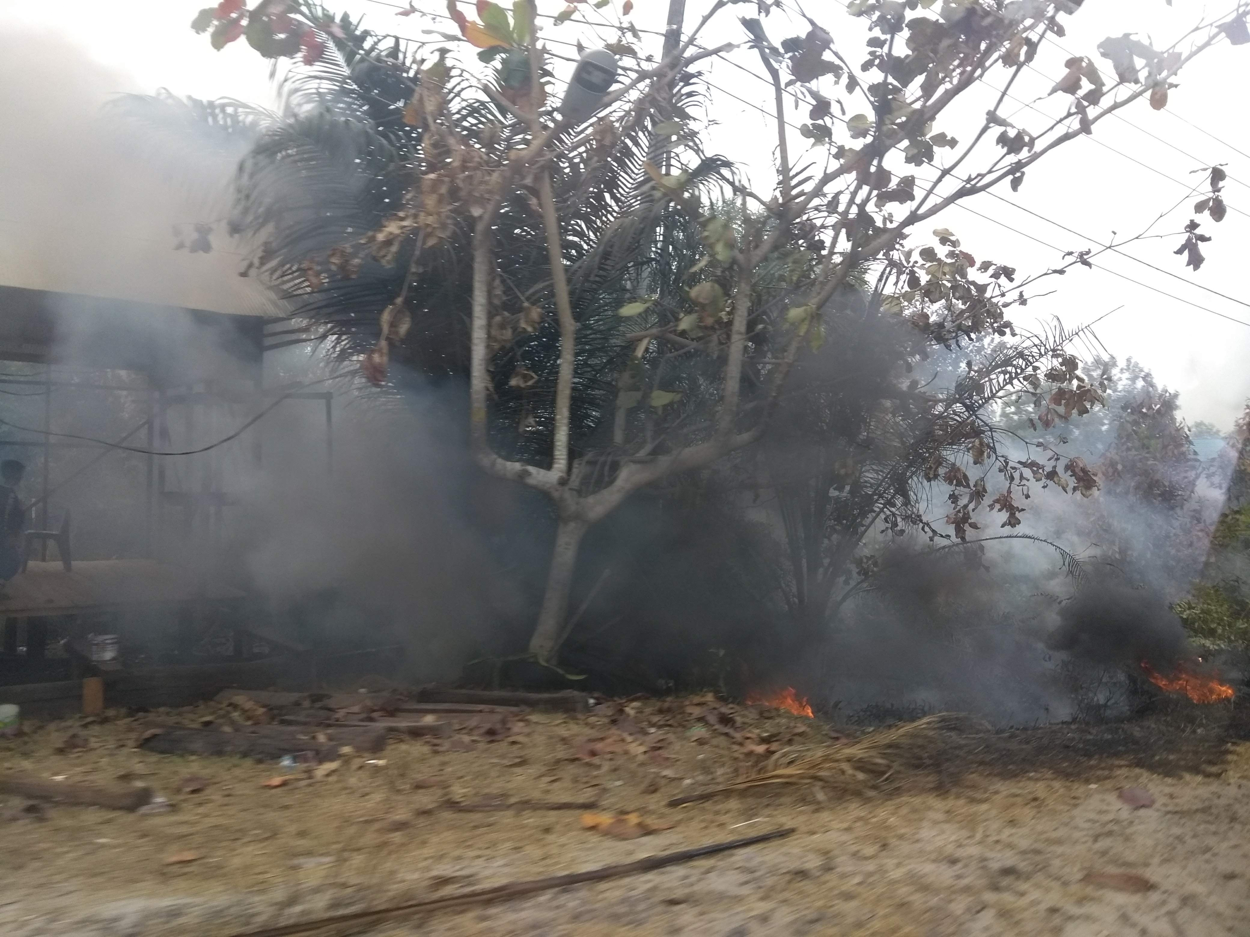
Smoke from fires has the potential to have far wider reaching impacts than those of the actual fire itself. In Indonesia, smoke from peatland fires has been well documented having air quality impacts across the wider region and internationally. Fire in these tropical environments is nearly always anthropogenic, stemming from long-term landscape degradation such as land drainage and clearance. Fire is often used as a labour efficient way of clearing scrub land to be used for small scale agriculture. The smoke emissions from this clearance in itself is not insubstantial, but the critical difference is that this above surface biomass clearance ignites underlying dry peat which will slowly smoulder away, burning not just horizontally but also vertically downwards. This means that particulate emissions from peat fires can be substantially higher per unit area with the smoke remaining close to the ground rather than being lofted into the atmosphere. Fire seasons in this region typically occur over a 3-month period meaning people can be subjected to smoke polluted air continuously for several weeks each year although the severity does vary from year to year and is closely related to El Niño activity.

The sensor network
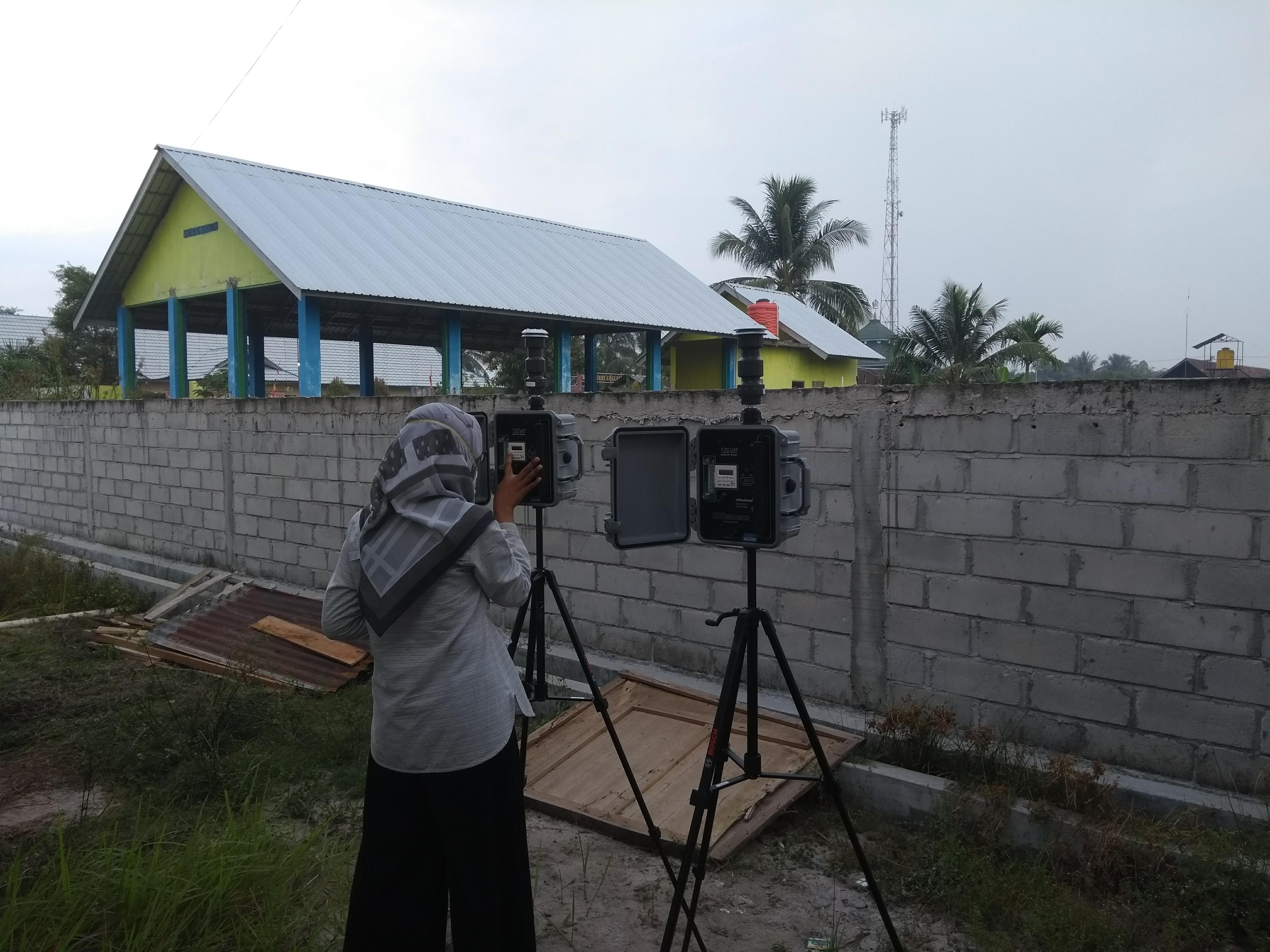
To better understand the impacts and variability of this smoke on a population, we set up a small network of low-cost particulate matter sensors. These were commercially available sensors which have been used in many previous studies. These sensors, distributed across the city of Palangka Raya would identify variability of PM2.5 across a populated area throughout a fire season lasting a few months.
In addition to the sensors themselves, one of the most important networks on the project was that of local managers and staff at Public Health Centres where the particulate monitors were installed. Some of the team already had links to these centres though a parallel study focused on the epidemiology of smoke exposure. One benefit of predominantly using health centres for the sensor locations was that they are already well distributed across the city within areas of population. Specific positions for the sensors had to be very carefully chosen to avoid introducing biases such as if the location was near a road or building site where other sources of particulates may be contributing to the air quality.
Keeping the sensors running throughout the fire season was a key logistical challenge, as some locations did not have reliable mains power so were instead kept powered using rechargeable battery packs. The network of local people managed to keep these charged, and regularly downloaded data from the sensors. Whilst the sensors have wifi capabilities, at the time of the measurements, wifi connections at the health centres were not strong enough to reliably keep the sensor connected.
One key issue with using low cost sensors in these extreme environments was to characterise their response to fire smoke. The sensors use a light scattering technique to count particulate matter within an air stream, and from this they use an assumption on the mass of the particles to transform the count data to a mass concentration (normally in µg.m-3). Most of these sensors are designed for typical urban pollution which generally has a higher mass than particulates from biomass fires. Deriving a reliable correction factor for peat smoke was therefore a key consideration in the project. This was partially done in the field using co-located filter samplers, but additionally some lab experiments were carried out for sustained higher concentrations.
During the fieldwork to set up the sensors and carry out calibration measurements, the field team were also subjected to poor air quality, however, unlike the majority of the population, were fortunate to have access to respirators, and were able to tape up accommodation windows and run air purifiers to help reduce their PM2.5 exposure.

Some of the concentrations measured in Indonesia were beyond the published measurement range of the small sensors, so we needed to be confident whether values above this threshold were reliable or not. By carrying out a series of lab experiments we were able to characterise the sensor response in these extreme environments and correct for this. We found that by using an adjusted correction factor, it was possible to use the sensors in these more extreme conditions although the precision was not as good.
Earth observation datasets
One aspect of our project was to compare our ground based measurements with satellite estimates of PM2.5 from CAMS. This provided rather good correlation with the general trends across the fire season suggesting satellite data in this region can be useful when assessing air quality impacts. However, our study highlighted the issue of scale when using these satellite datasets. The grid for the CAMS data is reasonably large, yet our ground measurements showed lots of small-scale variability across a city. More importantly, satellite datasets are measuring across the fire sources themselves where PM2.5 will be many times higher than once it has dispersed even a few hundred meters. This means that satellite datasets may overestimate what people are subjected to depending on the proximity to the fires.
Estimating health impacts
Many previous studies have investigated the link between exposure to fire smoke and health impacts, including attributable deaths. On a small-scale attributing health impact to smoke exposure is not straightforward as there are many different forms of health impact, along with differences in short- and long-term exposure as well as delays between exposure and impact. Also, the exposure to fire smoke as a predictor of adverse diseases can be significant due to the biological defence mechanisms in humans, which allow individuals to develop diseases with or without exhibiting illness, alongside variations in individual immunity. On a population level, however, some metrics can help to highlight the magnitude of issues. In our study we applied some previously published functions based on the mean ambient PM2.5 concentrations to calculate excess mortality and health impacts across the city of Palangka Raya, as well as more broadly across other regions of Indonesia where peat fire smoke is also a significant issue. On a national scale, the functions suggest there are many tens of thousands of attributable deaths from exposure to fire smoke. As nearly all of these fires are anthropogenic in source, reducing the number of ignitions, for example through changing fire use and reducing flammability of the land, could have wide reaching benefits to the health of people.
Follow the Topic
-
Communications Earth & Environment

An open access journal from Nature Portfolio that publishes high-quality research, reviews and commentary in the Earth, environmental and planetary sciences.
Related Collections
With Collections, you can get published faster and increase your visibility.
Archaeology & Environment
Publishing Model: Hybrid
Deadline: Mar 31, 2026
Drought
Publishing Model: Hybrid
Deadline: Mar 31, 2026


Please sign in or register for FREE
If you are a registered user on Research Communities by Springer Nature, please sign in