Channelling Jean-Luc Picard for urban dune surveys with handheld TLS
Published in Earth & Environment and Civil Engineering
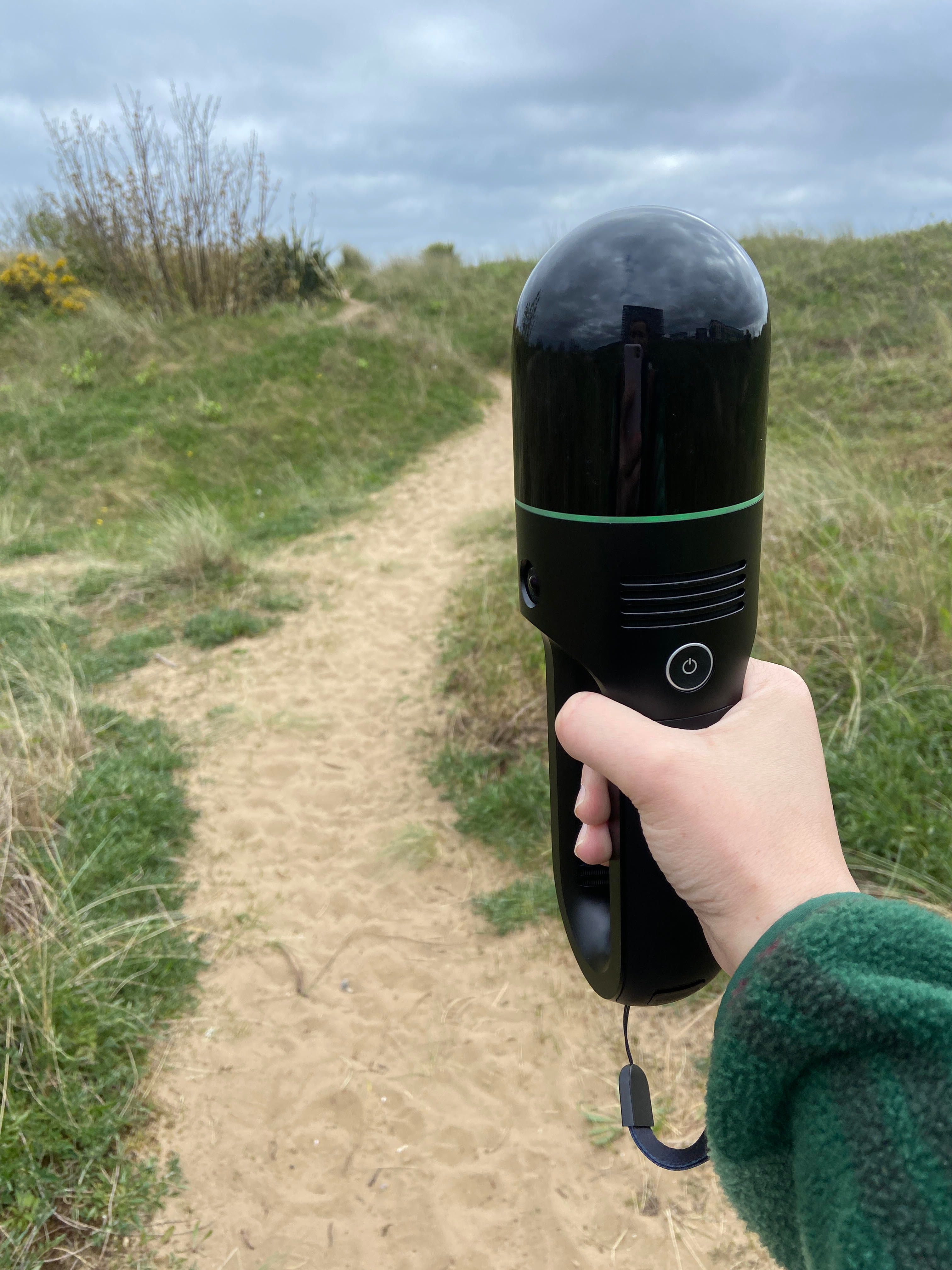

Walking through an urban dune in south Wales may not ordinarily sound like something out of this world, but the cautious rotation of a mobile terrestrial laser scanner (TLS) provides ample opportunity for Star Trek references. About the size of a fictional tricorder, we can now use these devices to readily scan a scene with high precision. The ability to rapidly acquire high resolution topographic data has resulted in huge advances in landform monitoring. Airbourne light detection and ranging (LiDAR) sensors for uncrewed aerial vehicles (UAV) in addition to UAV-derived photogrammetric methods are commonly used to produce digital surface models for monitoring landforms.
Terrestrial laser scanning has been used to examine geomorphic changes in a wide variety of environments, but until recently it was a static system. Mobilisation of non-moveable TLS technology has seen it mounted on a wide variety of mobile platforms (including carts, snowmobiles and sledges). Traditional TLS surveys are associated with labour intensive equipment set up and a need to reposition the equipment when overlapping scans are required. Handheld TLS scanners now overcome the mobility issues that face traditional TLS equipment. They are now progressively being deployed in challenging environmental settings such as confined cave passages, but most studies so far have benchmarked their performance indoors.
Newer TLS devices now use SLAM based technology, which stands for Simultaneous Localization and Mapping. This approach has an algorithm software that defines the trajectory of the device and the three-dimensional reconstruction of the recorded sensors. Simply, when combined with camera systems that are developed in the device, they can obtain imagery that is used to detect homologous features between successive images, which are then used to calculate the scanners movement throughout the environment. Therefore, they have real use in deployment for external environmental surveys. But do we need another tool in the toolbox?

It very much depends on where you are, and what you are trying to achieve. There are many issues in the natural environment that can prevent drone-based mapping, such as no-fly zones or vulnerable wildlife resulting in increased flight restrictions. Additionally, aerial approaches can be challenged by inclement weather conditions as well as many other restrictions. Therefore, despite their initial high cost, mobile TLS survey methods can offer a flexible survey approach with low training requirements that can be deployed quickly. But more work is needed to benchmark their performance against other survey methods. This short Tools of the Trade article describes the application of this technology in an urban dune environment and is part of an ongoing study to benchmark the performance of mobile TLS systems to help develop robust survey procedures and a timely comparative analysis of more common survey methods (such as UAV-SfM and UAV-derived LiDAR).
In this particular environment, the local dunes have experienced wide-spread changes including damage during the repair of a harbour pier wall and widespread sand accretion. In some instances, there are additional hazards where too much sand is present.
")
Aerial surveys at this site are limited by narrow weather windows and newly imposed 400m no-fly zones around HM Prisons. Non-native vegetation, comprising garden escapees and replanted Christmas trees are also a coastal management concern. To adequately map the vegetation and dense understorey, the mobile TLS offers a flexible approach able to map vegetation underneath larger trees which may be missed by photogrammetric methods. At this particular site, there is a network of wooden boardwalks along the dune site providing the opportunity to test the equipment, its range and applicability in a non-invasive manner. Additionally, the relative ease of use of this survey method has allowed it to be included in a range of hands-on practical demonstrations for students studying environmental and architectural programs.
If you want to keep up to date about benchmarking tests, please feel free to contact us.
Follow the Topic
-
Nature Reviews Earth & Environment
An online-only journal publishing high-quality Review, Perspective, and Commentary articles across the entire spectrum of Earth and environmental sciences.


Please sign in or register for FREE
If you are a registered user on Research Communities by Springer Nature, please sign in