Cost-effective drone toolkits for stream habitat monitoring — enabling scalable, high-resolution assessments
Published in Earth & Environment, Computational Sciences, and Civil Engineering
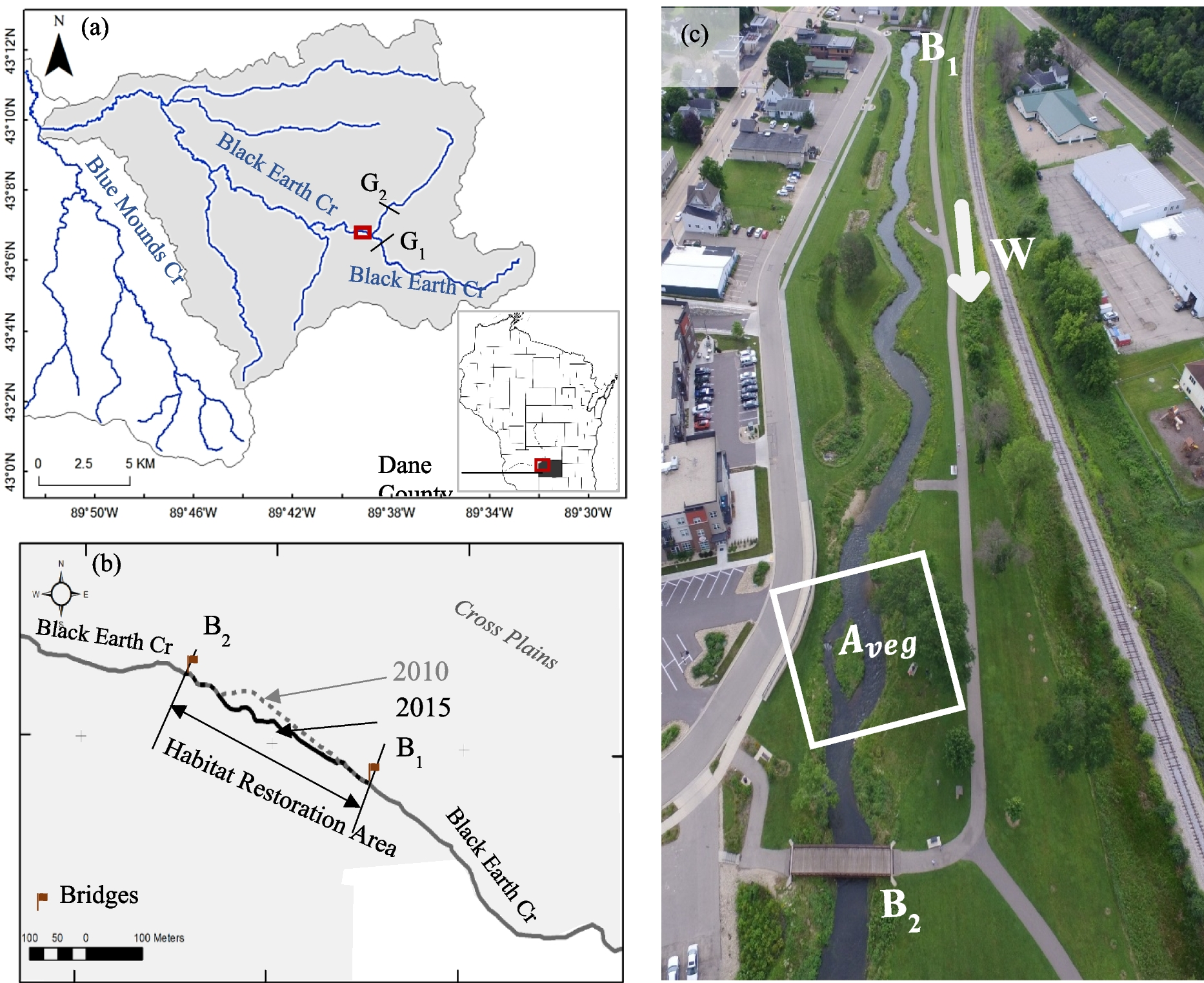
Monitoring stream habitat health is essential for understanding restoration outcomes, ecological resilience, and watershed management. Yet, conventional monitoring approaches — including transect-based surveys and manual habitat scoring — often demand significant time, labor, and cost. These limitations are especially challenging when managers need repeated assessments, rapid reporting after storm events, or broad spatial coverage beyond a single reach.
Our newly published paper in Environmental Monitoring and Assessment presents a cost-effective, UAV-based toolkit that offers a practical alternative for achieving high-resolution and repeatable stream habitat evaluations.
The workflow integrates:
-
Automated flight planning using off-the-shelf drones
-
Structure-from-Motion photogrammetry to generate elevation, vegetation, and channel structure products
-
Multi-Metric Index (MMI) evaluation, deriving habitat indicators
Results from Black Earth Creek (Wisconsin, USA) demonstrated strong agreement between UAV-derived metrics and traditional field assessments. More importantly, the spatial continuity offered by aerial imagery revealed localized degradation patterns and riparian corridor changes that field sampling alone could not detect.
This approach has immediate relevance for:
-
Stream restoration monitoring
-
Fisheries habitat assessment
-
Watershed planning and project prioritization
-
Environmental reporting and compliance
-
Post-event reconnaissance (e.g., storms, flooding, erosion)
Our goal is to support agencies, researchers, and community stakeholders by providing accessible, scalable monitoring options that fit within real-world resource constraints.
📄 Read the full article: https://doi.org/10.1007/s10661-025-14814-9
💬 We welcome discussion on adapting this approach to different ecological or geographic contexts and invite collaboration for further development.
Follow the Topic
-
Environmental Monitoring and Assessment

This is a journal that explores the design and implementation of monitoring systems and pollution risk assessment methods.
Please sign in or register for FREE
If you are a registered user on Research Communities by Springer Nature, please sign in