Joint interpretation of magnetic, transient electromagnetic, and electric resistivity tomography data for landfill characterization and contamination detection
Published in Earth & Environment
Read the paper
https://www.nature.com/articles/s41598-024-83848-9
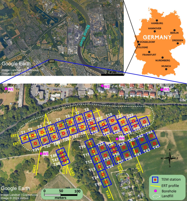
Have you ever wondered what happens to landfills after they’re closed? While they might seem like harmless mounds of dirt, landfills can hide secrets that pose risks to the environment, like pollution that seeps into groundwater. The Weidenpesch landfill in Cologne, Germany, became the beginning of a compelling scientific journey. This site, with its history as a former sand and gravel pit turned disposal ground, raised pressing questions about its environmental impact. Could it pose contamination threatening local groundwater? Could it pose a risk to the Rhine River, just 2.25 km away?
Traditional methods like digging and sampling can only provide small snapshots of what’s underground. Instead, we used non-invasive geophysical tools to “see” below the surface. Think of it as using technology to create an underground map without disturbing the environment. To address these challenges, we turned to non-invasive geophysical techniques.
Our solution?
An integrated approach combining magnetics, electrical resistivity tomography (ERT), and transient electromagnetic (TEM) techniques. By combinning these methods together, we aimed to create a detailed subsurface map, uncover contamination pathways, and assess risks to the surrounding environment.
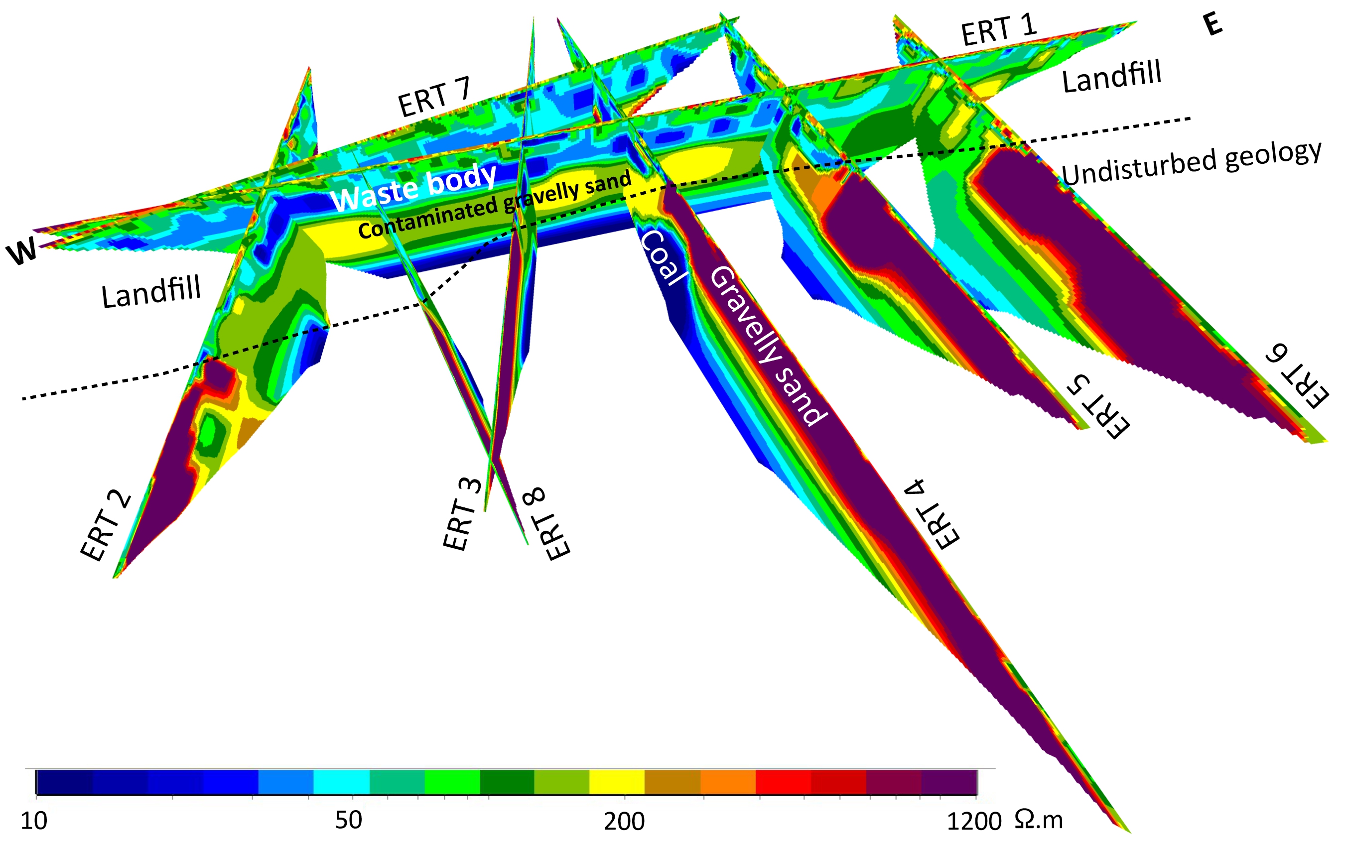
The fieldwork proved as fascinating as it was challenging. The magnetic survey revealed distinct zones of buried metallic waste. ERT offered insights into the structure and resistivity of the landfill, identifying zones of potential contamination. TEM added depth, allowing us to image contimination anomalies.
One of the standout moments of this study was identifying a highly conductive coal/clay layer beneath the landfill—a potential sink for contaminants migrating downward. Repeated TEM measurements over time further highlighted how rainfall and seasonal changes could influence contaminant migration, reminding us of the dynamic nature of these systems.
This study is about more than just one landfill. It’s about a methodology—a roadmap for tackling similar environmental challenges worldwide. By integrating geophysical techniques, we demonstrated how to achieve a comprehensive understanding of subsurface conditions without invasive methods.
We hope our experience inspires others to look beneath the surface to uncover solutions to pressing environmental issues.
Follow the Topic
-
Scientific Reports
An open access journal publishing original research from across all areas of the natural sciences, psychology, medicine and engineering.

Related Collections
With Collections, you can get published faster and increase your visibility.
Phytochemicals and health
Publishing Model: Open Access
Deadline: Jul 28, 2026
Health Policy and Systems Research
Publishing Model: Hybrid
Deadline: Jul 14, 2026


Please sign in or register for FREE
If you are a registered user on Research Communities by Springer Nature, please sign in