Mapping Morocco’s erosion hotspots: a new modeling approach to secure soils and water

Soil erosion threatens agriculture and water security, especially in Mediterranean and arid regions. This study introduces an advanced modeling approach showing how Sustainable Land Management reduces sediment loss, offering solutions transferable to similar vulnerable regions.
Mapping Morocco’s erosion hotspots: a new modeling approach to secure soils and water
Like

Share this post

Choose a social network to share with, or copy the URL to share elsewhere

This is a representation of how your post may appear on social media. The actual post will vary between social networks

Explore the Research

SpringerLink
SpringerLink SpringerLink

Mitigating Erosion and Enhancing Sediment Retention: A Modeling Approach to Sustainable Land Management - Earth Systems and Environment

Soil erosion poses a critical threat to global ecosystems, water resources, and agricultural productivity. This study assesses how Sustainable Land Management (SLM) mitigates sediment export and improves climate resilience using the InVEST Sediment Delivery Ratio (SDR) model across 12 Moroccan basins, representative of Mediterranean and arid environments. Our results identify significant hotspots in northern basins, where steep slopes and annual rainfall exceeding 500 mm drive erosion rates up to 14,700 tons per year, contributing substantially to downstream sediment transport. Conversely, arid basins exhibit lower erosion rates due to reduced precipitation and gentler slopes but struggle with sediment retention, with efficiencies below 50%. SLM interventions, such as a 25% increase in soil organic matter in agricultural lands, reduced sediment export by over 25% in northern basins and decreased sediment loss by more than 1 ton per hectare annually in vulnerable agricultural areas. These measures were especially effective in forested and terraced landscapes, enhancing sediment retention and minimizing impacts on reservoirs and water systems. This study underscores the dynamic nature of erosion and sediment transport under varying environmental and management conditions. By integrating high-resolution spatial data with scenario-based modeling, it provides a transferable framework for implementing SLM practices in erosion-prone regions. The findings emphasize the necessity of adaptive management to address soil erosion and inform sustainable land-use planning globally. Graphical Abstract This Graphical Abstract visually summarizes the study’s key findings on the role of Sustainable Land Management (SLM) in mitigating soil erosion and sediment export. The diagram outlines the methodology and key variables influencing erosion processes, using the Sediment Delivery Ratio (SDR) model to assess the impacts of SLM interventions. The left section of the figure highlights the study area in Morocco, covering 102 sub-basins across 12 hydrological basins, where erosion processes were analyzed. It illustrates a comparison between the current scenario and an SLM scenario, where agricultural lands experience a 25% increase in soil organic matter. In the central section, key environmental factors—land use, rainfall, soil erodibility (K Factor), and slope—are depicted as primary variables influencing sediment dynamics. These factors interact with SDR outputs, affecting soil loss, sediment export, and deposition patterns. The SDR model application (bottom-left) integrates these variables to simulate erosion processes, generating spatial outputs such as RUSLE, sediment export, sediment deposition, avoided export, and avoided erosion. The results demonstrate the differences between the current scenario and the SLM intervention, emphasizing the potential of improved land management practices. On the right side, statistical analysis results highlight the relationships between precipitation, slope, soil erodibility, and sediment transport across the study basins. The conclusion box presents the main findings: A 25% increase in soil organic matter reduces sediment loss by > 1 ton/ha annually. Scenario-based modeling provides a transferable framework for SLM applications. SLM significantly decreases soil erosion and sediment export, enhancing climate resilience. This graphical representation provides a clear and concise visual synthesis of the study, facilitating a better understanding of erosion processes and SLM effectiveness in mitigating land degradation.

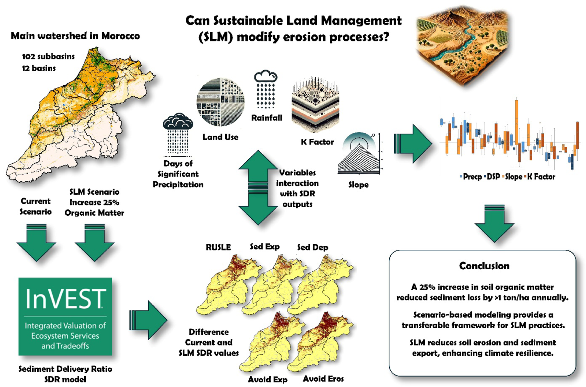
In this pioneering work, the authors, Pedro Pérez-Cutillas, Sara Benabdelouahab, and Adil Salhi, undertook a comprehensive national-scale modeling initiative to assess and mitigate soil erosion across Morocco’s twelve major river basins. These basins, spanning varied climatic and topographic gradients from Mediterranean hillsides to arid plains, served as a natural laboratory to explore the effectiveness of Sustainable Land Management (SLM) strategies.

The team employed the InVEST Sediment Delivery Ratio (SDR) model, calibrated with long-term sediment yield data from 42 reservoirs, to capture the spatial dynamics of soil erosion, sediment export, and natural retention processes. Through meticulous integration of high-resolution inputs, including rainfall intensity, soil erodibility, land use, and slope, they generated a detailed picture of erosion pressures and sediment pathways across more than 100 sub-basins.

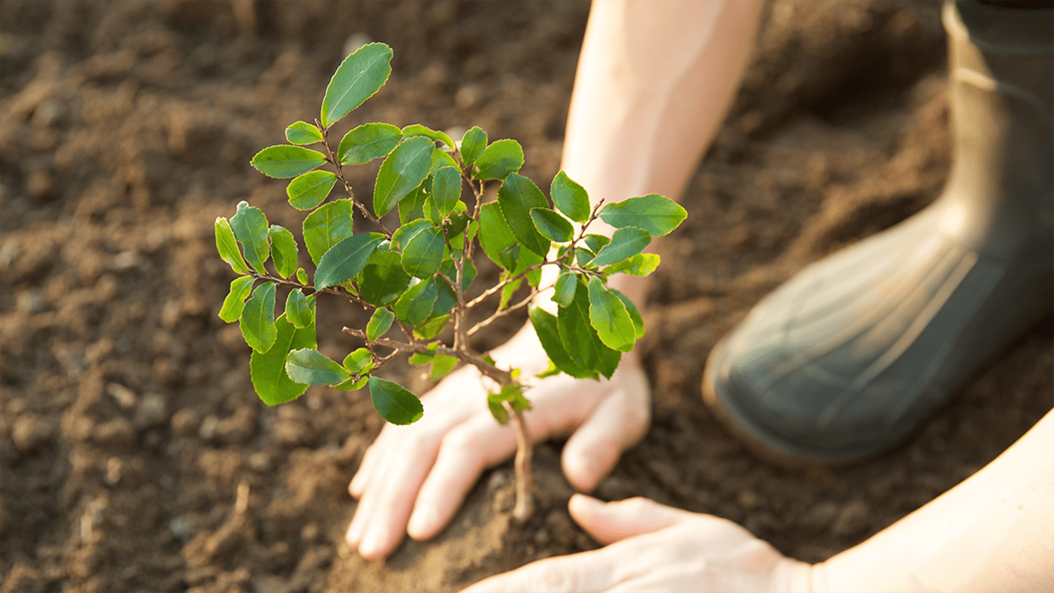
Crucially, the authors went beyond conventional static modeling by simulating realistic land management scenarios. They tested the impact of a 25% increase in soil organic matter in agricultural lands, revealing that this measure alone could reduce sediment export by over 25% in erosion-prone northern regions, and prevent more than 1 ton of soil loss per hectare annually in vulnerable croplands. The effectiveness of such practices was especially pronounced in forested and terraced zones, where natural retention processes are enhanced.

Their approach also included advanced geo-statistical analysis and sensitivity testing to quantify the influence of key environmental variables, helping to establish thresholds for effective intervention, such as maintaining forest cover above 25% and targeting areas with high precipitation and slope gradients. These findings offer clear, data-driven benchmarks for policymakers and land managers.

By combining technical precision with policy relevance, the authors have produced a replicable framework for erosion mitigation that balances environmental integrity and agricultural productivity. Their work exemplifies how science-based modeling can guide targeted, adaptive strategies for sustainable land use, not only in Morocco but across regions facing similar ecological vulnerabilities.

Please sign in or register for FREE

If you are a registered user on Research Communities by Springer Nature, please sign in