Satellite observations offer a novel perspective on the fluvial sediment dynamics in unmonitored cold regions
Published in Earth & Environment

The Tibetan Plateau (TP), revered as the 'Third Pole,' hosts the most unique hydrological and geographical environments within the mid-latitude cryosphere on Earth. Since the 1960s, the Plateau has exhibited a pronounced response to climate change, characterized by escalating soil erosion and increased river sediment transport. This intensification in erosion and sediment delivery poses significant threats to aquatic environments and terrestrial water bodies, potentially triggering a cascade of cryospheric geological disasters and interlinked water-landscape-ecological responses. However, the scarcity of observational data has constrained our objective understanding of these landscape erosional processes and their potential threats. Within the entire TP region, there are only 28 hydrological-sediment in situ monitoring stations, predominantly located at the outlets of large river basins. These stations suffer from low network density, limited monitoring scope, and outdated methodologies. These limitations not only introduce considerable uncertainty in characterizing intra-basin water and sediment processes but also impede our ability to quantitatively assess the hydro-sedimentary dynamics of the TP. To address the need for a comprehensive, large-scale spatiotemporal overview of the entire Plateau, our recent research article, 'Recent Intensified Erosion and Massive Sediment Deposition in Tibetan Plateau Rivers,' has been published in Nature Communications.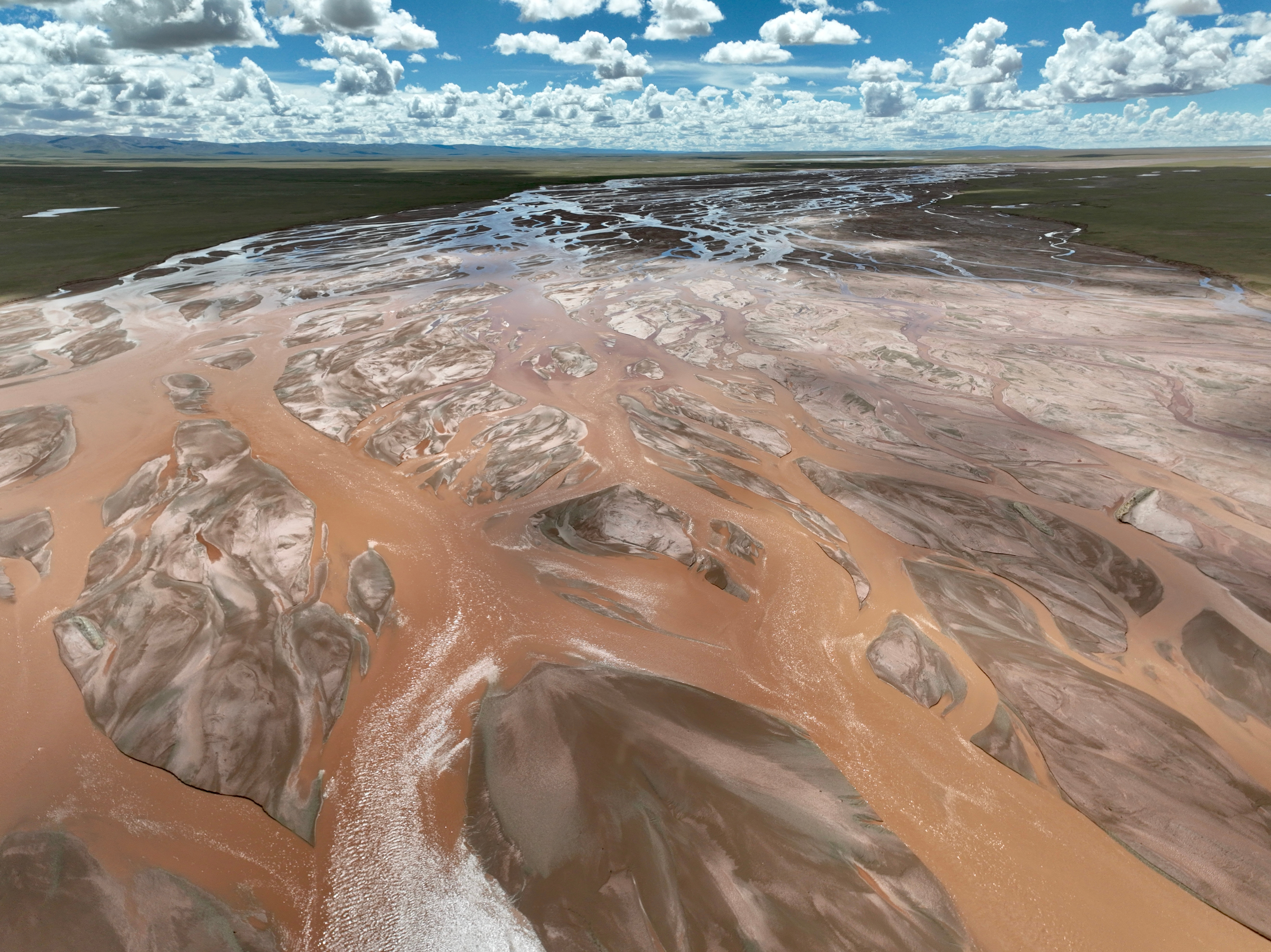
The expansive braided river networks and sediment-rich watercourses of the Yangtze River source region on the Tibetan Plateau, courtesy of C.Song
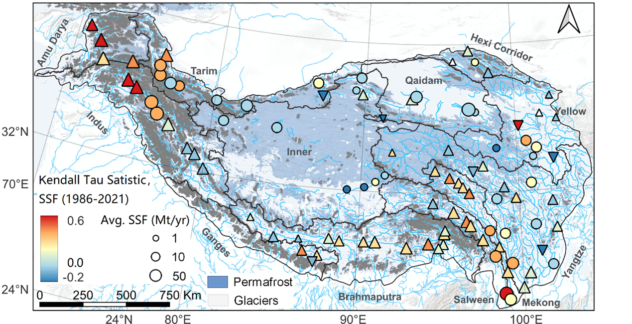
In recent years, particularly since the onset of the 2020s, there has been a significant global advancement in understanding the changes in cryospheric elements (e.g., glaciers, permafrost, and snowpack) and erosion in cold regions. Yet, to date, the spatiotemporal patterns of sediment transport in these cold areas have been constrained to site-specific scales. While the academic community has increasingly focused on the micro-scale hydro-sedimentary coupling mechanisms underlying the intensified erosion due to cryosphere degradation, a macroscopic perspective is still lacking. Specifically, there is a need for a comprehensive understanding of the sediment transport process from source to sink, including variations in erosion and deposition. To bridge this crucial scientific gap, for the first time, we have reconstructed and quantified the spatiotemporal changes in water and sediment patterns in the major river source areas of the TP from 1986 to 2021 (Figure 1). This work elucidates the pathways and mechanisms by which synchronized changes in climate, geomorphology, vegetation, and cryospheric elements influence basin hydro-sedimentary processes, thereby enriching the theoretical understanding of the dynamic changes in water and sediment flux in cold-region rivers.
Spatiotemporal Variations in Sediment Transport of Tibetan Plateau Rivers Over the Past Four Decades
In this work, we integrated long-term, in-situ daily runoff-sediment observational data from the Tibetan Plateau, cryosphere and ecosystem surveys, and high-resolution hydrometeorological data. We developed a large-scale, high-precision remote sensing inversion model for suspended sediment in the rivers of cold regions. Utilizing this model and the powerful Google Earth Engine platform, we discovered significant spatiotemporal variations in suspended sediment concentration and flux in the rivers of the Tibetan Plateau from 1986 to 2021. Notably, the rate of increase in sediment concentration and transport flux in the upper reaches of source basins significantly exceeded that in the lower reaches, with high sediment transport hotspots concentrated in basins dominated by glaciers and permafrost.
For the first time, our work reveals the actual severity of soil erosion in the Tibetan Plateau and the increasing trend of internal water-sediment flux, which have been significantly underestimated by station data, with an overall underestimation ranging from 7.8% to 43.5%. This underestimation is primarily due to in-situ data reflecting only the sediment transport state at the observation sites. Frequent transitions between erosion and deposition states in the upstream areas of the stations make it challenging to accurately reflect the actual erosional and sediment-producing conditions of the basins. This implies that, against the backdrop of increasing warmth and humidity on the Tibetan Plateau, intensified soil erosion and the re-transportation of sediment deposited during the flood season will further threaten the ecological function stability of soil and water conservation in the river source areas. Moreover, it may lead to more frequent hydro-sedimentary disasters, such as glacial lake outburst floods, ice-sand blockages altering river courses, and mudslides.
To support the Chinese government's conservation strategy for the Sanjiangyuan National Park and the policy of maintaining soil and water conservation stability on the Tibetan Plateau, we advocate for the initiation of more river observations and more open data-sharing practices among various academic teams. This should be complemented by the implementation of pragmatic sediment monitoring programs specific to the Tibetan Plateau, the development of physically-based, distributed models for erosion and sediment transport, and deeper, interdisciplinary international scientific collaborations. Such initiatives are crucial for advancing our understanding and management of these critical environmental systems.
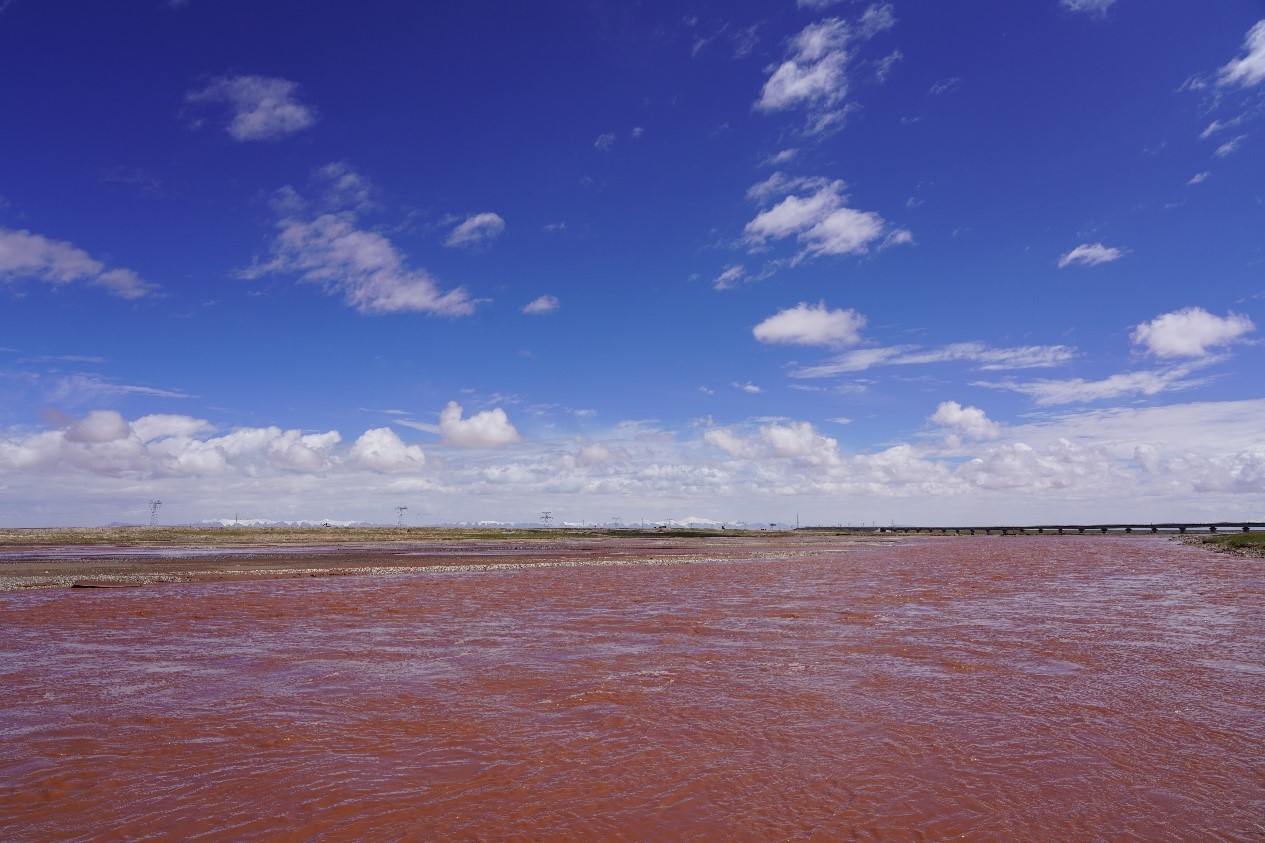
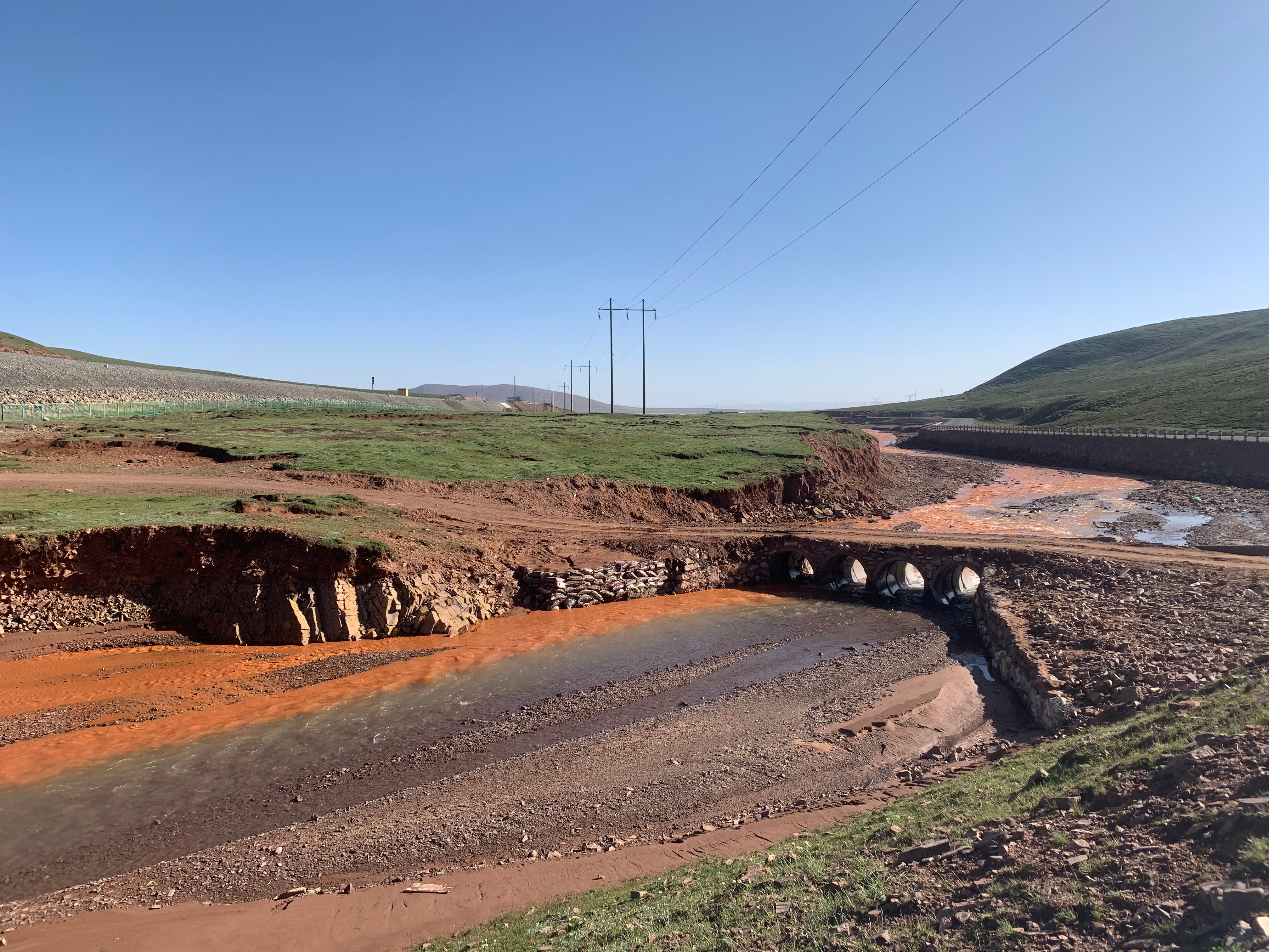
In the upper reaches of the Qumar River, a primary source of the Yangtze River, a marked increase in sediment load has led to a noticeable discoloration of the river waters, courtesy of C. Song
Follow the Topic
-
Nature Communications
An open access, multidisciplinary journal dedicated to publishing high-quality research in all areas of the biological, health, physical, chemical and Earth sciences.

Related Collections
With Collections, you can get published faster and increase your visibility.
Women's Health
Publishing Model: Hybrid
Deadline: Ongoing
Biosensing
Publishing Model: Hybrid
Deadline: Sep 30, 2026


Please sign in or register for FREE
If you are a registered user on Research Communities by Springer Nature, please sign in