TROPICAL WAVES TRIGGERED RARE NEAR-EQUATORIAL TROPICAL CYCLONE GENESIS, LEADING TO DEADLY IMPACT
Published in Earth & Environment
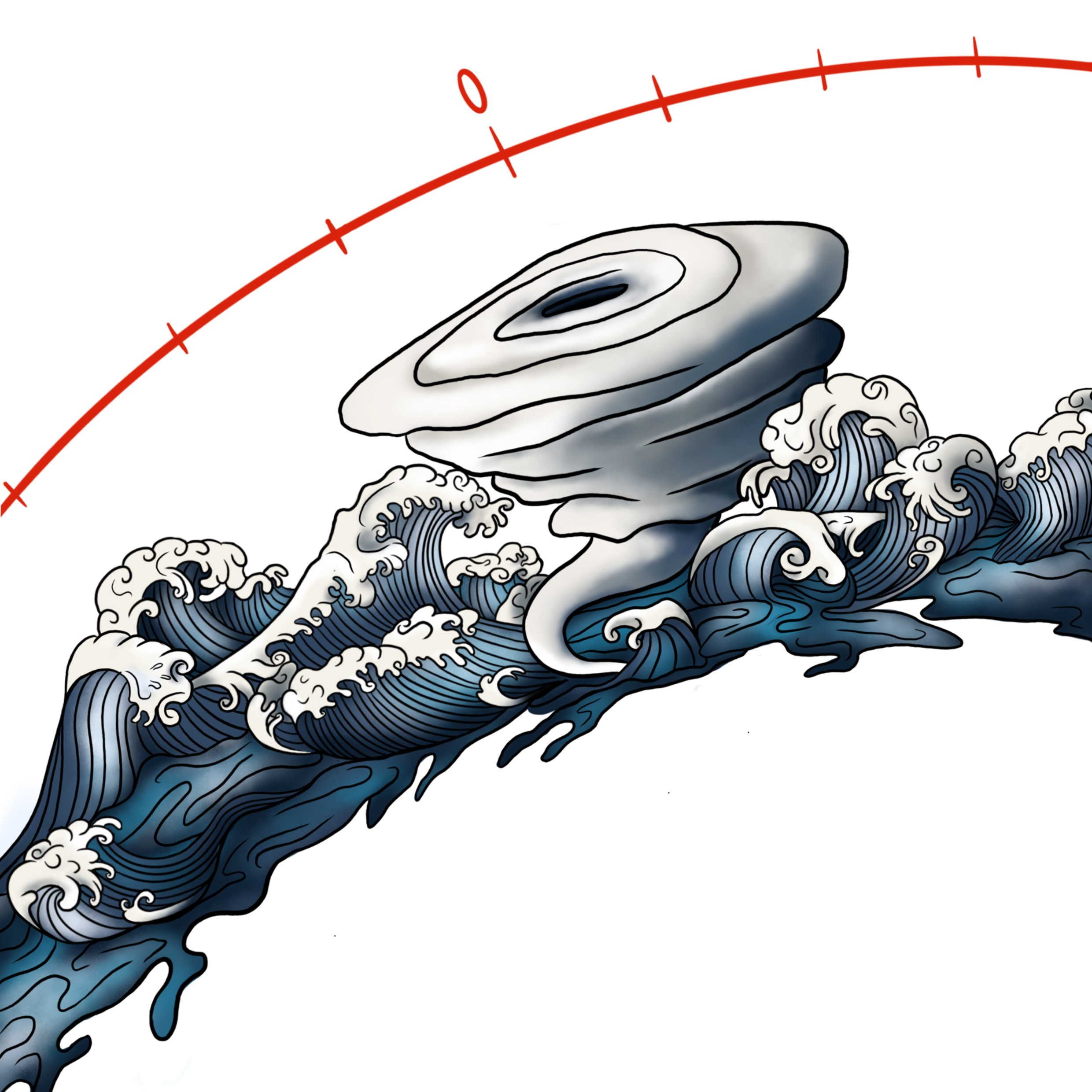

One day, we heard about a low-pressure system developing into a tropical cyclone near Timor-Leste. This was surprising because we knew that this area is not typically prone to cyclones. The heavy torrential rains and floods that occurred before the low-pressure system developed into Tropical Cyclone Seroja were also unusual. It was apparent that some of the most significant damage occurred before Seroja reached the threshold to be considered a tropical cyclone
Why did a cyclone develop in such conditions? A quick look at satellite data revealed the influence of Convectively Coupled Equatorial Waves. These waves are significant modes of tropical convection variability, accounting for a substantial portion of tropical cloudiness, humidity, and rainfall variability, and can sometimes impact cyclogenesis. Their impact on atmospheric properties can be estimated using mathematical methods, although some of them can also be visible to the naked eye of an expert.
.png "When the low intensified into Category 1 Tropical Cyclone by April 4, was given the name Seroja - meaning lotus flower. The name was given by the Tropical Cyclone Warning Centre (TCWC) Jakarta.")
When the low-pressure system intensified into
a Category 1 Tropical Cyclone by April 4,
it was given the name Seroja,
which means lotus flower. The name was given
by the Cyclone Warning Centre Jakarta
Although tropical cyclones can form quickly, thorough research takes time. Two years later (and after many cups of coffee), we finally proved that Convectively Coupled Equatorial Waves provided a sufficient impulse to enhance cyclogenesis, even in relatively close proximity to the Equator.
This was highly unusual since the planetary vorticity in this region is weak, which typically makes it a cyclone-free area. Normally, tropical storms develop over open oceans between 10° and 20° poleward from the Equator. We realized that the unusual near-equatorial cyclogenesis close to a landmass was due to a "perfect storm" of conditions resulting from the interaction of multiple weather systems, which was enhanced by unusually warm sea waters. Various tropical weather systems arrived simultaneously, creating favorable conditions for enhanced convection and spatial organization.
The largest of these weather systems, the "Madden-Julian Oscillation," moved slowly eastward from the Indian Ocean over Indonesia. The interaction between two "Kelvin waves" and a "Rossby wave" spun up the initial vortex and accelerated the cyclone's development.
.png "A conceptual diagram of meteorological drivers of Tropical Cyclone Seroja. Abbreviations are as follows: KW - Convectively Coupled Kelvin Wave; ER - Convectively Coupled Equatorial Rossby Wave; MJO - Madden-Julian Oscillation; MRG - Mixed Rossby-Gravity Wave.")
Our study raises the alarm about the impact of multiple wave interactions as a mechanism that can allow a "perfect storm" to develop, even in unfavorable conditions such as those encountered close to the Equator. Monitoring and forecasting such weather systems offer significant forecasting and research opportunities.
Read the article here.
Follow the Topic
-
Nature Communications
An open access, multidisciplinary journal dedicated to publishing high-quality research in all areas of the biological, health, physical, chemical and Earth sciences.

Related Collections
With Collections, you can get published faster and increase your visibility.
Women's Health
Publishing Model: Hybrid
Deadline: Ongoing
Healthy Aging
Publishing Model: Open Access
Deadline: Dec 31, 2026


Please sign in or register for FREE
If you are a registered user on Research Communities by Springer Nature, please sign in